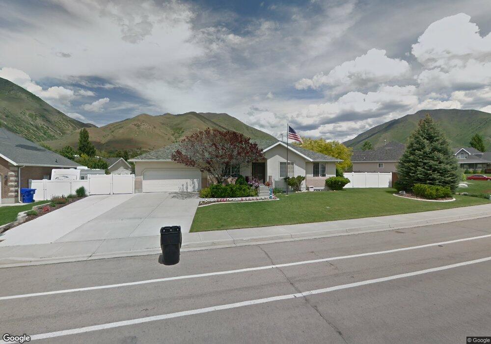
1875 River Bottom Rd Springville, UT 84663
East Hobble Creek NeighborhoodEstimated Value: $554,000 - $597,000
3
Beds
3
Baths
1,414
Sq Ft
$412/Sq Ft
Est. Value
About This Home
This home is located at 1875 River Bottom Rd, Springville, UT 84663 and is currently estimated at $582,039, approximately $411 per square foot. 1875 River Bottom Rd is a home located in Utah County with nearby schools including Hobble Creek School, Springville High School, and Springville Junior High School.
Ownership History
Date
Name
Owned For
Owner Type
Purchase Details
Closed on
Aug 5, 2022
Sold by
Dennis Gehring Greg and Lynn Jessica
Bought by
Gehring Family Trust
Current Estimated Value
Purchase Details
Closed on
Feb 14, 2005
Sold by
Anderson David W and Anderson Kathy K
Bought by
Gehring Greg Dennis and Gehring Jessica Lynn
Home Financials for this Owner
Home Financials are based on the most recent Mortgage that was taken out on this home.
Original Mortgage
$31,650
Interest Rate
5.73%
Mortgage Type
Credit Line Revolving
Purchase Details
Closed on
Dec 18, 2002
Sold by
Hanna Charles R
Bought by
Anderson David W and Anderson Kathy K
Create a Home Valuation Report for This Property
The Home Valuation Report is an in-depth analysis detailing your home's value as well as a comparison with similar homes in the area
Home Values in the Area
Average Home Value in this Area
Purchase History
| Date | Buyer | Sale Price | Title Company |
|---|---|---|---|
| Gehring Family Trust | -- | None Listed On Document | |
| Gehring Greg Dennis | -- | Title West Title Company | |
| Anderson David W | -- | Affiliated First Title |
Source: Public Records
Mortgage History
| Date | Status | Borrower | Loan Amount |
|---|---|---|---|
| Previous Owner | Gehring Greg Dennis | $31,650 | |
| Previous Owner | Gehring Greg Dennis | $168,800 |
Source: Public Records
Tax History Compared to Growth
Tax History
| Year | Tax Paid | Tax Assessment Tax Assessment Total Assessment is a certain percentage of the fair market value that is determined by local assessors to be the total taxable value of land and additions on the property. | Land | Improvement |
|---|---|---|---|---|
| 2025 | $2,912 | $304,425 | $245,100 | $308,400 |
| 2024 | $2,912 | $298,320 | $0 | $0 |
| 2023 | $2,864 | $293,700 | $0 | $0 |
| 2022 | $2,967 | $298,815 | $0 | $0 |
| 2021 | $2,510 | $393,500 | $158,800 | $234,700 |
| 2020 | $2,295 | $348,800 | $127,000 | $221,800 |
| 2019 | $2,231 | $345,200 | $123,400 | $221,800 |
| 2018 | $2,199 | $324,600 | $123,400 | $201,200 |
| 2017 | $1,971 | $154,550 | $0 | $0 |
| 2016 | $1,923 | $147,785 | $0 | $0 |
| 2015 | $1,840 | $144,595 | $0 | $0 |
| 2014 | $1,673 | $130,625 | $0 | $0 |
Source: Public Records
Map
Nearby Homes
- 59 E 775 S Unit 21
- 51 E 775 S Unit 20
- 695 E 1700 N
- 61 E 750 S Unit 2
- 66 E 750 S Unit 23
- 662 E 1700 N
- 687 S 2080 E
- 715 E 1700 N
- 2295 E 700 S Unit 8
- 2295 E 700 S Unit 18
- 1567 N 600 E Unit 26
- 645 S Red Devil Dr
- 1206 E 1150 S
- 868 E 1400 N
- 2541 Stonebury Loop Rd
- 2572 Stonebury Loop Rd
- 314 S 1850 E
- 1653 E 300 S
- 1138 N 1000 E
- 1447 N 1350 St E Unit 5
- 1875 E 900 S
- 1076 Cranberry Way
- 1863 E 900 S
- 1887 E 900 S
- 1863 River Bottom Rd
- 1887 River Bottom Rd
- 1062 Cranberry Way
- 1874 E 900 S
- 1882 E 900 S
- 1874 River Bottom Rd
- 1882 River Bottom Rd
- 1851 E 900 S
- 1851 River Bottom Rd
- 1864 E 900 S Unit 75
- 1864 River Bottom Rd
- 1892 E 900 S Unit Lot 72
- 1892 E 900 S
- 1864 River Bottom Rd
- 1892 River Bottom Rd
- 1048 Cranberry Way