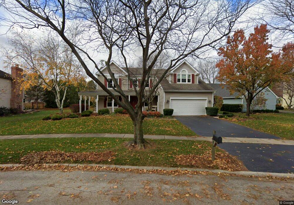
1875 Southampton Ct Geneva, IL 60134
Northwest Central Geneva NeighborhoodEstimated Value: $594,421 - $816,000
4
Beds
3
Baths
2,602
Sq Ft
$254/Sq Ft
Est. Value
About This Home
This home is located at 1875 Southampton Ct, Geneva, IL 60134 and is currently estimated at $660,355, approximately $253 per square foot. 1875 Southampton Ct is a home located in Kane County with nearby schools including Western Avenue Elementary School, Geneva Community High School, and St. Peter School.
Ownership History
Date
Name
Owned For
Owner Type
Purchase Details
Closed on
Feb 27, 2024
Sold by
Gershon Robert M and Gershon Lynda L
Bought by
Robert M Gershon Revocable Trust and Lynda L Gershon Revocable Trust
Current Estimated Value
Create a Home Valuation Report for This Property
The Home Valuation Report is an in-depth analysis detailing your home's value as well as a comparison with similar homes in the area
Home Values in the Area
Average Home Value in this Area
Purchase History
| Date | Buyer | Sale Price | Title Company |
|---|---|---|---|
| Robert M Gershon Revocable Trust | -- | None Listed On Document |
Source: Public Records
Tax History Compared to Growth
Tax History
| Year | Tax Paid | Tax Assessment Tax Assessment Total Assessment is a certain percentage of the fair market value that is determined by local assessors to be the total taxable value of land and additions on the property. | Land | Improvement |
|---|---|---|---|---|
| 2024 | $10,365 | $152,216 | $43,830 | $108,386 |
| 2023 | $10,040 | $138,378 | $39,845 | $98,533 |
| 2022 | $9,817 | $128,580 | $37,024 | $91,556 |
| 2021 | $9,513 | $123,801 | $35,648 | $88,153 |
| 2020 | $9,398 | $121,911 | $35,104 | $86,807 |
| 2019 | $9,364 | $119,602 | $34,439 | $85,163 |
| 2018 | $8,840 | $113,668 | $34,439 | $79,229 |
| 2017 | $8,728 | $110,637 | $33,521 | $77,116 |
| 2016 | $8,764 | $109,142 | $33,068 | $76,074 |
| 2015 | -- | $103,766 | $31,439 | $72,327 |
| 2014 | -- | $103,766 | $31,439 | $72,327 |
| 2013 | -- | $103,766 | $31,439 | $72,327 |
Source: Public Records
Map
Nearby Homes
- 1736 Kaneville Rd
- 2300 Kaneville Rd
- 1437 Cooper Ln
- 51 Burgess Rd
- 1530 Kaneville Rd
- 301 Country Club Place
- 1634 Scott Blvd
- 124 S Pine St
- 106 Bridgeport Ln
- 1417 Sherwood Ln
- 1211 James St
- 921 Western Ave
- 747 Cheever Ave
- 246 Kenston Ct Unit 246
- 1088 Dunstan Rd
- 221 Campbell Ct
- 520 N Pine St
- 527 Maple Ln
- 32 Anderson Blvd
- 615 Easton Ave
- 1855 Southampton Ct
- 1895 Southampton Ct
- 369 Southampton Dr
- 333 Southampton Dr
- 1845 Southampton Ct
- 339 Southampton Dr
- 1819 Southampton Ct
- 327 Southampton Dr
- 1889 Southampton Ct
- 1825 Southampton Ct
- 1805 Southampton Ct
- 321 Southampton Dr
- 387 Southampton Dr
- 1789 Southampton Ct
- 376 Southampton Dr
- 382 Southampton Dr
- 315 Southampton Dr
- 370 Southampton Dr
- 1785 Southampton Ct
- 388 Southampton Dr