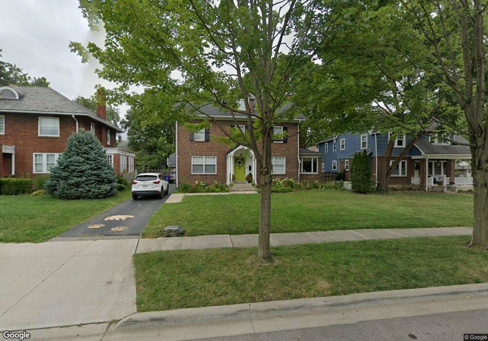
1876 Coventry Rd Columbus, OH 43212
Estimated Value: $847,000 - $1,128,000
5
Beds
4
Baths
3,170
Sq Ft
$318/Sq Ft
Est. Value
About This Home
This home is located at 1876 Coventry Rd, Columbus, OH 43212 and is currently estimated at $1,009,384, approximately $318 per square foot. 1876 Coventry Rd is a home located in Franklin County with nearby schools including Barrington Road Elementary School, Jones Middle School, and Upper Arlington High School.
Ownership History
Date
Name
Owned For
Owner Type
Purchase Details
Closed on
Feb 1, 2009
Sold by
Relo Direct Inc
Bought by
Mauro Tommaso and Mauro Amy
Current Estimated Value
Home Financials for this Owner
Home Financials are based on the most recent Mortgage that was taken out on this home.
Original Mortgage
$382,500
Outstanding Balance
$235,080
Interest Rate
4.91%
Mortgage Type
Purchase Money Mortgage
Estimated Equity
$774,304
Purchase Details
Closed on
Apr 26, 2008
Sold by
Prior James E and Prior Jeanne W
Bought by
Relo Direct Inc
Purchase Details
Closed on
Jul 21, 1994
Sold by
Held David J
Bought by
Prior James E and Prior Jeanne W
Create a Home Valuation Report for This Property
The Home Valuation Report is an in-depth analysis detailing your home's value as well as a comparison with similar homes in the area
Home Values in the Area
Average Home Value in this Area
Purchase History
| Date | Buyer | Sale Price | Title Company |
|---|---|---|---|
| Mauro Tommaso | $450,000 | Fidelity Land Title Agency O | |
| Relo Direct Inc | $562,500 | Fidelity Land Title Agency O | |
| Prior James E | $287,000 | -- |
Source: Public Records
Mortgage History
| Date | Status | Borrower | Loan Amount |
|---|---|---|---|
| Open | Mauro Tommaso | $382,500 |
Source: Public Records
Tax History
| Year | Tax Paid | Tax Assessment Tax Assessment Total Assessment is a certain percentage of the fair market value that is determined by local assessors to be the total taxable value of land and additions on the property. | Land | Improvement |
|---|---|---|---|---|
| 2025 | $17,487 | $300,830 | $122,290 | $178,540 |
| 2024 | $17,487 | $300,830 | $122,290 | $178,540 |
| 2023 | $17,200 | $300,825 | $122,290 | $178,535 |
| 2022 | $15,465 | $221,310 | $68,360 | $152,950 |
| 2021 | $13,690 | $221,310 | $68,360 | $152,950 |
| 2020 | $13,577 | $221,310 | $68,360 | $152,950 |
| 2019 | $13,534 | $195,170 | $68,360 | $126,810 |
| 2018 | $7,004 | $195,170 | $68,360 | $126,810 |
| 2017 | $6,864 | $195,170 | $68,360 | $126,810 |
| 2016 | $11,045 | $165,550 | $53,060 | $112,490 |
| 2015 | $5,794 | $165,550 | $53,060 | $112,490 |
| 2014 | $10,949 | $165,550 | $53,060 | $112,490 |
| 2013 | $5,278 | $150,500 | $48,230 | $102,270 |
Source: Public Records
Map
Nearby Homes
- 1942 Bedford Rd
- 1921 Wyandotte Rd
- 1951 Glenn Ave
- 1876 Westwood Ave
- 1780 Waltham Rd
- 1810 Ashland Ave
- 2006 Cambridge Blvd
- 1561 Glenn Ave
- 2015 W 5th Ave Unit 211
- 2015 W 5th Ave Unit 102
- 2015 W 5th Ave Unit 108
- 1654-1656 Ashland Ave
- 1648 Ashland Ave
- 1624 Ashland Ave
- 1631 Roxbury Rd Unit D2
- 1585 Arlington Ave Unit 1585A
- 1785 Northwest Ct Unit D
- 1579 Arlington Ave Unit 1579B
- 1530 Lincoln Rd
- 1523 Wyandotte Rd
- 1866 Coventry Rd
- 1884 Coventry Rd
- 1890 Coventry Rd
- 1867 Bedford Rd
- 1859 Bedford Rd
- 1879 Bedford Rd
- 1860 Tremont Rd
- 1851 Bedford Rd
- 1871 Coventry Rd
- 1879 Coventry Rd
- 1885 Bedford Rd
- 1885 Coventry Rd
- 1852 Tremont Rd
- 1880 Tremont Rd
- 1893 Coventry Rd
- 1893 Bedford Rd
- 1901 Coventry Rd
- 1890 Tremont Rd
- 1910 Coventry Rd
- 1839 Stanford Rd
Your Personal Tour Guide
Ask me questions while you tour the home.