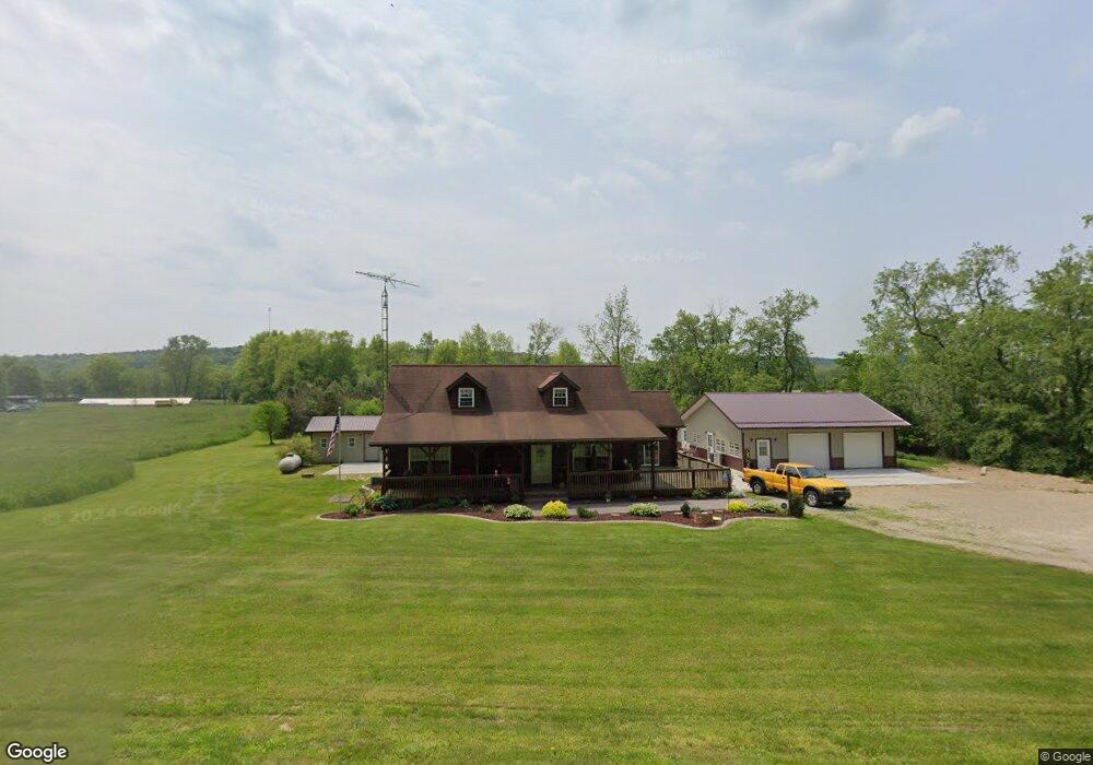
1876 Snyder Rd Butler, OH 44822
Estimated Value: $236,000 - $314,205
3
Beds
1
Bath
1,512
Sq Ft
$186/Sq Ft
Est. Value
About This Home
This home is located at 1876 Snyder Rd, Butler, OH 44822 and is currently estimated at $280,735, approximately $185 per square foot. 1876 Snyder Rd is a home with nearby schools including Clear Fork High School.
Ownership History
Date
Name
Owned For
Owner Type
Purchase Details
Closed on
Jul 1, 2025
Sold by
Partin Gerald L
Bought by
Partin Gerald L and Partin Nancy S
Current Estimated Value
Purchase Details
Closed on
Aug 11, 2005
Sold by
Countrytyme Lodi Ltd
Bought by
Partin Gerald L
Home Financials for this Owner
Home Financials are based on the most recent Mortgage that was taken out on this home.
Original Mortgage
$30,000
Interest Rate
5.44%
Mortgage Type
Credit Line Revolving
Purchase Details
Closed on
Aug 4, 2004
Sold by
Yarman Mark F and Fort Martha J
Bought by
Kovinchick Paula L
Purchase Details
Closed on
Apr 29, 1999
Sold by
Wilson Paul G
Bought by
Countrytyme Lodi Ltd
Home Financials for this Owner
Home Financials are based on the most recent Mortgage that was taken out on this home.
Original Mortgage
$395,000
Interest Rate
7.05%
Mortgage Type
New Conventional
Create a Home Valuation Report for This Property
The Home Valuation Report is an in-depth analysis detailing your home's value as well as a comparison with similar homes in the area
Home Values in the Area
Average Home Value in this Area
Purchase History
| Date | Buyer | Sale Price | Title Company |
|---|---|---|---|
| Partin Gerald L | -- | None Listed On Document | |
| Partin Gerald L | -- | None Listed On Document | |
| Partin Gerald L | $16,000 | -- | |
| Kovinchick Paula L | -- | -- | |
| Countrytyme Lodi Ltd | $395,000 | -- |
Source: Public Records
Mortgage History
| Date | Status | Borrower | Loan Amount |
|---|---|---|---|
| Previous Owner | Partin Gerald L | $30,000 | |
| Previous Owner | Countrytyme Lodi Ltd | $395,000 |
Source: Public Records
Tax History Compared to Growth
Tax History
| Year | Tax Paid | Tax Assessment Tax Assessment Total Assessment is a certain percentage of the fair market value that is determined by local assessors to be the total taxable value of land and additions on the property. | Land | Improvement |
|---|---|---|---|---|
| 2024 | $2,308 | $63,020 | $16,450 | $46,570 |
| 2023 | $2,308 | $63,020 | $16,450 | $46,570 |
| 2022 | $2,220 | $55,340 | $15,610 | $39,730 |
| 2021 | $2,405 | $55,340 | $15,610 | $39,730 |
| 2020 | $2,405 | $55,340 | $15,610 | $39,730 |
| 2019 | $2,169 | $47,270 | $13,230 | $34,040 |
| 2018 | $2,149 | $47,270 | $13,230 | $34,040 |
| 2017 | $2,115 | $57,450 | $13,230 | $44,220 |
| 2016 | $1,664 | $37,560 | $12,880 | $24,680 |
| 2015 | $1,661 | $37,560 | $12,880 | $24,680 |
| 2014 | $1,658 | $37,560 | $12,880 | $24,680 |
| 2012 | $754 | $35,090 | $12,880 | $22,210 |
Source: Public Records
Map
Nearby Homes
- 224 Blue Bird Dr
- 1259 State Route 97 E
- 1260 Ohio 97 Unit 115
- 2070 Riggle Rd
- 128 College St
- 5449 Hagerman Rd
- 3898 Ohio 97
- 1169 State Route 97 E
- 5042 Possum Run Rd
- 4978 Bott Rd
- 0 Kenton Rd
- 4234 Swigart Rd
- 1302 Hathaway Rd
- 0 Mill Rd
- 6533 Durbin Rd
- 74 E Durbin Ave
- 70 Betty Dr
- 119 Yorkshire Rd
- 0 Mishey Rd
- 3931 Hastings Newville Rd
- 1850 Snyder Rd
- 1924 Snyder Rd
- 1857 Snyder Rd
- 1901 Snyder Rd
- 1961 Snyder Rd
- 1845 Snyder Rd
- 1787 Snyder Rd
- 1845 Snyder Rd
- 1944 Snyder Rd
- 2055 Snyder Rd
- 1988 Snyder Rd
- 5584 Teeter Rd
- 2097 Snyder Rd
- 1582 State Route 97 E
- 5545 Teeter Rd
- 2145 Snyder Rd
- 2014 Snyder Rd
- 5523 Teeter Rd
- 2058 Snyder Rd
- 5517 Teeter Rd