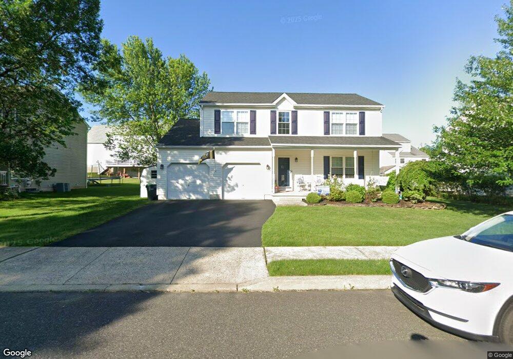
1876 Strong Rd Quakertown, PA 18951
Milford-Quakertown NeighborhoodEstimated Value: $476,000 - $493,000
3
Beds
3
Baths
1,852
Sq Ft
$263/Sq Ft
Est. Value
About This Home
This home is located at 1876 Strong Rd, Quakertown, PA 18951 and is currently estimated at $487,935, approximately $263 per square foot. 1876 Strong Rd is a home located in Bucks County with nearby schools including Pfaff Elementary School, Quakertown Community Senior High School, and United Friends School.
Ownership History
Date
Name
Owned For
Owner Type
Purchase Details
Closed on
Jul 28, 2005
Sold by
Mcgill Edward and Mcgill Lucy
Bought by
Cammann William K and Cammann Mandy L
Current Estimated Value
Home Financials for this Owner
Home Financials are based on the most recent Mortgage that was taken out on this home.
Original Mortgage
$46,485
Interest Rate
5.12%
Mortgage Type
New Conventional
Purchase Details
Closed on
May 27, 1999
Sold by
Milford Acquisitions Inc
Bought by
Mcgill Edward and Mcgill Lucy
Home Financials for this Owner
Home Financials are based on the most recent Mortgage that was taken out on this home.
Original Mortgage
$112,425
Interest Rate
6.85%
Create a Home Valuation Report for This Property
The Home Valuation Report is an in-depth analysis detailing your home's value as well as a comparison with similar homes in the area
Home Values in the Area
Average Home Value in this Area
Purchase History
| Date | Buyer | Sale Price | Title Company |
|---|---|---|---|
| Cammann William K | $309,900 | -- | |
| Mcgill Edward | $149,900 | First American Title Ins Co |
Source: Public Records
Mortgage History
| Date | Status | Borrower | Loan Amount |
|---|---|---|---|
| Closed | Cammann William K | $46,485 | |
| Open | Cammann William K | $247,920 | |
| Previous Owner | Mcgill Edward | $112,425 | |
| Closed | Mcgill Edward | $29,980 |
Source: Public Records
Tax History Compared to Growth
Tax History
| Year | Tax Paid | Tax Assessment Tax Assessment Total Assessment is a certain percentage of the fair market value that is determined by local assessors to be the total taxable value of land and additions on the property. | Land | Improvement |
|---|---|---|---|---|
| 2025 | $5,558 | $27,560 | $4,800 | $22,760 |
| 2024 | $5,558 | $27,560 | $4,800 | $22,760 |
| 2023 | $5,503 | $27,560 | $4,800 | $22,760 |
| 2022 | $5,409 | $27,560 | $4,800 | $22,760 |
| 2021 | $5,409 | $27,560 | $4,800 | $22,760 |
| 2020 | $5,409 | $27,560 | $4,800 | $22,760 |
| 2019 | $5,260 | $27,560 | $4,800 | $22,760 |
| 2018 | $5,077 | $27,560 | $4,800 | $22,760 |
| 2017 | $4,920 | $27,560 | $4,800 | $22,760 |
| 2016 | $4,920 | $27,560 | $4,800 | $22,760 |
| 2015 | -- | $27,560 | $4,800 | $22,760 |
| 2014 | -- | $27,560 | $4,800 | $22,760 |
Source: Public Records
Map
Nearby Homes
- 2120 Brinkman Rd
- 2255 Spinnerstown Rd
- 0 Krammes Rd Unit PABU2104522
- 2420 Bannerstone Dr
- 1999 Crossing Way
- 1926 Alamingo Dr
- 2453 Hieter Rd
- 1690 Kumry Rd
- 1715 Kumry Rd
- 2064 Allentown Rd
- 1770 Joanne Dr
- 1710 Joanne Dr
- 1370 Kumry Rd
- 1730 Fels Rd
- 2565 Allentown Rd
- 1625 Canary Rd
- 1615 Canary Rd
- 8769 Spinnerstown Rd
- 444 Enclave Dr Unit COVINGTON
- 444 Enclave Dr Unit DEVONSHIRE
- 1872 Strong Rd
- 1880 Strong Rd
- 1810 Leedum Ln
- 1806 Leedum Ln
- 1814 Leedum Ln
- 1877 Strong Rd
- 1873 Strong Rd
- 1868 Strong Rd
- 1884 Strong Rd
- 1881 Strong Rd
- 1802 Leedum Ln
- 1818 Leedum Ln
- 1869 Strong Rd
- 1885 Strong Rd
- 1745 Red Bud Rd
- 1739 Red Bud Rd
- 1888 Strong Rd
- 43 Evelyn Ln
- 1809 Leedum Ln
- 1749 Red Bud Rd