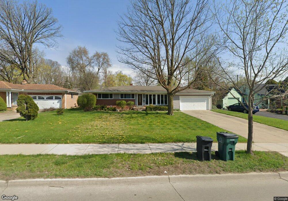
1877 E Maple Rd Birmingham, MI 48009
Estimated Value: $412,960 - $538,000
3
Beds
1
Bath
1,450
Sq Ft
$325/Sq Ft
Est. Value
About This Home
This home is located at 1877 E Maple Rd, Birmingham, MI 48009 and is currently estimated at $471,490, approximately $325 per square foot. 1877 E Maple Rd is a home located in Oakland County with nearby schools including Harlan Elementary School, Derby Middle School, and Ernest W. Seaholm High School.
Ownership History
Date
Name
Owned For
Owner Type
Purchase Details
Closed on
Jun 29, 2011
Sold by
Kinloch Properties Llc and Paciocco Antonino
Bought by
Lalonde Rachelle
Current Estimated Value
Purchase Details
Closed on
Oct 27, 2009
Sold by
Lanxner David
Bought by
Deutsche Bank National Trust Company
Purchase Details
Closed on
Jan 17, 2003
Sold by
Johnson Albert G and The Johnson Living Trust
Bought by
Lanxner David
Purchase Details
Closed on
Feb 26, 1997
Sold by
Johnson Wave T
Bought by
Johnson Trust
Create a Home Valuation Report for This Property
The Home Valuation Report is an in-depth analysis detailing your home's value as well as a comparison with similar homes in the area
Home Values in the Area
Average Home Value in this Area
Purchase History
| Date | Buyer | Sale Price | Title Company |
|---|---|---|---|
| Lalonde Rachelle | $163,000 | Fnt | |
| Deutsche Bank National Trust Company | $123,250 | None Available | |
| Lanxner David | $176,500 | Metropolitan Title Company | |
| Johnson Trust | -- | -- |
Source: Public Records
Tax History
| Year | Tax Paid | Tax Assessment Tax Assessment Total Assessment is a certain percentage of the fair market value that is determined by local assessors to be the total taxable value of land and additions on the property. | Land | Improvement |
|---|---|---|---|---|
| 2025 | $4,791 | $172,280 | $0 | $0 |
| 2024 | $4,230 | $166,980 | $0 | $0 |
| 2023 | $4,053 | $148,910 | $0 | $0 |
| 2022 | $4,452 | $137,830 | $0 | $0 |
| 2021 | $4,498 | $135,760 | $0 | $0 |
| 2020 | $4,025 | $132,610 | $0 | $0 |
| 2019 | $4,544 | $122,300 | $0 | $0 |
| 2018 | $4,516 | $117,590 | $0 | $0 |
| 2017 | $4,511 | $116,170 | $0 | $0 |
| 2016 | $4,529 | $112,240 | $0 | $0 |
| 2015 | -- | $102,300 | $0 | $0 |
| 2014 | -- | $98,200 | $0 | $0 |
| 2011 | -- | $103,770 | $0 | $0 |
Source: Public Records
Map
Nearby Homes
- 1777 Hazel St
- 323 N Eton St Unit 35C
- 2051 Villa Rd Unit 302
- 2051 Villa Rd Unit 401
- 1974 Graefield Rd
- 729 N Eton St
- 1397 Hazel St
- 1996 Haynes St
- 1982 Haynes St
- 1675 Graefield Rd
- 716 Graefield Ct Unit 158
- 1724 Graefield Rd
- 1235 Yorkshire Rd
- 3237 Newbury Place
- 1840 Holland St
- 475 S Adams Rd
- 1798 Webster St
- 3286 Camden Dr Unit 132
- 3086 Camden Dr Unit 47
- 3135 Camden Dr Unit 93 / bldg 10
- 1849 E Maple Rd
- 1911 E Maple Rd
- 1825 E Maple Rd
- 1860 Yorkshire Rd
- 1872 E Maple Rd
- 1953 E Maple Rd
- 1912 Yorkshire Rd
- 1844 Yorkshire Rd
- 1856 E Maple Rd
- 1802-1898 E Maple Rd
- 1802 E Maple Rd
- 1783 E Maple Rd
- 1818 Yorkshire Rd
- 1824 E Maple Rd
- 1790 Yorkshire Rd
- 1796 E Maple Rd
- 1749 E Maple Rd
- 1859 Yorkshire Rd
- 1756 Yorkshire Rd
- 1845 Yorkshire Rd
Your Personal Tour Guide
Ask me questions while you tour the home.