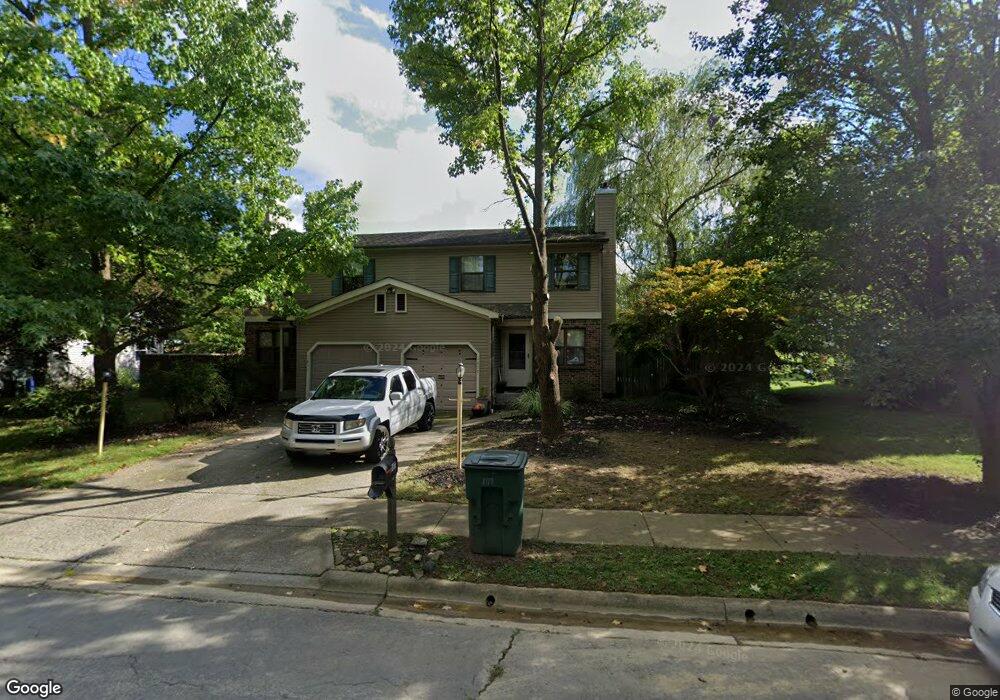
1877 Laramie Dr Powell, OH 43065
Western Hills NeighborhoodEstimated Value: $259,000 - $311,912
3
Beds
2
Baths
1,237
Sq Ft
$235/Sq Ft
Est. Value
About This Home
This home is located at 1877 Laramie Dr, Powell, OH 43065 and is currently estimated at $290,478, approximately $234 per square foot. 1877 Laramie Dr is a home located in Franklin County with nearby schools including Liberty Elementary School, McCord Middle School, and Worthington Kilbourne High School.
Ownership History
Date
Name
Owned For
Owner Type
Purchase Details
Closed on
Aug 14, 2014
Sold by
The Brophy Co Ltd
Bought by
Caro Ohio Llc
Current Estimated Value
Purchase Details
Closed on
Mar 1, 2004
Sold by
Kinsey David M and Kinsey Catherine G
Bought by
The Brophy Co Ltd
Home Financials for this Owner
Home Financials are based on the most recent Mortgage that was taken out on this home.
Original Mortgage
$78,400
Interest Rate
5.25%
Mortgage Type
Purchase Money Mortgage
Purchase Details
Closed on
Nov 4, 1994
Sold by
Kettlewell Larry R
Bought by
David M and Kinsey Kinsey
Home Financials for this Owner
Home Financials are based on the most recent Mortgage that was taken out on this home.
Original Mortgage
$126,329
Interest Rate
8.75%
Mortgage Type
FHA
Purchase Details
Closed on
Jul 1, 1986
Create a Home Valuation Report for This Property
The Home Valuation Report is an in-depth analysis detailing your home's value as well as a comparison with similar homes in the area
Home Values in the Area
Average Home Value in this Area
Purchase History
| Date | Buyer | Sale Price | Title Company |
|---|---|---|---|
| Caro Ohio Llc | $842,000 | Cardinal Title | |
| The Brophy Co Ltd | $98,000 | Hummel Title Agency | |
| David M | $128,000 | -- | |
| -- | -- | -- |
Source: Public Records
Mortgage History
| Date | Status | Borrower | Loan Amount |
|---|---|---|---|
| Previous Owner | The Brophy Co Ltd | $78,400 | |
| Previous Owner | David M | $126,329 |
Source: Public Records
Tax History Compared to Growth
Tax History
| Year | Tax Paid | Tax Assessment Tax Assessment Total Assessment is a certain percentage of the fair market value that is determined by local assessors to be the total taxable value of land and additions on the property. | Land | Improvement |
|---|---|---|---|---|
| 2024 | $5,178 | $82,710 | $17,500 | $65,210 |
| 2023 | $4,955 | $82,705 | $17,500 | $65,205 |
| 2022 | $4,420 | $58,520 | $13,580 | $44,940 |
| 2021 | $4,085 | $58,520 | $13,580 | $44,940 |
| 2020 | $3,938 | $58,520 | $13,580 | $44,940 |
| 2019 | $3,639 | $48,760 | $11,310 | $37,450 |
| 2018 | $3,130 | $48,760 | $11,310 | $37,450 |
| 2017 | $2,880 | $48,760 | $11,310 | $37,450 |
| 2016 | $2,488 | $34,100 | $10,050 | $24,050 |
| 2015 | $2,731 | $34,100 | $10,050 | $24,050 |
| 2014 | $2,488 | $34,100 | $10,050 | $24,050 |
| 2013 | $1,239 | $34,090 | $10,045 | $24,045 |
Source: Public Records
Map
Nearby Homes
- 1908 Lost Valley Rd
- 8205 Longhorn Rd
- 8266 Waco Ln
- 8345 Smoky Row Rd Unit 8345
- 7898 Sarahurst Dr
- 8351 Smoky Row Rd Unit 48351
- 2074 Hard Rd
- 1486 Clubview Blvd S
- 2120 Sharwood Ct
- 1949 Hamrock Dr
- 2280 Saberly Ct
- 1399 Briarmeadow Dr
- 1938 Slaton Ct
- 2220 Surreygate Dr
- 8594 Broadacre Dr
- 2251 Surreygate Dr
- 2228 Gnarled Pine Dr
- 1827 Watertower Dr Unit 1827
- 2013 Summit Row Blvd
- 1825 Watertower Dr Unit 1825
- 1883 Laramie Dr
- 1871 Laramie Dr
- 1889 Laramie Dr
- 1865 Laramie Dr
- 1859 Laramie Dr
- 1895 Laramie Dr
- 1853 Laramie Dr
- 1901 Laramie Dr
- 1847 Laramie Dr
- 1896 Laramie Dr Unit 32
- 1872 Laramie Dr
- 1876 Laramie Dr
- 1900 Laramie Dr
- 1880 Laramie Dr
- 1898 Laramie Dr
- 1868 Laramie Dr
- 1884 Laramie Dr
- 1864 Laramie Dr
- 1902 Laramie Dr Unit 29
- 1911 Laramie Dr Unit 1911