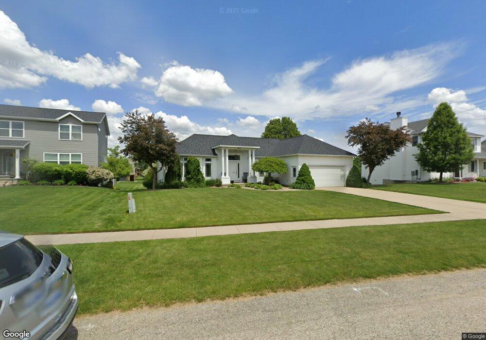
1877 Misty Ridge SW Byron Center, MI 49315
Estimated Value: $367,222 - $464,000
--
Bed
--
Bath
1,416
Sq Ft
$301/Sq Ft
Est. Value
About This Home
This home is located at 1877 Misty Ridge SW, Byron Center, MI 49315 and is currently estimated at $425,806, approximately $300 per square foot. 1877 Misty Ridge SW is a home located in Kent County with nearby schools including Brown Elementary School, Robert L. Nickels Intermediate School, and Byron Center West Middle School.
Ownership History
Date
Name
Owned For
Owner Type
Purchase Details
Closed on
Nov 4, 2002
Sold by
Padding Shani and Oconnor Shani
Bought by
Padding Shani
Current Estimated Value
Home Financials for this Owner
Home Financials are based on the most recent Mortgage that was taken out on this home.
Original Mortgage
$116,000
Interest Rate
6.1%
Create a Home Valuation Report for This Property
The Home Valuation Report is an in-depth analysis detailing your home's value as well as a comparison with similar homes in the area
Home Values in the Area
Average Home Value in this Area
Purchase History
| Date | Buyer | Sale Price | Title Company |
|---|---|---|---|
| Padding Shani | -- | -- |
Source: Public Records
Mortgage History
| Date | Status | Borrower | Loan Amount |
|---|---|---|---|
| Closed | Padding Shani | $116,000 |
Source: Public Records
Tax History Compared to Growth
Tax History
| Year | Tax Paid | Tax Assessment Tax Assessment Total Assessment is a certain percentage of the fair market value that is determined by local assessors to be the total taxable value of land and additions on the property. | Land | Improvement |
|---|---|---|---|---|
| 2025 | $2,347 | $176,000 | $0 | $0 |
| 2024 | $2,347 | $162,500 | $0 | $0 |
| 2023 | $2,245 | $150,600 | $0 | $0 |
| 2022 | $3,128 | $134,400 | $0 | $0 |
| 2021 | $3,045 | $119,400 | $0 | $0 |
| 2020 | $2,066 | $108,700 | $0 | $0 |
| 2019 | $2,971 | $108,100 | $0 | $0 |
| 2018 | $2,910 | $101,300 | $23,500 | $77,800 |
| 2017 | $2,831 | $97,300 | $0 | $0 |
| 2016 | $2,730 | $93,000 | $0 | $0 |
| 2015 | $2,683 | $93,000 | $0 | $0 |
| 2013 | -- | $86,300 | $0 | $0 |
Source: Public Records
Map
Nearby Homes
- 1647 Morning Dew Dr SW
- 1832 Kingsland Dr SW
- 1942 Creekside Dr SW
- 1912 Creekside Dr SW
- 1828 Gloryfield Dr
- 1666 Thyme Dr
- 1664 Thyme Dr
- 8638 Bethany Dr SW
- 8652 Bethany Dr SW
- 8608 Woodruff Dr SW
- The Fitzgerald Plan at Walnut Ridge
- The Marley Plan at Walnut Ridge
- The Hearthside Plan at Walnut Ridge
- The Balsam Plan at Walnut Ridge
- The Rutherford Plan at Walnut Ridge
- The Stockton Plan at Walnut Ridge
- The Georgetown Plan at Walnut Ridge
- The Mayfair Plan at Walnut Ridge
- The Hadley Plan at Walnut Ridge
- The Jamestown Plan at Walnut Ridge
- 1891 Misty Ridge Blvd
- 1859 Misty Ridge SW
- 1891 Misty Ridge SW
- 1786 Morning Dew Dr SW
- 1878 Misty Ridge SW
- 1896 Misty Ridge Blvd
- 1778 Morning Dew Dr SW
- 1864 Misty Ridge SW
- 1864 Misty Ridge SW
- 1801 Morning Dew Dr SW
- 1817 Misty Ridge SW
- 8195 Landstar Dr SW
- 1850 Misty Ridge SW
- 1850 Misty Ridge Blvd
- 1789 Morning Dew Dr SW
- 1772 Morning Dew Dr SW
- 8191 Landstar Dr SW
- 1814 Morning Dew Dr SW
- 8191 Landstar Dr SW
- 1838 Misty Ridge SW