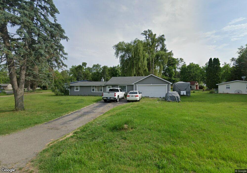
1877 Weir Rd Walled Lake, MI 48390
Estimated Value: $192,000 - $229,305
2
Beds
1
Bath
709
Sq Ft
$297/Sq Ft
Est. Value
About This Home
This home is located at 1877 Weir Rd, Walled Lake, MI 48390 and is currently estimated at $210,576, approximately $297 per square foot. 1877 Weir Rd is a home located in Oakland County with nearby schools including Mary Helen Guest Elementary School, James R Geisler Middle School, and Walled Lake Central High School.
Ownership History
Date
Name
Owned For
Owner Type
Purchase Details
Closed on
Oct 17, 2022
Sold by
Ivezaj Rok
Bought by
Ivezaj Gjon Jani
Current Estimated Value
Purchase Details
Closed on
Dec 10, 2008
Sold by
Chase Bank Usa Na
Bought by
Deutsche Bank National Trust Company
Purchase Details
Closed on
Mar 18, 2008
Sold by
Spencer Monica
Bought by
Chase Bank Usa Na
Purchase Details
Closed on
Aug 17, 2006
Sold by
Alexander Charles and Alexander Carol
Bought by
Spencer Monica
Home Financials for this Owner
Home Financials are based on the most recent Mortgage that was taken out on this home.
Original Mortgage
$98,400
Interest Rate
6.87%
Mortgage Type
Purchase Money Mortgage
Create a Home Valuation Report for This Property
The Home Valuation Report is an in-depth analysis detailing your home's value as well as a comparison with similar homes in the area
Home Values in the Area
Average Home Value in this Area
Purchase History
| Date | Buyer | Sale Price | Title Company |
|---|---|---|---|
| Ivezaj Gjon Jani | -- | -- | |
| Deutsche Bank National Trust Company | -- | Metropolitan | |
| Chase Bank Usa Na | $62,630 | None Available | |
| Spencer Monica | $123,000 | Multiple |
Source: Public Records
Mortgage History
| Date | Status | Borrower | Loan Amount |
|---|---|---|---|
| Previous Owner | Spencer Monica | $98,400 |
Source: Public Records
Tax History Compared to Growth
Tax History
| Year | Tax Paid | Tax Assessment Tax Assessment Total Assessment is a certain percentage of the fair market value that is determined by local assessors to be the total taxable value of land and additions on the property. | Land | Improvement |
|---|---|---|---|---|
| 2024 | $2,643 | $97,440 | $0 | $0 |
| 2023 | $2,118 | $90,680 | $0 | $0 |
| 2022 | $2,081 | $82,350 | $0 | $0 |
| 2021 | $2,037 | $78,680 | $0 | $0 |
| 2020 | $1,966 | $74,580 | $0 | $0 |
| 2019 | $2,690 | $68,060 | $0 | $0 |
| 2018 | $1,991 | $60,760 | $0 | $0 |
| 2017 | $1,968 | $59,510 | $0 | $0 |
| 2016 | $1,971 | $56,080 | $0 | $0 |
| 2015 | -- | $45,550 | $0 | $0 |
| 2014 | -- | $34,520 | $0 | $0 |
| 2011 | -- | $35,620 | $0 | $0 |
Source: Public Records
Map
Nearby Homes
- 1904 Meadow Ridge Dr
- 2138 Metzner Rd
- 3101 Cameron Cir
- 568 Woodhaven Dr Unit 89
- 462 Woodhaven Dr Unit 137
- 29204 April Ct Unit 236
- 8204 Alexa Dr Unit 88
- 17102 Caitlin Cir Unit 147
- 30204 Chantel Dr Unit 228
- 18203 Adri Cir Unit 122
- 34202 Emma Cir
- 651 Woodhaven Dr
- 1128 Annjo St
- 1439 Shankin Dr
- 2144 Park Place Dr
- 1700 Big Trail Rd
- 1533 Covington Crossing Unit 16
- 1895 Big Trail Rd
- 1747 Shankin Dr
- 2450 S Commerce Rd