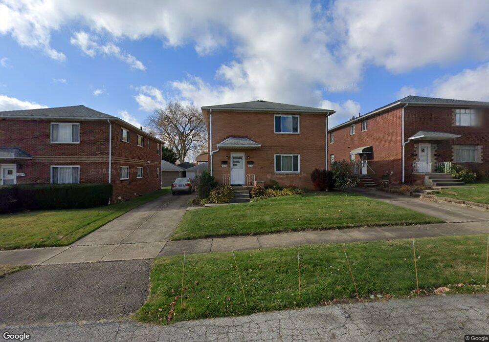
1878 Carter Ave Unit 1880 Akron, OH 44301
Firestone Park NeighborhoodEstimated Value: $190,000 - $202,172
4
Beds
2
Baths
2,322
Sq Ft
$84/Sq Ft
Est. Value
About This Home
This home is located at 1878 Carter Ave Unit 1880, Akron, OH 44301 and is currently estimated at $195,793, approximately $84 per square foot. 1878 Carter Ave Unit 1880 is a home located in Summit County with nearby schools including Kenmore Garfield Community Learning Center, Main Preparatory Academy, and Eagle Elementary.
Ownership History
Date
Name
Owned For
Owner Type
Purchase Details
Closed on
Aug 28, 2025
Sold by
Truman Tony A
Bought by
Tony A Truman Revocable Living Trust and Truman
Current Estimated Value
Purchase Details
Closed on
Sep 27, 2012
Sold by
Shipley James and Shipley Sharon K
Bought by
Truman Tony A
Create a Home Valuation Report for This Property
The Home Valuation Report is an in-depth analysis detailing your home's value as well as a comparison with similar homes in the area
Home Values in the Area
Average Home Value in this Area
Purchase History
| Date | Buyer | Sale Price | Title Company |
|---|---|---|---|
| Tony A Truman Revocable Living Trust | -- | None Listed On Document | |
| Truman Tony A | $79,000 | None Available |
Source: Public Records
Tax History Compared to Growth
Tax History
| Year | Tax Paid | Tax Assessment Tax Assessment Total Assessment is a certain percentage of the fair market value that is determined by local assessors to be the total taxable value of land and additions on the property. | Land | Improvement |
|---|---|---|---|---|
| 2025 | $3,253 | $60,183 | $8,677 | $51,506 |
| 2024 | $3,253 | $60,183 | $8,677 | $51,506 |
| 2023 | $3,253 | $60,183 | $8,677 | $51,506 |
| 2022 | $3,033 | $44,030 | $6,286 | $37,744 |
| 2021 | $3,036 | $44,030 | $6,286 | $37,744 |
| 2020 | $2,991 | $44,030 | $6,290 | $37,740 |
| 2019 | $2,095 | $27,650 | $6,290 | $21,360 |
| 2018 | $2,068 | $27,650 | $6,290 | $21,360 |
| 2017 | $2,191 | $27,650 | $6,290 | $21,360 |
| 2016 | $2,192 | $27,650 | $6,290 | $21,360 |
| 2015 | $2,191 | $27,650 | $6,290 | $21,360 |
| 2014 | $2,174 | $27,650 | $6,290 | $21,360 |
| 2013 | $2,867 | $38,060 | $6,290 | $31,770 |
Source: Public Records
Map
Nearby Homes
- 739 S Firestone Blvd
- 1882 Gless Ave
- 1698 Sunset Ave
- 315 Clinton Ave
- 1699 Redwood Ave
- 1663 Sunset Ave
- 1731 Highview Ave
- 1708 Highview Ave
- 1645 Hammel St
- 369 Mission Dr
- 361 Mission Dr
- 249 Naomi St
- 1642 Highview Ave
- 1576 Hammel St
- 1604 Oakwood Ave
- 1614 Glenmount Ave
- 0 Woodview Dr
- 1571 Redwood Ave
- 2179 Glenmount Ave
- 437 Palmetto Ave
- 1880 Carter Ave
- 1874 Carter Ave Unit 1876
- 1882 Carter Ave Unit 1884
- 1868 Carter Ave Unit 1870
- 1888 Carter Ave Unit 1890
- 737 S Firestone Blvd Unit 739
- 745 S Firestone Blvd Unit 747
- 1892 Carter Ave Unit 1894
- 733 S Firestone Blvd Unit 735
- 733 S Firestone Blvd Unit 735
- 735 S Firestone Blvd Unit UP
- 735 S Firestone Blvd
- 735 S Firestone Blvd Unit 735
- 733 S Firestone Blvd
- 735 S Firestone Blvd
- 733 S Firestone Blvd Unit DOWN
- 1881 Carter Ave
- 1881 Carter Ave
- 751 753 S Firestone Blvd
- 751 S Firestone Blvd Unit 753