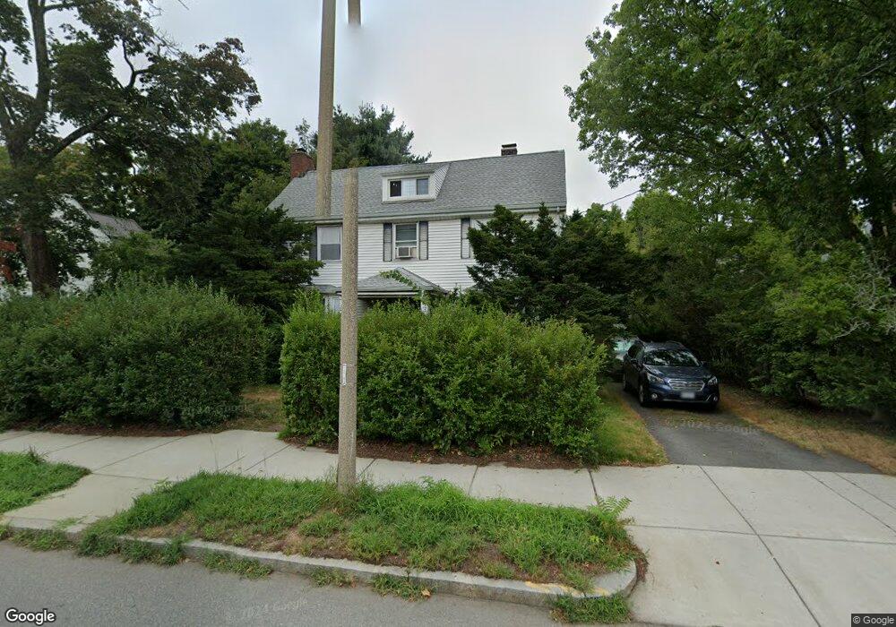
1878 Commonwealth Ave Auburndale, MA 02466
Auburndale NeighborhoodEstimated Value: $1,424,557 - $1,857,000
3
Beds
2
Baths
2,114
Sq Ft
$761/Sq Ft
Est. Value
About This Home
This home is located at 1878 Commonwealth Ave, Auburndale, MA 02466 and is currently estimated at $1,609,389, approximately $761 per square foot. 1878 Commonwealth Ave is a home located in Middlesex County with nearby schools including Williams Elementary School, Charles E Brown Middle School, and Newton South High School.
Ownership History
Date
Name
Owned For
Owner Type
Purchase Details
Closed on
Oct 30, 1996
Sold by
Goldberg Andrew H and Wojdyslawski Suzi
Bought by
Baker Michael and Pollack-Baker Aimee
Current Estimated Value
Home Financials for this Owner
Home Financials are based on the most recent Mortgage that was taken out on this home.
Original Mortgage
$100,000
Outstanding Balance
$9,838
Interest Rate
8.07%
Mortgage Type
Purchase Money Mortgage
Estimated Equity
$1,599,551
Create a Home Valuation Report for This Property
The Home Valuation Report is an in-depth analysis detailing your home's value as well as a comparison with similar homes in the area
Home Values in the Area
Average Home Value in this Area
Purchase History
| Date | Buyer | Sale Price | Title Company |
|---|---|---|---|
| Baker Michael | $370,000 | -- |
Source: Public Records
Mortgage History
| Date | Status | Borrower | Loan Amount |
|---|---|---|---|
| Open | Baker Michael | $100,000 | |
| Previous Owner | Baker Michael | $64,000 | |
| Previous Owner | Baker Michael | $190,000 |
Source: Public Records
Tax History
| Year | Tax Paid | Tax Assessment Tax Assessment Total Assessment is a certain percentage of the fair market value that is determined by local assessors to be the total taxable value of land and additions on the property. | Land | Improvement |
|---|---|---|---|---|
| 2025 | $12,028 | $1,227,300 | $853,700 | $373,600 |
| 2024 | $11,630 | $1,191,600 | $828,800 | $362,800 |
| 2023 | $10,998 | $1,080,400 | $632,600 | $447,800 |
| 2022 | $10,524 | $1,000,400 | $585,700 | $414,700 |
| 2021 | $10,155 | $943,800 | $552,500 | $391,300 |
| 2020 | $9,853 | $943,800 | $552,500 | $391,300 |
| 2019 | $9,575 | $916,300 | $536,400 | $379,900 |
| 2018 | $3,827 | $839,800 | $486,100 | $353,700 |
| 2017 | $8,810 | $792,300 | $458,600 | $333,700 |
| 2016 | $8,427 | $740,500 | $428,600 | $311,900 |
| 2015 | $8,035 | $692,100 | $400,600 | $291,500 |
Source: Public Records
Map
Nearby Homes
- 194 Auburn St Unit 2
- 1917 Commonwealth Ave Unit 1917
- 226 Auburn St Unit 226
- 7 Sharon Ave Unit 7
- 283 Woodland Rd
- 1754 Washington St
- 0 Duncan Rd Unit 72925240
- 8 Curve St
- 17 Lasell St
- 283 Melrose St
- 232 Melrose St Unit 2
- 27 Tennyson Rd
- 10 Higgins St
- 160 Pine St Unit 15
- 160 Pine St Unit 12
- 2202 Commonwealth Ave Unit 1
- 12 Oakwood Rd
- 40 Sewall St
- 18 Sewall St
- 49 Staniford St
- 1874 Commonwealth Ave
- 1888 Commonwealth Ave
- 158 Auburn St
- 25 Central St
- 1870 Commonwealth Ave
- 164 Auburn St
- 21 Central St
- 11 Central St
- 1881 Commonwealth Ave
- 1875 Commonwealth Ave
- 170 Auburn St
- 1887 Commonwealth Ave
- 29 Central St
- 1863 Commonwealth Ave
- 1897 Commonwealth Ave Unit 1899
- 1897 Commonwealth Ave Unit 1
- 1855 Commonwealth Ave
- 35 Central St
- 122 Auburn St
- 127 Auburn St Unit 129
Your Personal Tour Guide
Ask me questions while you tour the home.