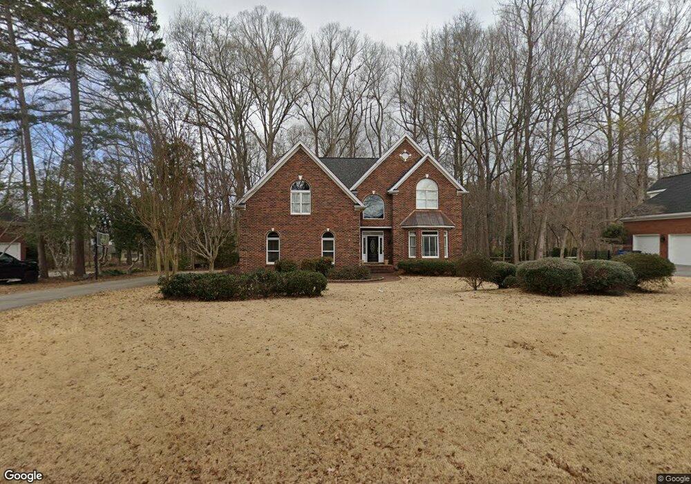
1879 Landry Ln Rock Hill, SC 29732
Estimated Value: $746,808 - $799,000
--
Bed
1
Bath
3,502
Sq Ft
$221/Sq Ft
Est. Value
About This Home
This home is located at 1879 Landry Ln, Rock Hill, SC 29732 and is currently estimated at $773,702, approximately $220 per square foot. 1879 Landry Ln is a home located in York County with nearby schools including Rawlinson Road Middle School, Northwestern High School, and York Preparatory Academy.
Ownership History
Date
Name
Owned For
Owner Type
Purchase Details
Closed on
Jul 14, 2005
Sold by
Mingus Robert P
Bought by
The Beverly H Barringer Trust
Current Estimated Value
Home Financials for this Owner
Home Financials are based on the most recent Mortgage that was taken out on this home.
Original Mortgage
$282,000
Outstanding Balance
$146,541
Interest Rate
5.59%
Mortgage Type
New Conventional
Estimated Equity
$627,161
Create a Home Valuation Report for This Property
The Home Valuation Report is an in-depth analysis detailing your home's value as well as a comparison with similar homes in the area
Home Values in the Area
Average Home Value in this Area
Purchase History
| Date | Buyer | Sale Price | Title Company |
|---|---|---|---|
| The Beverly H Barringer Trust | $354,000 | -- |
Source: Public Records
Mortgage History
| Date | Status | Borrower | Loan Amount |
|---|---|---|---|
| Open | The Beverly H Barringer Trust | $282,000 |
Source: Public Records
Tax History Compared to Growth
Tax History
| Year | Tax Paid | Tax Assessment Tax Assessment Total Assessment is a certain percentage of the fair market value that is determined by local assessors to be the total taxable value of land and additions on the property. | Land | Improvement |
|---|---|---|---|---|
| 2024 | $3,108 | $14,168 | $2,973 | $11,195 |
| 2023 | $3,117 | $14,168 | $2,973 | $11,195 |
| 2022 | $3,138 | $14,168 | $2,971 | $11,197 |
| 2021 | -- | $14,168 | $2,971 | $11,197 |
| 2020 | $3,145 | $14,168 | $0 | $0 |
| 2019 | $2,821 | $12,320 | $0 | $0 |
| 2018 | $2,818 | $12,320 | $0 | $0 |
| 2017 | $2,714 | $12,320 | $0 | $0 |
| 2016 | $2,689 | $12,320 | $0 | $0 |
| 2014 | $2,908 | $12,320 | $2,720 | $9,600 |
| 2013 | $2,908 | $13,980 | $2,720 | $11,260 |
Source: Public Records
Map
Nearby Homes
- 1594 Summit View Dr
- 1593 Worthington Crossing
- 2069 Landry Ln Unit 233
- 2765 Dogwood Cir
- 1548 Summit View Dr
- 2076 Landry Ln Unit 232
- 1189 Quiet Acres Rd
- 1183 Quiet Acres Rd
- 1487 The Crossing
- 2615 Oakhurst Dr
- 1768 Williamsburg Dr
- 1122 Wendy Rd
- 609 Rosemore Place
- 1648 Williamsburg Dr
- 1939 Hendricks St
- 1925 Hendricks St
- 1655 Durant Dr
- 2085 Fordhill St
- 985 Montgomery Dr
- 1664 Dresden Dr
- 1869 Landry Ln
- 1889 Landry Ln
- 1894 Landry Ln
- 1876 Landry Ln
- 1859 Landry Ln
- 1859 Landry Ln Unit 274
- 1866 Landry Ln
- 1839 Jack White Dr
- 1849 Landry Ln
- 1412 Quiet Acres Cir
- 1856 Landry Ln
- 1909 Landry Ln
- 1839 Landry Ln
- 1686 Saybrook Ct
- 1919 Landry Ln
- 1928 Landry Ln
- 1678 Saybrook Ct
- 1678 Saybrook Ct Unit 285
- 1929 Landry Ln
- 1428 Quiet Acres Cir