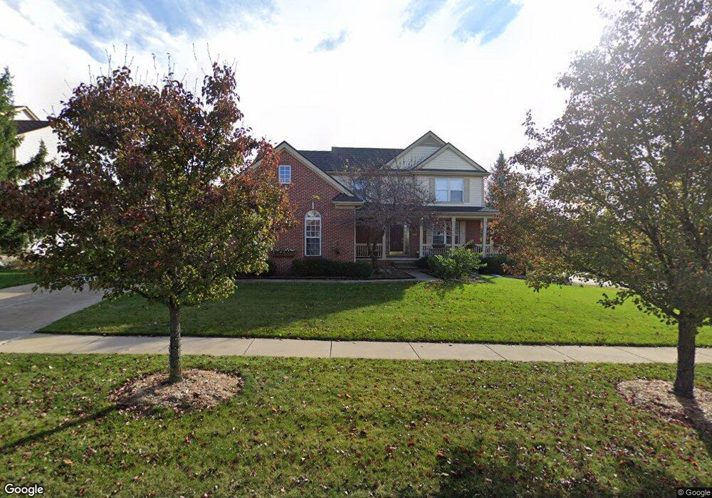
1879 Meadowside Dr Unit 17 Ann Arbor, MI 48104
Allen NeighborhoodEstimated Value: $615,000 - $804,000
3
Beds
2
Baths
2,601
Sq Ft
$268/Sq Ft
Est. Value
About This Home
This home is located at 1879 Meadowside Dr Unit 17, Ann Arbor, MI 48104 and is currently estimated at $696,726, approximately $267 per square foot. 1879 Meadowside Dr Unit 17 is a home located in Washtenaw County with nearby schools including Allen Elementary School, Tappan Middle School, and Huron High School.
Ownership History
Date
Name
Owned For
Owner Type
Purchase Details
Closed on
Dec 2, 2016
Sold by
Lie Leo D
Bought by
Lie Nora L
Current Estimated Value
Purchase Details
Closed on
Oct 25, 2005
Sold by
Lie Leo D and Lie Nora L
Bought by
Lie Leo D and Lie Nora L
Purchase Details
Closed on
Oct 1, 2003
Sold by
Sparks John N and Sparks Susan
Bought by
Lie Leo D and Lie Nora L
Home Financials for this Owner
Home Financials are based on the most recent Mortgage that was taken out on this home.
Original Mortgage
$200,000
Outstanding Balance
$85,524
Interest Rate
5%
Mortgage Type
Unknown
Estimated Equity
$611,202
Purchase Details
Closed on
May 15, 2001
Sold by
Sparks John N
Bought by
Sparks John N
Purchase Details
Closed on
Jun 30, 2000
Sold by
Builders L L C Arbor
Bought by
Sparks John N
Create a Home Valuation Report for This Property
The Home Valuation Report is an in-depth analysis detailing your home's value as well as a comparison with similar homes in the area
Home Values in the Area
Average Home Value in this Area
Purchase History
We collect this data history from publicly available records. To have your information removed, we recommend requesting removal directly through your county’s website.
| Date | Buyer | Sale Price | Title Company |
|---|---|---|---|
| Lie Nora L | -- | None Available | |
| Lie Leo D | -- | None Available | |
| Lie Leo D | $420,000 | -- | |
| Sparks John N | -- | -- | |
| Sparks John N | $280,925 | -- |
Source: Public Records
Mortgage History
We collect this data history from publicly available records. To have your information removed, we recommend requesting removal directly through your county’s website.
| Date | Status | Borrower | Loan Amount |
|---|---|---|---|
| Open | Lie Leo D | $200,000 |
Source: Public Records
Tax History
| Year | Tax Paid | Tax Assessment Tax Assessment Total Assessment is a certain percentage of the fair market value that is determined by local assessors to be the total taxable value of land and additions on the property. | Land | Improvement |
|---|---|---|---|---|
| 2025 | $10,116 | $278,000 | $0 | $0 |
| 2024 | $9,867 | $295,800 | $0 | $0 |
| 2023 | $9,098 | $295,000 | $0 | $0 |
| 2022 | $9,914 | $263,800 | $0 | $0 |
| 2021 | $9,680 | $249,900 | $0 | $0 |
| 2020 | $9,485 | $223,200 | $0 | $0 |
| 2019 | $9,026 | $225,700 | $225,700 | $0 |
| 2018 | $8,899 | $215,800 | $0 | $0 |
| 2017 | $8,657 | $218,600 | $0 | $0 |
| 2016 | $8,352 | $173,110 | $0 | $0 |
| 2015 | $7,954 | $172,593 | $0 | $0 |
| 2014 | $7,954 | $167,200 | $0 | $0 |
| 2013 | -- | $167,200 | $0 | $0 |
Source: Public Records
Map
Nearby Homes
- 1867 Lindsay Ln
- 1660 Meadowside Dr Unit 68
- 1941 Boulder Dr
- 3201 Asher Rd
- 3195 Asher Rd Unit 5
- 2292 Yost Blvd
- 2310 Pinecrest Ave
- 2201 S Huron Pkwy Unit 4
- 2310 Yost Blvd
- 2318 Pittsfield Blvd
- 2371 Yost Blvd
- 3091 Warwick Rd
- 2233 S Huron Pkwy Unit 2
- 3586 E Huron River Dr
- 4031 Clark Rd
- 2468 Fernwood Ave
- 3575 E Huron River Dr
- 3159 Edgewood Dr
- 3621 Eli Rd
- 2292 Greenway Trail
- 1859 Meadowside Dr Unit 18
- 1870 Meadowside Dr
- 1850 Meadowside Dr Unit 75
- 1900 Woodcreek Blvd Unit 15
- 1830 Meadowside Dr
- 1839 Meadowside Dr Unit 19
- 1860 Woodcreek Blvd Unit 14
- 1800 Woodcreek Blvd
- 1950 Woodcreek Blvd Unit 16
- 1829 Meadowside Dr Unit 20
- 1730 Woodcreek Blvd Unit 11
- 3440 Wooddale Ct Unit 77
- 1820 Meadowside Dr Unit 73
- 1819 Meadowside Dr Unit 21
- 1800 Meadowside Dr Unit 72
- 3450 Wooddale Ct Unit 78
- 1710 Woodcreek Blvd
- 1750 Meadowside Dr
- 3460 Wooddale Ct Unit 79
- 1725 Chalmers Dr
Your Personal Tour Guide
Ask me questions while you tour the home.