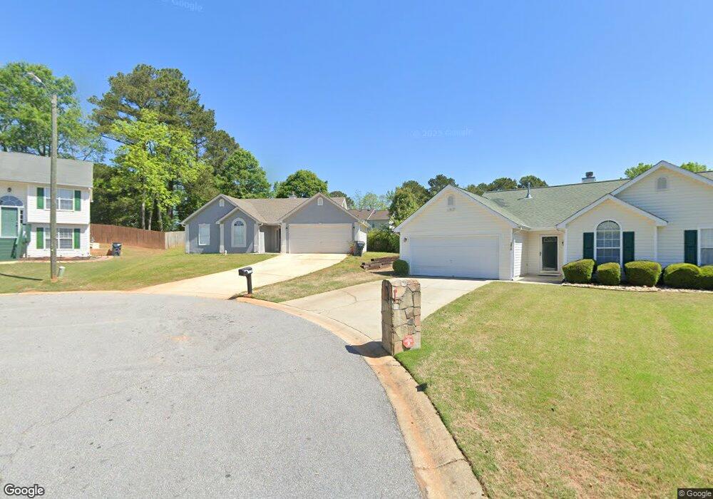
1879 Portwest Way Unit 66 Hampton, GA 30228
Estimated Value: $226,000 - $257,000
3
Beds
2
Baths
1,416
Sq Ft
$168/Sq Ft
Est. Value
About This Home
This home is located at 1879 Portwest Way Unit 66, Hampton, GA 30228 and is currently estimated at $237,903, approximately $168 per square foot. 1879 Portwest Way Unit 66 is a home located in Clayton County with nearby schools including Kemp Primary School, Kemp Elementary School, and Lovejoy Middle School.
Ownership History
Date
Name
Owned For
Owner Type
Purchase Details
Closed on
Dec 21, 2018
Sold by
Tejada Paris S
Bought by
Yamasa Co Ltd
Current Estimated Value
Purchase Details
Closed on
May 19, 2010
Sold by
Oul Pheas S
Bought by
Georgia R/E Solutions Llc
Purchase Details
Closed on
Jul 31, 1997
Sold by
Peachtree Homes
Bought by
Oul Pheas S and Clot Sorn
Home Financials for this Owner
Home Financials are based on the most recent Mortgage that was taken out on this home.
Original Mortgage
$89,750
Interest Rate
7.59%
Mortgage Type
FHA
Create a Home Valuation Report for This Property
The Home Valuation Report is an in-depth analysis detailing your home's value as well as a comparison with similar homes in the area
Home Values in the Area
Average Home Value in this Area
Purchase History
| Date | Buyer | Sale Price | Title Company |
|---|---|---|---|
| Yamasa Co Ltd | $133,000 | -- | |
| Georgia R/E Solutions Llc | -- | -- | |
| Oul Pheas S | $91,900 | -- |
Source: Public Records
Mortgage History
| Date | Status | Borrower | Loan Amount |
|---|---|---|---|
| Previous Owner | Oul Pheas S | $89,750 |
Source: Public Records
Tax History Compared to Growth
Tax History
| Year | Tax Paid | Tax Assessment Tax Assessment Total Assessment is a certain percentage of the fair market value that is determined by local assessors to be the total taxable value of land and additions on the property. | Land | Improvement |
|---|---|---|---|---|
| 2024 | $3,205 | $95,600 | $7,200 | $88,400 |
| 2023 | $3,246 | $88,920 | $7,200 | $81,720 |
| 2022 | $2,595 | $65,240 | $7,200 | $58,040 |
| 2021 | $2,184 | $54,400 | $7,200 | $47,200 |
| 2020 | $2,076 | $51,040 | $7,200 | $43,840 |
| 2019 | $1,789 | $43,199 | $6,800 | $36,399 |
| 2018 | $1,620 | $39,040 | $6,800 | $32,240 |
| 2017 | $1,368 | $32,751 | $6,800 | $25,951 |
| 2016 | $1,402 | $33,588 | $6,800 | $26,788 |
| 2015 | $1,238 | $0 | $0 | $0 |
| 2014 | $1,018 | $24,724 | $6,800 | $17,924 |
Source: Public Records
Map
Nearby Homes
- 1741 Portwest Way
- 10959 Thrasher Rd
- 1683 Spoonbill Rd
- 1685 Kinglet Rd
- 11005 Regents Ct
- 1739 Cardinal Rd
- 10996 Shannon Cir
- 11045 Knotty Pine Place
- 11057 Aliyah Dr
- 11059 Sedalia Way
- 1579 Leonard St
- 1432 Shadow Creek Ave
- 1558 Leonard St
- 11179 Knotty Pine Place Unit I
- 11187 Shannon Cir
- 11224 Aliyah Dr
- 1646 Flicker Rd
- 10897 Paladin Dr
- 1590 Flicker Rd
- 1350 Birdsong Ln
- 1867 Portwest Way
- 1875 Portwest Way
- 1879 Portwest Way
- 1883 Portwest Way
- 1891 Portwest Way
- 1897 Portwest Way
- 1903 Portwest Way
- 1909 Portwest Way Unit 61
- 1909 Portwest Way
- 1915 Portwest Way
- 1921 Portwest Way
- 1927 Portwest Way
- 1933 Portwest Way
- 1945 Portwest Way
- 1939 Portwest Way
- 1939 Portwest Way Unit 1
- 1951 Portwest Way
- 1955 Portwest Way
- 1735 Portwest Way Unit 1735
- 1735 Portwest Way