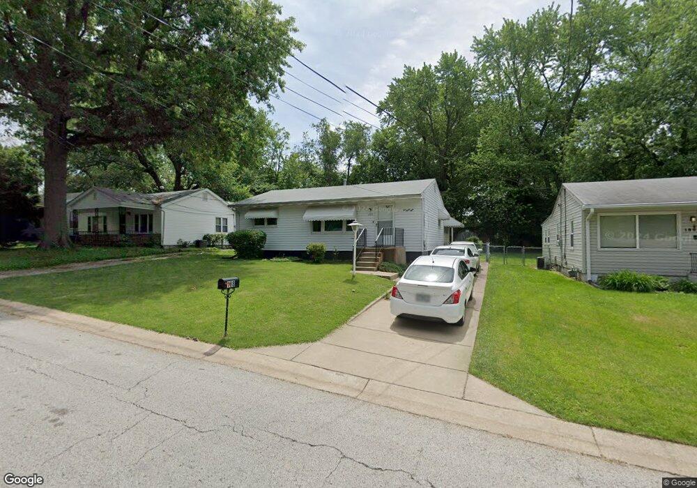
188 Bascom Dr Saint Louis, MO 63135
Estimated Value: $106,717 - $118,000
3
Beds
1
Bath
972
Sq Ft
$115/Sq Ft
Est. Value
About This Home
This home is located at 188 Bascom Dr, Saint Louis, MO 63135 and is currently estimated at $111,679, approximately $114 per square foot. 188 Bascom Dr is a home located in St. Louis County with nearby schools including Walnut Grove Elementary School, Ferguson Middle School, and McCluer High School.
Ownership History
Date
Name
Owned For
Owner Type
Purchase Details
Closed on
Oct 19, 2007
Sold by
Bryant John A and Bryant Donna L
Bought by
Brown Bernard
Current Estimated Value
Home Financials for this Owner
Home Financials are based on the most recent Mortgage that was taken out on this home.
Original Mortgage
$71,402
Outstanding Balance
$44,831
Interest Rate
6.32%
Mortgage Type
VA
Estimated Equity
$66,848
Create a Home Valuation Report for This Property
The Home Valuation Report is an in-depth analysis detailing your home's value as well as a comparison with similar homes in the area
Home Values in the Area
Average Home Value in this Area
Purchase History
| Date | Buyer | Sale Price | Title Company |
|---|---|---|---|
| Brown Bernard | $69,900 | Ctc |
Source: Public Records
Mortgage History
| Date | Status | Borrower | Loan Amount |
|---|---|---|---|
| Open | Brown Bernard | $71,402 |
Source: Public Records
Tax History
| Year | Tax Paid | Tax Assessment Tax Assessment Total Assessment is a certain percentage of the fair market value that is determined by local assessors to be the total taxable value of land and additions on the property. | Land | Improvement |
|---|---|---|---|---|
| 2025 | $959 | $18,950 | $1,960 | $16,990 |
| 2024 | $959 | $13,720 | $780 | $12,940 |
| 2023 | $978 | $13,720 | $780 | $12,940 |
| 2022 | $847 | $10,430 | $2,340 | $8,090 |
| 2021 | $843 | $10,430 | $2,340 | $8,090 |
| 2020 | $827 | $9,580 | $1,580 | $8,000 |
| 2019 | $804 | $9,580 | $1,580 | $8,000 |
| 2018 | $811 | $8,690 | $1,220 | $7,470 |
| 2017 | $796 | $8,690 | $1,220 | $7,470 |
| 2016 | $947 | $10,170 | $1,980 | $8,190 |
Source: Public Records
Map
Nearby Homes
- 194 Elbring Dr
- 135 Grether Ave
- 120 Grether Ave
- 968 Buckeye Dr
- 225 Sadonia Ave
- 25 Vierling Dr
- 6717 Thurston Ave
- 273 Buddie Ave
- 201 Becker Dr
- 6625 Thurston Ave
- 20 Connolly Dr
- 8330 Red Fir Dr
- 242 Connolly Dr
- 8401 Saint Olaf Dr
- 12 Thackery Ct
- 116 Barto Dr
- 8 Drummond Dr
- 8379 Midwood Ave
- 233 Connolly Dr
- 13 Barto Dr
Your Personal Tour Guide
Ask me questions while you tour the home.