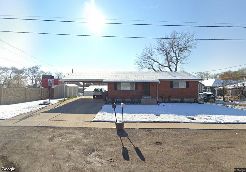
188 E 200 N American Fork, UT 84003
Estimated Value: $496,942 - $548,000
4
Beds
2
Baths
2,214
Sq Ft
$236/Sq Ft
Est. Value
About This Home
This home is located at 188 E 200 N, American Fork, UT 84003 and is currently estimated at $521,736, approximately $235 per square foot. 188 E 200 N is a home located in Utah County with nearby schools including Forbes Elementary School, American Fork Junior High School, and American Fork High School.
Ownership History
Date
Name
Owned For
Owner Type
Purchase Details
Closed on
Nov 13, 2019
Sold by
Anderson William J and Anderson Heather
Bought by
W & H 184 Llc
Current Estimated Value
Purchase Details
Closed on
Jul 15, 2009
Sold by
Flood Kimberly
Bought by
Anderson William J and Anderson Heather
Home Financials for this Owner
Home Financials are based on the most recent Mortgage that was taken out on this home.
Original Mortgage
$112,000
Interest Rate
5.59%
Mortgage Type
Purchase Money Mortgage
Purchase Details
Closed on
Jun 29, 2007
Sold by
Lebaron Shirl Don and Shirley S Lebaron Charitable R
Bought by
Flood Kimberly
Home Financials for this Owner
Home Financials are based on the most recent Mortgage that was taken out on this home.
Original Mortgage
$165,000
Interest Rate
8.78%
Mortgage Type
New Conventional
Purchase Details
Closed on
Jan 27, 2004
Sold by
Lebaron Charles and Lebaron Shirley S
Bought by
Lebaron Shirl Don and Shirley S Lebaron Charitable R
Purchase Details
Closed on
Nov 19, 1996
Sold by
Atwood Gay L and Atwood Lynn William
Bought by
Atwood Dale Lynn and Atwood Shellie A
Create a Home Valuation Report for This Property
The Home Valuation Report is an in-depth analysis detailing your home's value as well as a comparison with similar homes in the area
Home Values in the Area
Average Home Value in this Area
Purchase History
| Date | Buyer | Sale Price | Title Company |
|---|---|---|---|
| W & H 184 Llc | -- | None Available | |
| Anderson William J | -- | Eagle Pointe Title Insuranc | |
| Flood Kimberly | -- | Union Title | |
| Lebaron Shirl Don | -- | Lone Peak Title Insurance | |
| Atwood Dale Lynn | -- | -- |
Source: Public Records
Mortgage History
| Date | Status | Borrower | Loan Amount |
|---|---|---|---|
| Previous Owner | Anderson William J | $112,000 | |
| Previous Owner | Flood Kimberly | $165,000 |
Source: Public Records
Tax History Compared to Growth
Tax History
| Year | Tax Paid | Tax Assessment Tax Assessment Total Assessment is a certain percentage of the fair market value that is determined by local assessors to be the total taxable value of land and additions on the property. | Land | Improvement |
|---|---|---|---|---|
| 2025 | $2,148 | $263,065 | $190,800 | $287,500 |
| 2024 | $2,148 | $238,645 | $0 | $0 |
| 2023 | $2,027 | $238,755 | $0 | $0 |
| 2022 | $2,081 | $241,945 | $0 | $0 |
| 2021 | $1,782 | $323,500 | $136,900 | $186,600 |
| 2020 | $1,666 | $293,400 | $122,200 | $171,200 |
| 2019 | $1,515 | $275,900 | $104,700 | $171,200 |
| 2018 | $1,396 | $243,100 | $94,200 | $148,900 |
| 2017 | $1,348 | $126,720 | $0 | $0 |
| 2016 | $1,371 | $119,735 | $0 | $0 |
| 2015 | $1,331 | $110,275 | $0 | $0 |
| 2014 | $1,273 | $104,060 | $0 | $0 |
Source: Public Records
Map
Nearby Homes