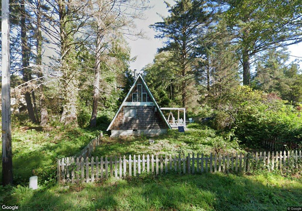
188 E Dawes Ave Cannon Beach, OR 97110
Estimated Value: $579,000 - $664,000
1
Bed
1
Bath
600
Sq Ft
$1,017/Sq Ft
Est. Value
About This Home
This home is located at 188 E Dawes Ave, Cannon Beach, OR 97110 and is currently estimated at $610,315, approximately $1,017 per square foot. 188 E Dawes Ave is a home located in Clatsop County with nearby schools including Seaside High School and The Cannon Beach Academy.
Ownership History
Date
Name
Owned For
Owner Type
Purchase Details
Closed on
May 7, 2021
Sold by
Rouzee Dianna J and Rouzee Eric
Bought by
Adams Tyler Robert
Current Estimated Value
Purchase Details
Closed on
Jul 21, 2017
Sold by
Rouzee Dianna J and Scott Dianna J
Bought by
Rouzee Dianna J and Rouzee Eric
Home Financials for this Owner
Home Financials are based on the most recent Mortgage that was taken out on this home.
Original Mortgage
$126,000
Interest Rate
3.91%
Mortgage Type
New Conventional
Create a Home Valuation Report for This Property
The Home Valuation Report is an in-depth analysis detailing your home's value as well as a comparison with similar homes in the area
Home Values in the Area
Average Home Value in this Area
Purchase History
| Date | Buyer | Sale Price | Title Company |
|---|---|---|---|
| Adams Tyler Robert | $415,000 | Ticor Title Company Of Or | |
| Rouzee Dianna J | -- | Title Source Inc |
Source: Public Records
Mortgage History
| Date | Status | Borrower | Loan Amount |
|---|---|---|---|
| Previous Owner | Rouzee Dianna J | $126,000 |
Source: Public Records
Tax History Compared to Growth
Tax History
| Year | Tax Paid | Tax Assessment Tax Assessment Total Assessment is a certain percentage of the fair market value that is determined by local assessors to be the total taxable value of land and additions on the property. | Land | Improvement |
|---|---|---|---|---|
| 2024 | $2,632 | $208,545 | -- | -- |
| 2023 | $2,378 | $202,472 | $0 | $0 |
| 2022 | $2,317 | $196,575 | $0 | $0 |
| 2021 | $2,269 | $190,851 | $0 | $0 |
| 2020 | $2,230 | $185,293 | $0 | $0 |
| 2019 | $2,096 | $179,897 | $0 | $0 |
| 2018 | $1,986 | $174,659 | $0 | $0 |
| 2017 | $1,909 | $169,573 | $0 | $0 |
| 2016 | $1,641 | $164,635 | $99,252 | $65,383 |
| 2015 | $1,576 | $159,841 | $96,362 | $63,479 |
| 2014 | $1,525 | $155,187 | $0 | $0 |
| 2013 | -- | $150,668 | $0 | $0 |
Source: Public Records
Map
Nearby Homes
- 264 E Elliott Way
- 264 Elliott Way
- 0 E Elliott Way Unit 25-50
- 0 E Elliott Way Unit 6903
- 107 Sunset Blvd
- 164 E Hills Ln
- 216 E Harrison St
- 1631 S Hemlock St
- 1625 Forest Lawn Rd
- 1659 Forest Lawn Rd
- 131 Arbor Ln
- 296 E Jackson St
- 108 W Jefferson St
- 421 Elk Creek Rd
- 1880 Pacific St
- 420 Elk Creek Rd Unit 503
- 3750 Pacific St
- 123 S Hemlock St
- 123 S Hemlock St Unit 201
- 123 W 1st Ave
- 188 Dawes Ave
- 155 Breakers Point Condo
- 3447 W Pacific
- 753 Breakers Point Condo Unit 753
- 0 Dawes Ave Unit 254315
- 0 Dawes Ave Unit 9-82
- 0 Dawes Ave Unit 12-857
- 0 Dawes Ave Unit 13-392
- 0 Dawes Ave Unit 12-1553
- 0 Dawes Ave Unit 15-565
- 0 Dawes Ave Unit 16-459
- 0 Dawes Ave Unit Lot 7 20404727
- 0 Dawes Ave Unit 1 9004525
- 0 Dawes Ave Unit 1 12267855
- 0 Dawes Ave Unit 13240416
- 0 Dawes Ave Unit 14060416
- 0 Dawes Ave Unit 15103708
- 0 Dawes Ave Unit 16418706
- 0 Dawes Ave Unit 12308
- 147 Dawes Ave