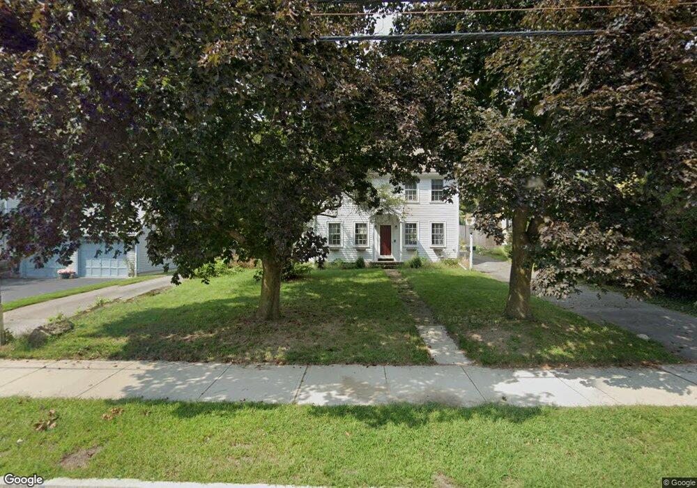
188 Main St Medway, MA 02053
Estimated Value: $502,000 - $544,000
3
Beds
2
Baths
1,344
Sq Ft
$393/Sq Ft
Est. Value
About This Home
This home is located at 188 Main St, Medway, MA 02053 and is currently estimated at $528,142, approximately $392 per square foot. 188 Main St is a home located in Norfolk County with nearby schools including John D. McGovern Elementary School, Burke-Memorial Elementary, and Medway Middle School.
Ownership History
Date
Name
Owned For
Owner Type
Purchase Details
Closed on
Nov 30, 2018
Sold by
Ebert Joseph R and Ebert Leslie B
Bought by
Houde Stephanie
Current Estimated Value
Purchase Details
Closed on
Jul 29, 1987
Sold by
Sweeney George O
Bought by
Ebert Joseph R
Home Financials for this Owner
Home Financials are based on the most recent Mortgage that was taken out on this home.
Original Mortgage
$110,400
Interest Rate
10.43%
Mortgage Type
Purchase Money Mortgage
Create a Home Valuation Report for This Property
The Home Valuation Report is an in-depth analysis detailing your home's value as well as a comparison with similar homes in the area
Home Values in the Area
Average Home Value in this Area
Purchase History
| Date | Buyer | Sale Price | Title Company |
|---|---|---|---|
| Houde Stephanie | $240,000 | -- | |
| Ebert Joseph R | $138,000 | -- |
Source: Public Records
Mortgage History
| Date | Status | Borrower | Loan Amount |
|---|---|---|---|
| Previous Owner | Ebert Joseph R | $118,500 | |
| Previous Owner | Ebert Joseph R | $110,400 | |
| Previous Owner | Ebert Joseph R | $110,400 |
Source: Public Records
Tax History Compared to Growth
Tax History
| Year | Tax Paid | Tax Assessment Tax Assessment Total Assessment is a certain percentage of the fair market value that is determined by local assessors to be the total taxable value of land and additions on the property. | Land | Improvement |
|---|---|---|---|---|
| 2025 | $6,330 | $444,200 | $256,600 | $187,600 |
| 2024 | $6,396 | $444,200 | $256,600 | $187,600 |
| 2023 | $6,248 | $392,000 | $224,000 | $168,000 |
| 2022 | $5,942 | $351,000 | $189,400 | $161,600 |
| 2021 | $5,699 | $326,400 | $171,100 | $155,300 |
| 2020 | $5,437 | $310,700 | $150,700 | $160,000 |
| 2019 | $5,008 | $295,100 | $142,600 | $152,500 |
| 2018 | $4,948 | $280,200 | $122,200 | $158,000 |
| 2017 | $4,996 | $278,800 | $122,200 | $156,600 |
| 2016 | $4,533 | $250,300 | $101,800 | $148,500 |
| 2015 | $4,047 | $221,900 | $101,800 | $120,100 |
| 2014 | $4,207 | $223,300 | $111,100 | $112,200 |
Source: Public Records
Map
Nearby Homes
- 176 Main St Unit 3
- 28 Wellington St
- 5 Fales St
- 220 Main St Unit 220
- 6 Freedom Trail
- 4 Shaw St
- 280 Village St Unit D2
- 21 Riverside Rd
- 14 Heritage Dr
- 22 Sunset Dr
- 39 West St
- 18 Mary Anne Dr
- 36 Lovering St
- 462 Hartford Ave
- 12 Lovering St
- 455 Hartford Ave
- 3 Meryl St
- 106 Holliston St
- 12 Longmeadow Ln
- 951 Pond St
- 184 Main St
- 190 Main St
- 186 Main St
- 182 Main St
- 187 Main St
- 183 Main St
- 189 Main St
- 180 Main St Unit 1B
- 180 Main St
- 180 Main St Unit 1A
- 180 Main St Unit 2A
- 180 Main St Unit 2B
- 192 Main St Unit F
- 192 Main St Unit E
- 192 Main St Unit D/E
- 192 Main St Unit F/G
- 192 Main St Unit C
- 192 Main St Unit 4
- 192 Main St Unit 2
- 192 Main St Unit 1