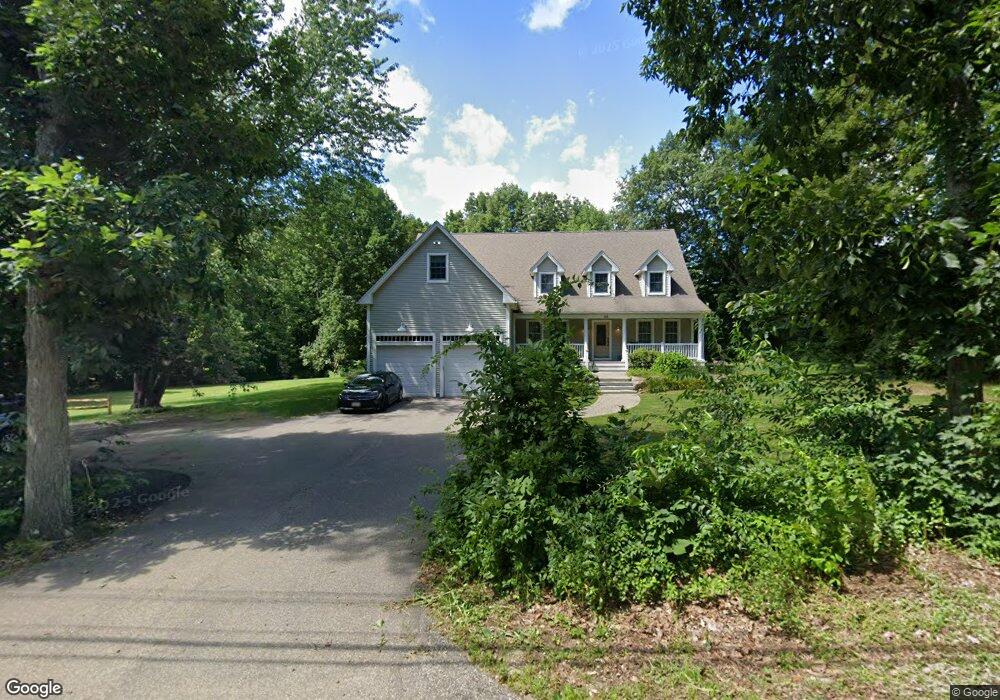
188 Pleasantdale Rd Rutland, MA 01543
Estimated Value: $736,000 - $894,000
3
Beds
3
Baths
3,528
Sq Ft
$230/Sq Ft
Est. Value
About This Home
This home is located at 188 Pleasantdale Rd, Rutland, MA 01543 and is currently estimated at $813,035, approximately $230 per square foot. 188 Pleasantdale Rd is a home located in Worcester County with nearby schools including Wachusett Regional High School.
Ownership History
Date
Name
Owned For
Owner Type
Purchase Details
Closed on
Aug 19, 2019
Sold by
Pleasantdale Rt
Bought by
Linda G Robertson T
Current Estimated Value
Purchase Details
Closed on
Jul 14, 2004
Sold by
Stoddard Michael R and Stoddard Nancy C
Bought by
Stoddard Linda G and Stoddard Mark S
Home Financials for this Owner
Home Financials are based on the most recent Mortgage that was taken out on this home.
Original Mortgage
$120,000
Interest Rate
6.25%
Mortgage Type
Purchase Money Mortgage
Create a Home Valuation Report for This Property
The Home Valuation Report is an in-depth analysis detailing your home's value as well as a comparison with similar homes in the area
Home Values in the Area
Average Home Value in this Area
Purchase History
| Date | Buyer | Sale Price | Title Company |
|---|---|---|---|
| Linda G Robertson T | -- | -- | |
| Stoddard Linda G | $150,000 | -- |
Source: Public Records
Mortgage History
| Date | Status | Borrower | Loan Amount |
|---|---|---|---|
| Previous Owner | Stoddard Linda G | $120,000 |
Source: Public Records
Tax History Compared to Growth
Tax History
| Year | Tax Paid | Tax Assessment Tax Assessment Total Assessment is a certain percentage of the fair market value that is determined by local assessors to be the total taxable value of land and additions on the property. | Land | Improvement |
|---|---|---|---|---|
| 2025 | $10,223 | $717,900 | $97,800 | $620,100 |
| 2024 | $10,921 | $736,400 | $93,900 | $642,500 |
| 2023 | $10,083 | $734,900 | $88,600 | $646,300 |
| 2022 | $10,071 | $637,800 | $74,900 | $562,900 |
| 2021 | $9,911 | $593,500 | $74,900 | $518,600 |
| 2020 | $10,085 | $572,700 | $71,100 | $501,600 |
| 2019 | $10,344 | $578,200 | $67,700 | $510,500 |
| 2018 | $10,224 | $563,900 | $67,700 | $496,200 |
| 2017 | $9,283 | $506,700 | $67,700 | $439,000 |
| 2016 | $8,374 | $482,100 | $64,400 | $417,700 |
| 2015 | $7,632 | $432,400 | $64,400 | $368,000 |
| 2014 | $7,398 | $432,400 | $64,400 | $368,000 |
Source: Public Records
Map
Nearby Homes
- Lot 11 Pleasantdale Rd
- 252 Pleasantdale Rd
- 43 Irish Ln
- 37 Irish Ln
- 39 Irish Ln
- 236 Turkey Hill Rd
- 7 Emerald Rd
- 21 Wildbrook Dr
- Lot 2 Barrack Hill Rd
- 0 Barrack Hill Rd Unit 73395148
- Lot 24R Quail Run
- Lot 29 Quail Run
- Lot 27A Quail Run
- 4 Fidelity Dr Unit 2
- 6 Fidelity Dr Unit 3
- 14 Welch Ave Unit A
- 47 Woodside Ave
- 51 Woodside Ave
- 12 Fidelity Dr Unit 6
- 10 Fidelity Dr Unit 5
- 177 Pleasantdale Rd
- 183 Pleasantdale Rd
- 173 Pleasantdale Rd
- 184 Pleasantdale Rd
- 180 Pleasantdale Rd
- Lot A Pleasantdale Rd
- Lot B Pleasantdale Rd
- Lot on Barre Paxton Road (Route 122)
- Lot E Barre Paxton Rd
- 178 Pleasantdale Rd
- 176 Pleasantdale Rd
- 176 Pleasantdale Rd Unit 1
- 217 Barre Paxton Rd
- 0 Rte 122 Unit 30799903
- 212 Barre Paxton Rd
- 212 Barre Paxton Rd Unit 1
- Lot 2 Barre Paxton Rd
- 186 Pleasantdale Rd Unit 186A
- 210 Barre Paxton Rd
- 14 Prospect St