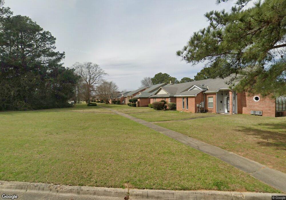
188 S Burbank Dr Montgomery, AL 36117
East Montgomery NeighborhoodEstimated Value: $110,000 - $150,201
3
Beds
3
Baths
1,452
Sq Ft
$92/Sq Ft
Est. Value
About This Home
This home is located at 188 S Burbank Dr, Montgomery, AL 36117 and is currently estimated at $134,050, approximately $92 per square foot. 188 S Burbank Dr is a home located in Montgomery County with nearby schools including Goodwyn Middle School, Johnson Abernathy Graetz (JAG) High School, and Alabama Christian Academy.
Ownership History
Date
Name
Owned For
Owner Type
Purchase Details
Closed on
Jun 10, 2021
Sold by
Benton Krystal Ann and Edwards Kimberly Allison
Bought by
Rudder Timothy L
Current Estimated Value
Purchase Details
Closed on
May 27, 2008
Sold by
Cut Iii Properties Llc
Bought by
Edwards Kimberly M
Home Financials for this Owner
Home Financials are based on the most recent Mortgage that was taken out on this home.
Original Mortgage
$100,424
Interest Rate
6%
Mortgage Type
FHA
Purchase Details
Closed on
Oct 25, 2007
Sold by
Blane Martin F
Bought by
Cut 3 Properties
Purchase Details
Closed on
Dec 26, 2000
Sold by
Southtrust Mtg Corp
Bought by
Southtrust Bank
Purchase Details
Closed on
Dec 13, 2000
Sold by
Stanfield Jeanne M
Bought by
Southtrust Mtg Corp
Create a Home Valuation Report for This Property
The Home Valuation Report is an in-depth analysis detailing your home's value as well as a comparison with similar homes in the area
Home Values in the Area
Average Home Value in this Area
Purchase History
| Date | Buyer | Sale Price | Title Company |
|---|---|---|---|
| Rudder Timothy L | $76,000 | None Available | |
| Edwards Kimberly M | -- | None Available | |
| Cut 3 Properties | $67,151 | None Available | |
| Southtrust Bank | -- | -- | |
| Southtrust Mtg Corp | $79,253 | -- |
Source: Public Records
Mortgage History
| Date | Status | Borrower | Loan Amount |
|---|---|---|---|
| Previous Owner | Edwards Kimberly M | $100,424 |
Source: Public Records
Tax History Compared to Growth
Tax History
| Year | Tax Paid | Tax Assessment Tax Assessment Total Assessment is a certain percentage of the fair market value that is determined by local assessors to be the total taxable value of land and additions on the property. | Land | Improvement |
|---|---|---|---|---|
| 2024 | $576 | $12,510 | $1,200 | $11,310 |
| 2023 | $576 | $11,350 | $1,200 | $10,150 |
| 2022 | $328 | $10,100 | $1,200 | $8,900 |
| 2021 | $354 | $10,820 | $0 | $0 |
| 2020 | $328 | $10,100 | $1,200 | $8,900 |
| 2019 | $312 | $9,650 | $1,200 | $8,450 |
| 2018 | $361 | $9,880 | $1,200 | $8,680 |
| 2017 | $310 | $19,240 | $2,400 | $16,840 |
| 2014 | $288 | $9,020 | $1,200 | $7,820 |
| 2013 | -- | $7,930 | $1,200 | $6,730 |
Source: Public Records
Map
Nearby Homes
- 5904 Carmel Dr
- 5948 Balmoral Rd
- 6121 Bell Road Manor
- 5922 Havenwood Dr
- 6232 Bell Road Ct
- 6037 Burbank Crossing Loop
- 148 Charleston Ct N
- 116 Charleston Ct N
- 389 Spenseth Dr
- 137 Charleston Ct N
- 417 Lurene Cir
- 310 Kroy Dr
- 6272 Nature Dr
- 6204 Lycoming Rd
- 6258 Monticello Dr
- 6266 Monticello Dr
- 6274 Monticello Dr
- 6282 Monticello Dr
- 6290 Monticello Dr
- 6512 Ashton Cir
- 186 S Burbank Dr
- 5967 Carmel Dr
- 184 S Burbank Dr
- 5965 Carmel Dr
- 5963 Carmel Dr
- 182 S Burbank Dr
- 5961 Carmel Dr
- 5959 Carmel Dr
- 5957 Carmel Dr
- 5953 Carmel Dr
- 183 S Burbank Dr
- 181 S Burbank Dr
- 5984 Carmel Dr
- 5982 Carmel Dr
- 185 S Burbank Dr
- 6001 Meridian Ln
- 5980 Carmel Dr
- 5978 Carmel Dr
- 5949 Carmel Dr
- 187 S Burbank Dr