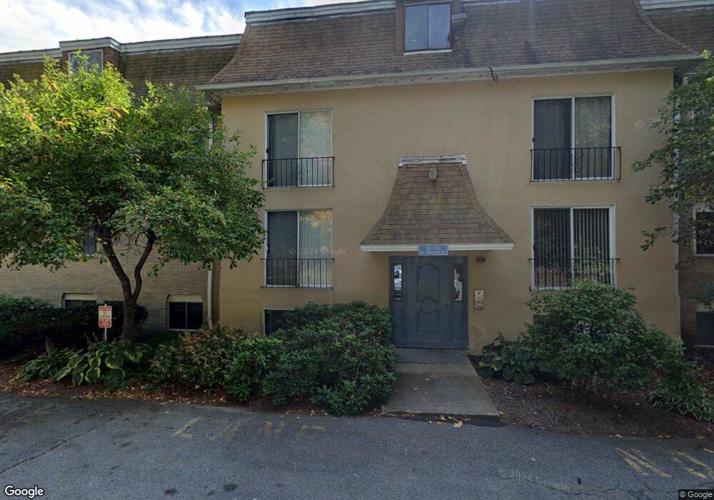
188 Swanson Rd Unit 335 Boxborough, MA 01719
Estimated Value: $217,000 - $241,000
2
Beds
1
Bath
824
Sq Ft
$275/Sq Ft
Est. Value
About This Home
This home is located at 188 Swanson Rd Unit 335, Boxborough, MA 01719 and is currently estimated at $226,667, approximately $275 per square foot. 188 Swanson Rd Unit 335 is a home located in Middlesex County with nearby schools including Acton-Boxborough Regional High School.
Ownership History
Date
Name
Owned For
Owner Type
Purchase Details
Closed on
Feb 16, 2001
Sold by
Wilkinson Matthew T and Kelly Shauna L
Bought by
Kekis John D and Fodor Anna
Current Estimated Value
Home Financials for this Owner
Home Financials are based on the most recent Mortgage that was taken out on this home.
Original Mortgage
$61,900
Interest Rate
7.08%
Mortgage Type
Purchase Money Mortgage
Purchase Details
Closed on
Dec 2, 1998
Sold by
Haftel Abbe E
Bought by
Wilkinson Matthew T and Kelly Shauna L
Home Financials for this Owner
Home Financials are based on the most recent Mortgage that was taken out on this home.
Original Mortgage
$77,400
Interest Rate
6.68%
Mortgage Type
Purchase Money Mortgage
Create a Home Valuation Report for This Property
The Home Valuation Report is an in-depth analysis detailing your home's value as well as a comparison with similar homes in the area
Home Values in the Area
Average Home Value in this Area
Purchase History
| Date | Buyer | Sale Price | Title Company |
|---|---|---|---|
| Kekis John D | $115,000 | -- | |
| Wilkinson Matthew T | $81,500 | -- |
Source: Public Records
Mortgage History
| Date | Status | Borrower | Loan Amount |
|---|---|---|---|
| Open | Wilkinson Matthew T | $450,000 | |
| Closed | Wilkinson Matthew T | $61,900 | |
| Previous Owner | Wilkinson Matthew T | $77,400 |
Source: Public Records
Tax History Compared to Growth
Tax History
| Year | Tax Paid | Tax Assessment Tax Assessment Total Assessment is a certain percentage of the fair market value that is determined by local assessors to be the total taxable value of land and additions on the property. | Land | Improvement |
|---|---|---|---|---|
| 2025 | $3,558 | $235,000 | $0 | $235,000 |
| 2024 | $2,808 | $187,300 | $0 | $187,300 |
| 2023 | $2,561 | $165,000 | $0 | $165,000 |
| 2022 | $2,768 | $158,900 | $0 | $158,900 |
| 2020 | $2,501 | $149,600 | $0 | $149,600 |
| 2019 | $2,110 | $128,500 | $0 | $128,500 |
| 2018 | $2,017 | $122,700 | $0 | $122,700 |
| 2017 | $1,979 | $117,700 | $0 | $117,700 |
| 2016 | $1,703 | $104,100 | $0 | $104,100 |
| 2015 | $1,470 | $88,300 | $0 | $88,300 |
| 2014 | $1,594 | $90,100 | $0 | $90,100 |
Source: Public Records
Map
Nearby Homes
- 176 Swanson Rd Unit 307
- 176 Swanson Rd Unit 309
- 196 Swanson Rd Unit 505
- 220 Swanson Rd Unit 605
- 42 Swanson Ct Unit 14A
- 50 Spencer Rd Unit 36
- 58 Spencer Rd Unit 18K
- 5 Trail Ridge Way Unit C
- 1155 Burroughs Rd
- 89 School House Ln
- 216 Old Littleton Rd
- 52 Mayfair Dr
- 166 Littleton Rd Unit 3
- 20 Lyons Ln Unit 20
- 20 Lyons Ln
- 24 Fairbanks St
- 4 Bolton Rd
- 11 Fairbanks St Unit 2
- 5 Fairbank St
- 2 Littleton Rd Unit 1
- 188 Swanson Rd Unit 336
- 188 Swanson Rd Unit 334
- 188 Swanson Rd Unit 333
- 188 Swanson Rd Unit 332
- 188 Swanson Rd Unit 330
- 188 Swanson Rd Unit 329
- 188 Swanson Rd Unit 328
- 188 Swanson Rd Unit 327
- 188 Swanson Rd Unit 326
- 188 Swanson Rd Unit 325
- 182 Swanson Rd Unit 324
- 182 Swanson Rd Unit 323
- 182 Swanson Rd Unit 322
- 182 Swanson Rd Unit 321
- 182 Swanson Rd Unit 320
- 182 Swanson Rd Unit 319
- 182 Swanson Rd Unit 318
- 182 Swanson Rd Unit 317
- 182 Swanson Rd Unit 316
- 182 Swanson Rd Unit 315