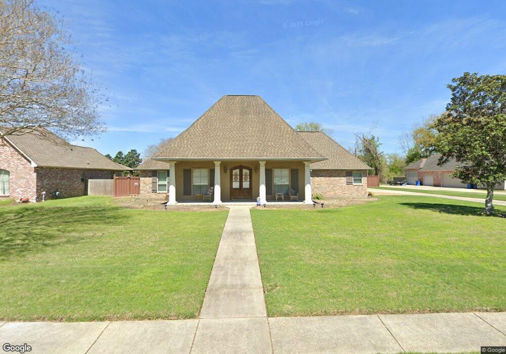
1880 Safford Blvd Port Allen, LA 70767
West Baton Rouge Parish NeighborhoodEstimated Value: $415,000 - $438,000
--
Bed
--
Bath
2,528
Sq Ft
$168/Sq Ft
Est. Value
About This Home
This home is located at 1880 Safford Blvd, Port Allen, LA 70767 and is currently estimated at $425,947, approximately $168 per square foot. 1880 Safford Blvd is a home located in West Baton Rouge Parish with nearby schools including Brusly Elementary School, Lukeville Upper Elementary School, and Brusly Middle School.
Ownership History
Date
Name
Owned For
Owner Type
Purchase Details
Closed on
Nov 21, 2014
Sold by
Berthelot Kim Marie
Bought by
Guidry Bayhi James Albert and Guidry Bayhi Sabrina
Current Estimated Value
Home Financials for this Owner
Home Financials are based on the most recent Mortgage that was taken out on this home.
Original Mortgage
$202,000
Outstanding Balance
$68,483
Interest Rate
3.93%
Mortgage Type
New Conventional
Estimated Equity
$357,464
Purchase Details
Closed on
Oct 20, 2006
Sold by
Bourgovne Boniol John Andrew and Bourgovne Boniol Christy
Bought by
Berthelot Kim Marie
Home Financials for this Owner
Home Financials are based on the most recent Mortgage that was taken out on this home.
Original Mortgage
$220,000
Interest Rate
6.37%
Mortgage Type
New Conventional
Create a Home Valuation Report for This Property
The Home Valuation Report is an in-depth analysis detailing your home's value as well as a comparison with similar homes in the area
Home Values in the Area
Average Home Value in this Area
Purchase History
| Date | Buyer | Sale Price | Title Company |
|---|---|---|---|
| Guidry Bayhi James Albert | $362,000 | Gulf Coast Title | |
| Berthelot Kim Marie | $295,000 | None Available |
Source: Public Records
Mortgage History
| Date | Status | Borrower | Loan Amount |
|---|---|---|---|
| Open | Guidry Bayhi James Albert | $202,000 | |
| Previous Owner | Berthelot Kim Marie | $220,000 |
Source: Public Records
Tax History Compared to Growth
Tax History
| Year | Tax Paid | Tax Assessment Tax Assessment Total Assessment is a certain percentage of the fair market value that is determined by local assessors to be the total taxable value of land and additions on the property. | Land | Improvement |
|---|---|---|---|---|
| 2024 | $2,824 | $36,660 | $9,000 | $27,660 |
| 2023 | $2,633 | $32,860 | $8,500 | $24,360 |
| 2022 | $3,446 | $32,860 | $8,500 | $24,360 |
| 2021 | $3,524 | $32,860 | $8,500 | $24,360 |
| 2020 | $3,203 | $29,570 | $7,650 | $21,920 |
| 2019 | $3,360 | $29,780 | $5,480 | $24,300 |
| 2018 | $3,421 | $29,780 | $5,480 | $24,300 |
| 2017 | $3,159 | $29,780 | $5,480 | $24,300 |
| 2015 | $2,514 | $29,270 | $4,970 | $24,300 |
| 2014 | $2,473 | $29,270 | $4,970 | $24,300 |
| 2013 | $2,473 | $29,270 | $4,970 | $24,300 |
Source: Public Records
Map
Nearby Homes
- 4747 Evergreen Dr
- 1959 Fairview Ave
- 2217 Silverstone Ave
- 1394 Rue Riviere
- 1152 Freeman Ln
- 2428 Riverside Dr
- 2488 Oak Alley Dr
- Whitmore II Plan at The Woodlands
- Woodland II Plan at The Woodlands
- Whitmore I - The Woodlands Plan at The Woodlands
- Waldorf I Plan at The Woodlands
- Chadford I Plan at The Woodlands
- 4000 Lake Beau Pre Blvd Unit 198
- 4000 Lake Beau Pre Blvd Unit 69
- 4000 Lake Beau Pre Blvd Unit 110
- 4000 Lake Beau Pre Blvd Unit 13
- 4000 Lake Beau Pre Blvd Unit 87
- 4000 Lake Beau Pre Blvd Unit 131
- 6312 Louisiana 1
- 2607 Riverside Dr
- 1916 Safford Blvd
- 1854 Safford Blvd
- 1869 Safford Blvd
- 1836 Safford Blvd
- 1944 Safford Blvd
- 1921 Safford Blvd
- 1815 Auguste St
- 1825 Auguste St
- 1845 Safford Blvd
- 1957 Safford Blvd
- 1968 Safford Blvd
- 4809 Lafitte Ct
- 4734 S River Rd
- 4655 Missouri Dr
- 4814 Lafitte Ct
- 4760 S River Rd
- 4810 S River Rd
- 1979 Safford Blvd
- 4605 Missouri Dr
- 0 Missouri Dr