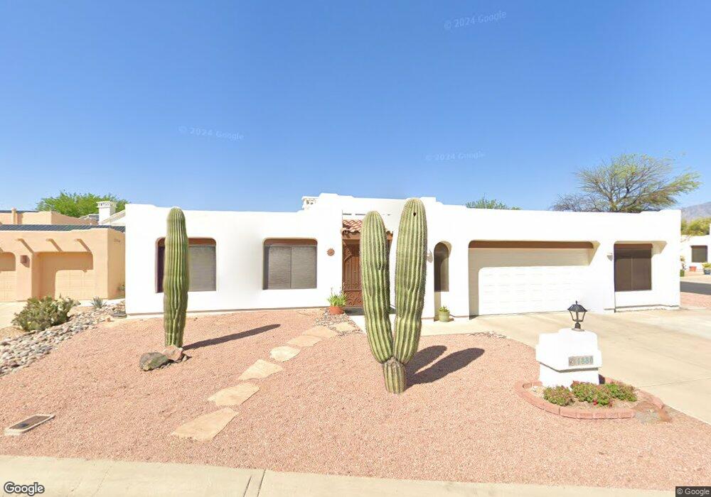
1880 W Carnoustie Place Tucson, AZ 85737
Estimated Value: $516,000 - $551,000
--
Bed
3
Baths
2,193
Sq Ft
$244/Sq Ft
Est. Value
About This Home
This home is located at 1880 W Carnoustie Place, Tucson, AZ 85737 and is currently estimated at $535,868, approximately $244 per square foot. 1880 W Carnoustie Place is a home located in Pima County with nearby schools including Richard B. Wilson Jr. School, Ironwood Ridge High School, and Leman Academy Of Excellence-Oro Valley Arizona.
Ownership History
Date
Name
Owned For
Owner Type
Purchase Details
Closed on
Jun 4, 2003
Sold by
King David and King Debra
Bought by
Celaya Michael O and Celaya Carole M
Current Estimated Value
Home Financials for this Owner
Home Financials are based on the most recent Mortgage that was taken out on this home.
Original Mortgage
$191,920
Outstanding Balance
$83,032
Interest Rate
5.61%
Mortgage Type
New Conventional
Estimated Equity
$452,836
Purchase Details
Closed on
Jun 20, 1997
Sold by
Murray William D and Murray Shirley A
Bought by
King David and King Debra
Home Financials for this Owner
Home Financials are based on the most recent Mortgage that was taken out on this home.
Original Mortgage
$140,000
Interest Rate
7.91%
Mortgage Type
New Conventional
Create a Home Valuation Report for This Property
The Home Valuation Report is an in-depth analysis detailing your home's value as well as a comparison with similar homes in the area
Home Values in the Area
Average Home Value in this Area
Purchase History
| Date | Buyer | Sale Price | Title Company |
|---|---|---|---|
| Celaya Michael O | $239,900 | -- | |
| Celaya Michael O | $239,900 | -- | |
| King David | $175,000 | -- |
Source: Public Records
Mortgage History
| Date | Status | Borrower | Loan Amount |
|---|---|---|---|
| Open | Celaya Michael O | $191,920 | |
| Closed | Celaya Michael O | $191,920 | |
| Previous Owner | King David | $140,000 | |
| Closed | Celaya Michael O | $23,900 |
Source: Public Records
Tax History Compared to Growth
Tax History
| Year | Tax Paid | Tax Assessment Tax Assessment Total Assessment is a certain percentage of the fair market value that is determined by local assessors to be the total taxable value of land and additions on the property. | Land | Improvement |
|---|---|---|---|---|
| 2025 | $3,939 | $33,145 | -- | -- |
| 2024 | $3,939 | $31,567 | -- | -- |
| 2023 | $3,608 | $30,063 | $0 | $0 |
| 2022 | $3,608 | $28,632 | $0 | $0 |
| 2021 | $3,698 | $26,956 | $0 | $0 |
| 2020 | $3,639 | $26,956 | $0 | $0 |
| 2019 | $3,524 | $26,564 | $0 | $0 |
| 2018 | $3,372 | $23,549 | $0 | $0 |
| 2017 | $3,345 | $23,549 | $0 | $0 |
| 2016 | $3,252 | $23,697 | $0 | $0 |
| 2015 | $3,165 | $22,586 | $0 | $0 |
Source: Public Records
Map
Nearby Homes
- 1901 W Carnoustie Place
- 1851 W Desert Forest Ct
- 1975 W Muirhead Loop
- 10895 N Canada Hills Ct
- 1791 W Desert Highlands Dr
- 11050 N Canada Ridge Dr
- 10991 N Double Eagle Ct
- 11019 N Mountain Breeze Dr
- 11018 N Mountain Breeze Dr
- 2072 W Double Eagle Dr
- 1735 W Windgate Place
- 11116 N Eagle Crest Dr
- 11143 N Divot Dr
- 10355 N La Cholla Blvd
- 10959 N Tatum Dr
- 1605 W Fairway Place
- 1538 W Carmel Pointe Dr
- 1489 W Bridalveil Place
- 1497 W Carmel Pointe Dr
- 1374 W Blooming Desert Way
- 1890 W Carnoustie Place
- 1871 W La Quinta Place
- 10720 N La Quinta Dr
- 10730 N La Quinta Dr
- 10710 N La Quinta Dr
- 1881 W La Quinta Place
- 1891 W Carnoustie Place
- 1900 W Carnoustie Place
- 10740 N La Quinta Dr
- 10700 N La Quinta Dr
- 1910 W Carnoustie Place
- 1891 W La Quinta Place
- 10690 N La Quinta Dr
- 10750 N La Quinta Dr
- 1911 W Carnoustie Place
- 1870 W La Quinta Place
- 10760 N La Quinta Dr
- 1890 W La Quinta Place
- 10685 N La Quinta Dr
- 1880 W La Quinta Place