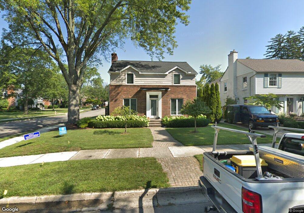
1880 Winthrop Ln Birmingham, MI 48009
Estimated Value: $1,019,000 - $1,639,000
3
Beds
5
Baths
3,350
Sq Ft
$378/Sq Ft
Est. Value
About This Home
This home is located at 1880 Winthrop Ln, Birmingham, MI 48009 and is currently estimated at $1,267,230, approximately $378 per square foot. 1880 Winthrop Ln is a home located in Oakland County with nearby schools including Quarton Elementary, Derby Middle School, and Ernest W. Seaholm High School.
Ownership History
Date
Name
Owned For
Owner Type
Purchase Details
Closed on
Aug 31, 1995
Sold by
Burr Karl E
Bought by
Sarkisian Lisa A
Current Estimated Value
Home Financials for this Owner
Home Financials are based on the most recent Mortgage that was taken out on this home.
Original Mortgage
$45,000
Interest Rate
7.81%
Mortgage Type
New Conventional
Create a Home Valuation Report for This Property
The Home Valuation Report is an in-depth analysis detailing your home's value as well as a comparison with similar homes in the area
Home Values in the Area
Average Home Value in this Area
Purchase History
| Date | Buyer | Sale Price | Title Company |
|---|---|---|---|
| Sarkisian Lisa A | -- | -- |
Source: Public Records
Mortgage History
| Date | Status | Borrower | Loan Amount |
|---|---|---|---|
| Closed | Sarkisian Lisa A | $45,000 |
Source: Public Records
Tax History
| Year | Tax Paid | Tax Assessment Tax Assessment Total Assessment is a certain percentage of the fair market value that is determined by local assessors to be the total taxable value of land and additions on the property. | Land | Improvement |
|---|---|---|---|---|
| 2025 | $10,194 | $408,000 | $0 | $0 |
| 2024 | $8,999 | $400,910 | $0 | $0 |
| 2023 | $8,623 | $382,830 | $0 | $0 |
| 2022 | $9,246 | $349,200 | $0 | $0 |
| 2021 | $9,328 | $342,850 | $0 | $0 |
| 2020 | $8,311 | $338,050 | $0 | $0 |
| 2019 | $9,405 | $349,680 | $0 | $0 |
| 2018 | $9,333 | $324,070 | $0 | $0 |
| 2017 | $9,317 | $313,620 | $0 | $0 |
| 2016 | $9,334 | $319,990 | $0 | $0 |
| 2015 | -- | $305,880 | $0 | $0 |
| 2014 | -- | $264,560 | $0 | $0 |
| 2011 | -- | $201,720 | $0 | $0 |
Source: Public Records
Map
Nearby Homes
- 186 Westwood Dr
- 1882 Melbourne St
- 533 Westwood Dr
- 394 S Glenhurst Dr
- 520 Pleasant St
- 1120 Lyonhurst St
- 576 Golfview Blvd
- 0000 Larchlea Dr
- 2627 Bradway Blvd
- 1094 Suffield Ave
- 852 Puritan Ave
- 488 Bryn Mawr St
- 757 Woodlea Ct
- 862 S Glenhurst Dr
- 592 Lakeside Dr
- 1183 Puritan Ave
- 580 S Cranbrook Rd
- 1444 Fairfax St
- 999 Pleasant Ave
- 856 Lakeview Ave
- 1862 Winthrop Ln
- 1854 Winthrop Ln
- 1889 Pine St
- 1875 Pine St
- 431 Kimberly St
- 453 Kimberly St
- 1832 Winthrop Ln
- 1849 Pine St
- 407 Kimberly St
- 465 Kimberly St
- 380 Kimberly St
- 393 Kimberly St
- 453 Kimberly St
- 1810 Winthrop Ln
- 1825 Pine St Unit Bldg-Unit
- 1825 Pine St
- 485 Kimberly St
- 1831 Winthrop Ln
- 369 Kimberly St
- 420 N Glenhurst Dr
Your Personal Tour Guide
Ask me questions while you tour the home.