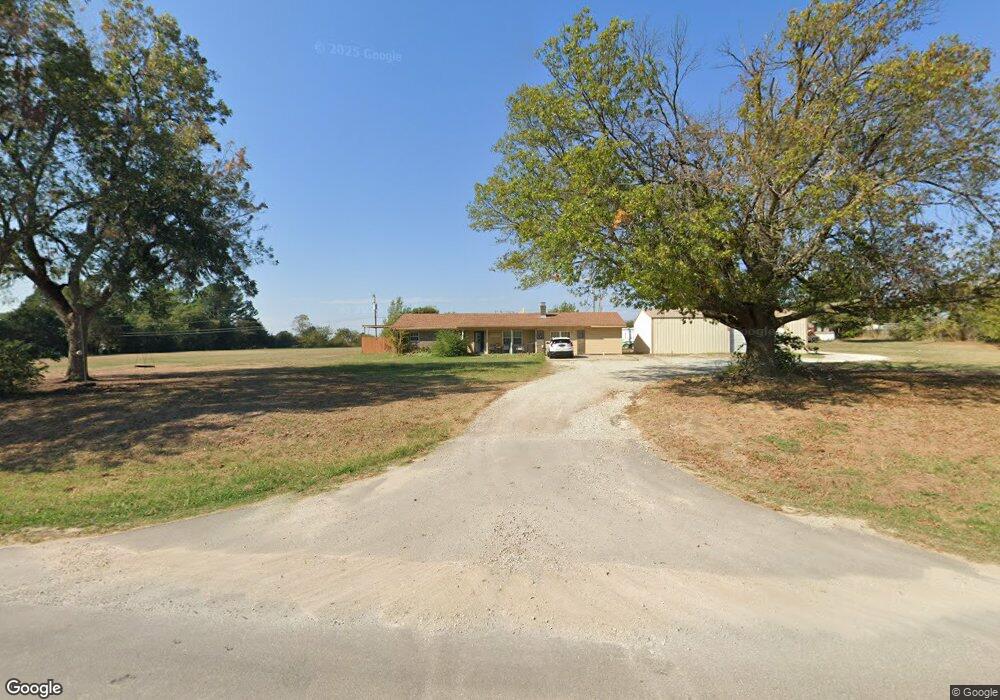
18806 Brangus Rd Shawnee, OK 74801
Estimated Value: $255,000 - $388,000
3
Beds
2
Baths
1,694
Sq Ft
$178/Sq Ft
Est. Value
About This Home
This home is located at 18806 Brangus Rd, Shawnee, OK 74801 and is currently estimated at $301,628, approximately $178 per square foot. 18806 Brangus Rd is a home located in Pottawatomie County with nearby schools including South Rock Creek Public School.
Ownership History
Date
Name
Owned For
Owner Type
Purchase Details
Closed on
Oct 20, 2006
Sold by
Goodall Gerry John and Goodall Casey B
Bought by
Whiteside Randy H and Whiteside Mary J
Current Estimated Value
Home Financials for this Owner
Home Financials are based on the most recent Mortgage that was taken out on this home.
Original Mortgage
$108,000
Outstanding Balance
$63,778
Interest Rate
6.46%
Mortgage Type
Purchase Money Mortgage
Estimated Equity
$237,850
Purchase Details
Closed on
Sep 5, 2003
Sold by
Higgs Larry and Higgs Ella
Bought by
Goodall Gerry and Goodall Casey
Purchase Details
Closed on
Apr 5, 2001
Sold by
Pratt Stanley and Pratt Betty
Bought by
Higgs Larry and Higgs Ella
Create a Home Valuation Report for This Property
The Home Valuation Report is an in-depth analysis detailing your home's value as well as a comparison with similar homes in the area
Home Values in the Area
Average Home Value in this Area
Purchase History
| Date | Buyer | Sale Price | Title Company |
|---|---|---|---|
| Whiteside Randy H | $135,000 | Nationwide Title Clearing In | |
| Goodall Gerry | $128,000 | -- | |
| Higgs Larry | $83,000 | -- |
Source: Public Records
Mortgage History
| Date | Status | Borrower | Loan Amount |
|---|---|---|---|
| Open | Whiteside Randy H | $108,000 |
Source: Public Records
Tax History Compared to Growth
Tax History
| Year | Tax Paid | Tax Assessment Tax Assessment Total Assessment is a certain percentage of the fair market value that is determined by local assessors to be the total taxable value of land and additions on the property. | Land | Improvement |
|---|---|---|---|---|
| 2025 | -- | $18,825 | $3,289 | $15,536 |
| 2024 | -- | $18,277 | $3,193 | $15,084 |
| 2023 | -- | $17,745 | $2,540 | $15,205 |
| 2022 | $0 | $17,745 | $2,540 | $15,205 |
| 2021 | $0 | $17,745 | $2,540 | $15,205 |
| 2020 | $1,742 | $17,853 | $2,540 | $15,313 |
| 2019 | $1,615 | $17,529 | $2,479 | $15,050 |
| 2018 | $1,602 | $17,018 | $2,403 | $14,615 |
| 2017 | $1,544 | $16,522 | $2,338 | $14,184 |
| 2016 | $1,405 | $16,042 | $2,257 | $13,785 |
| 2015 | $1,398 | $15,574 | $2,375 | $13,199 |
| 2014 | $1,354 | $15,120 | $1,200 | $13,920 |
Source: Public Records
Map
Nearby Homes
- 18509 Brangus Rd
- 00 Charleston Pointe
- 44303 Hardesty Rd
- 00 Benson Park Rd
- 44508 Kingsbury Ln
- 44630 Kingsbury
- 00 Hardesty Rd 15 Acres
- 00 S Rock Creek Rd
- 00 Allyson Ln
- 42601 Stout Dr
- 19708 Persimmon Ln
- 45201 Hardesty Rd
- 45210 Hardesty Rd
- 17701 S Rock Creek Rd
- 42608 Bob Crouch Rd
- 19705 Harrison Rd
- 43252 Highway 9
- 20302 Kings Rd
- 1600 E Farrall
- 19903 Prairieview Rd
- 43902 Benson Park Rd
- 43810 Benson Park Rd
- 18804 Brangus Rd
- 18901 Brangus Rd
- 19107 Charleston Loop
- 43806 Benson Park Rd
- 43808 Benson Park Rd
- 18971 Brangus Rd
- 18787 Brangus Rd
- 19268 Charleston Point
- 19239 Charleston Point
- 19223 Charleston Point
- 19239 Charleston Point
- 19004 Brangus Rd
- 43689 Hunters Hill Dr
- 43710 Benson Park Rd
- 19005 Charleston Loop
- 44206 Benson Park Rd
- 19185 Charleston Point
- 19194 Charleston Point