Estimated Value: $574,000 - $624,000
4
Beds
3
Baths
2,524
Sq Ft
$238/Sq Ft
Est. Value
About This Home
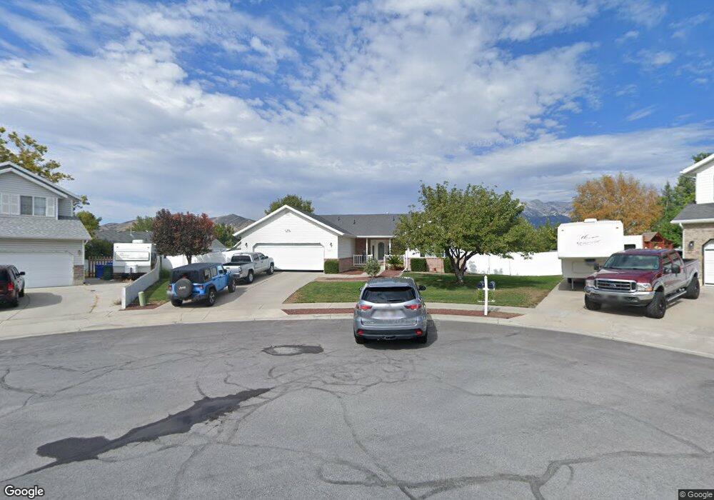
This home is located at 1881 N 800 E, Lehi, UT 84043 and is currently estimated at $600,556, approximately $237 per square foot. 1881 N 800 E is a home located in Utah County with nearby schools including Sego Lily Elementary School, Lehi Junior High School, and Skyridge High School.
Ownership History
Date
Name
Owned For
Owner Type
Purchase Details
Closed on
May 16, 2017
Sold by
Lopez Jody Lynn
Bought by
Stock Cheryl Lynn
Current Estimated Value
Home Financials for this Owner
Home Financials are based on the most recent Mortgage that was taken out on this home.
Original Mortgage
$252,000
Outstanding Balance
$209,569
Interest Rate
4.1%
Mortgage Type
New Conventional
Estimated Equity
$390,987
Purchase Details
Closed on
Aug 28, 2013
Sold by
Hodson Morris A
Bought by
The Morris Allan Hodson Revocable Trust
Purchase Details
Closed on
Nov 3, 2005
Sold by
Carlson Sherman Arthur
Bought by
Hodson Morris A and Hodson Ruth
Home Financials for this Owner
Home Financials are based on the most recent Mortgage that was taken out on this home.
Original Mortgage
$75,000
Interest Rate
5.74%
Mortgage Type
Purchase Money Mortgage
Purchase Details
Closed on
Jul 1, 1999
Sold by
Carlson Wesley Burtis and Carlson Sherman Arthur
Bought by
Carlson Wesley Burtis and Carlson Sherman Arthur
Create a Home Valuation Report for This Property
The Home Valuation Report is an in-depth analysis detailing your home's value as well as a comparison with similar homes in the area
Home Values in the Area
Average Home Value in this Area
Purchase History
| Date | Buyer | Sale Price | Title Company |
|---|---|---|---|
| Stock Cheryl Lynn | -- | Meridian Title Co | |
| The Morris Allan Hodson Revocable Trust | -- | None Available | |
| Hodson Morris A | -- | Equity Title Orem Blvd | |
| Carlson Wesley Burtis | -- | -- |
Source: Public Records
Mortgage History
| Date | Status | Borrower | Loan Amount |
|---|---|---|---|
| Open | Stock Cheryl Lynn | $252,000 | |
| Previous Owner | Hodson Morris A | $75,000 |
Source: Public Records
Tax History
| Year | Tax Paid | Tax Assessment Tax Assessment Total Assessment is a certain percentage of the fair market value that is determined by local assessors to be the total taxable value of land and additions on the property. | Land | Improvement |
|---|---|---|---|---|
| 2025 | $2,407 | $310,035 | -- | -- |
| 2024 | $2,407 | $281,655 | $0 | $0 |
| 2023 | $2,241 | $284,790 | $0 | $0 |
| 2022 | $2,489 | $306,570 | $0 | $0 |
| 2021 | $2,218 | $413,100 | $135,500 | $277,600 |
| 2020 | $2,091 | $384,900 | $125,500 | $259,400 |
| 2019 | $1,857 | $355,300 | $125,500 | $229,800 |
| 2018 | $1,776 | $321,300 | $120,000 | $201,300 |
| 2017 | $1,727 | $166,100 | $0 | $0 |
| 2016 | $1,604 | $143,110 | $0 | $0 |
| 2015 | $1,569 | $132,935 | $0 | $0 |
| 2014 | $1,555 | $130,955 | $0 | $0 |
Source: Public Records
Map
Nearby Homes
- 1370 N Cedar Hollow Blvd
- 1272 N Cedar Hollow Blvd
- 4233 N 325 E Unit 1415
- 10365 N 6960 W
- 1329 N 100 E Unit 21
- 1175 E 900 N
- 2139 N Banbury Ct
- 6756 W 10050 N
- 890 N Whipple Dr
- 832 N Somerset Aly
- 9967 N 6670 W
- 807 N Somerset Aly
- 975 E 2850 N
- 9435 N Aspen Hollow Cir
- 356 W 1850 N Unit 6
- 893 N 1580 E
- 878 E 3050 N
- 6576 W 9810 N
- 1150 N 200 W Unit 6
- 52 W State St
- 1869 N 800 E
- 1896 N Airport Dr
- 1880 N 800 E
- 1475 N 800 St E Unit 216
- 1475 N 800 St E Unit 215
- 1882 Airport Dr
- 1882 N Airport Dr
- 1927 Airport Dr
- 1870 N Airport Dr
- 1896 Airport Dr
- 1908 Airport Dr
- 1863 N 900 E
- 1857 N 800 E
- 1847 N 900 E
- 1875 N 900 E
- 1858 N Airport Dr
- 1868 N 800 E
- 1856 N 800 E
- 1835 N 900 E
- 807 N Oak Dr
Your Personal Tour Guide
Ask me questions while you tour the home.