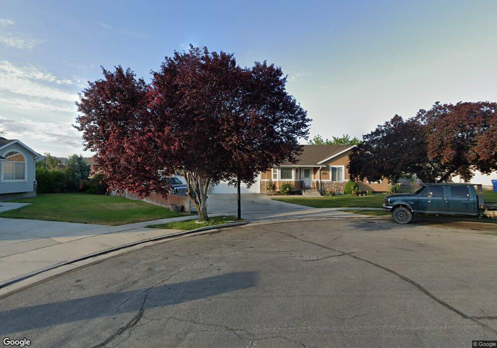
1881 Rips Ct Riverton, UT 84065
Estimated Value: $560,000 - $621,237
4
Beds
3
Baths
1,372
Sq Ft
$428/Sq Ft
Est. Value
About This Home
This home is located at 1881 Rips Ct, Riverton, UT 84065 and is currently estimated at $587,559, approximately $428 per square foot. 1881 Rips Ct is a home located in Salt Lake County with nearby schools including Riverton School, Hidden Valley Middle School, and Riverton High School.
Ownership History
Date
Name
Owned For
Owner Type
Purchase Details
Closed on
Jan 2, 1997
Sold by
Ross Jesse W and Ross Anita B
Bought by
Ross Jesse William and Ross Anita B
Current Estimated Value
Home Financials for this Owner
Home Financials are based on the most recent Mortgage that was taken out on this home.
Original Mortgage
$115,000
Outstanding Balance
$12,240
Interest Rate
7.53%
Estimated Equity
$575,319
Purchase Details
Closed on
Sep 10, 1996
Sold by
Ross Bill I and Mines Grant J
Bought by
Ross Jesse W and Ross Anita B
Home Financials for this Owner
Home Financials are based on the most recent Mortgage that was taken out on this home.
Original Mortgage
$120,418
Interest Rate
8.23%
Mortgage Type
Construction
Purchase Details
Closed on
Jan 30, 1996
Sold by
North Peak Development
Bought by
Ross Bill I and Mines Grant J
Create a Home Valuation Report for This Property
The Home Valuation Report is an in-depth analysis detailing your home's value as well as a comparison with similar homes in the area
Home Values in the Area
Average Home Value in this Area
Purchase History
| Date | Buyer | Sale Price | Title Company |
|---|---|---|---|
| Ross Jesse William | -- | -- | |
| Ross Jesse W | -- | -- | |
| Ross Bill I | -- | -- |
Source: Public Records
Mortgage History
| Date | Status | Borrower | Loan Amount |
|---|---|---|---|
| Open | Ross Jesse William | $115,000 | |
| Previous Owner | Ross Jesse W | $120,418 |
Source: Public Records
Tax History Compared to Growth
Tax History
| Year | Tax Paid | Tax Assessment Tax Assessment Total Assessment is a certain percentage of the fair market value that is determined by local assessors to be the total taxable value of land and additions on the property. | Land | Improvement |
|---|---|---|---|---|
| 2025 | -- | $589,700 | $198,700 | $391,000 |
| 2024 | -- | $572,400 | $189,200 | $383,200 |
| 2023 | $489 | $547,400 | $185,400 | $362,000 |
| 2022 | $489 | $559,400 | $181,800 | $377,600 |
| 2021 | $3,925 | $428,400 | $110,100 | $318,300 |
| 2020 | $2,694 | $358,000 | $110,100 | $247,900 |
| 2019 | $148 | $353,200 | $103,800 | $249,400 |
| 2018 | $0 | $328,900 | $103,800 | $225,100 |
| 2017 | $2,470 | $309,600 | $103,800 | $205,800 |
| 2016 | $2,318 | $278,800 | $103,800 | $175,000 |
| 2015 | $2,336 | $272,400 | $105,800 | $166,600 |
| 2014 | -- | $258,000 | $100,900 | $157,100 |
Source: Public Records
Map
Nearby Homes
- 2048 W 12920 S
- 1560 W 12730 S
- 2249 W 13035 S
- 2106 W 13220 S
- 12952 S Croix Cir
- 1056 W Kate Springs Ln S Unit 10
- 2356 W Montcalm Dr
- 12345 S Redwood Rd
- 12325 S Redwood Rd
- 12317 S Redwood Rd
- 1373 W Stewart Falls Dr
- 1273 W Hendrix St Unit 145
- 1259 W Moon Way
- 1269 W Hendrix St Unit 146
- 13053 S 1300 W
- 12294 S 1490 W
- 12501 Falls Creek Rd
- 12392 S 1300 W
- 1233 W 12500 S
- 12566 S Tithing Hill Dr
- 1881 W Rip's Ct Unit 9
- 12854 S 1830 W
- 1869 Rips Ct
- 1869 W Rip's Ct Unit 8
- 1899 W Rips Ct Unit 10
- 1899 W Rips Ct
- 1899 Rips Ct
- 1908 W Berlynn Dr
- 1872 Rips Ct
- 1886 Rips Ct
- 1886 W Rips Ct
- 12842 S 1830 W
- 12832 S 1830 W
- 1921 Rips Ct
- 12852 S 1830 W
- 1906 Rips Ct
- 1906 W Rips Ct
- 12824 S 1830 W
- 12862 S 1830 W
- 12879 S Sabrina Row