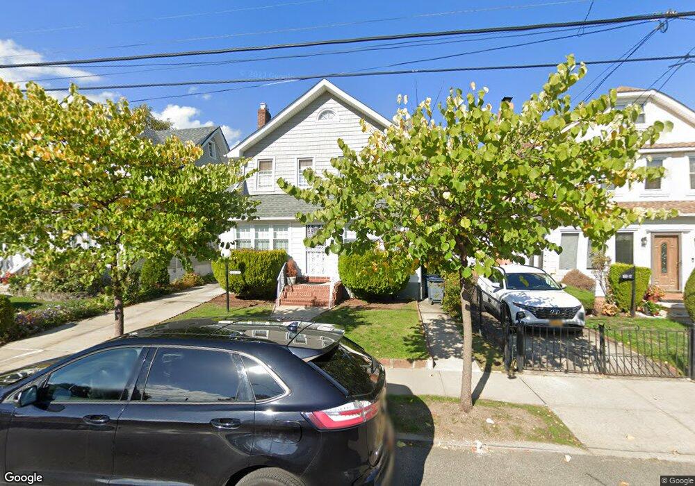
18813 Quencer Rd Saint Albans, NY 11412
Saint Albans NeighborhoodEstimated Value: $711,342 - $806,000
--
Bed
--
Bath
1,600
Sq Ft
$467/Sq Ft
Est. Value
About This Home
This home is located at 18813 Quencer Rd, Saint Albans, NY 11412 and is currently estimated at $747,836, approximately $467 per square foot. 18813 Quencer Rd is a home located in Queens County with nearby schools including Ps 36 St Albans School, Is 59 Springfield Gardens, and Riverton Street Charter School.
Ownership History
Date
Name
Owned For
Owner Type
Purchase Details
Closed on
Aug 2, 2007
Sold by
Foster Evelyn and Foster Toussaint
Bought by
Berry James A and Berry Laverne
Current Estimated Value
Home Financials for this Owner
Home Financials are based on the most recent Mortgage that was taken out on this home.
Original Mortgage
$407,250
Outstanding Balance
$255,604
Interest Rate
6.67%
Mortgage Type
Purchase Money Mortgage
Estimated Equity
$492,232
Create a Home Valuation Report for This Property
The Home Valuation Report is an in-depth analysis detailing your home's value as well as a comparison with similar homes in the area
Home Values in the Area
Average Home Value in this Area
Purchase History
| Date | Buyer | Sale Price | Title Company |
|---|---|---|---|
| Berry James A | $452,500 | -- | |
| Berry James A | $452,500 | -- |
Source: Public Records
Mortgage History
| Date | Status | Borrower | Loan Amount |
|---|---|---|---|
| Open | Berry James A | $407,250 | |
| Closed | Berry James A | $407,250 |
Source: Public Records
Tax History Compared to Growth
Tax History
| Year | Tax Paid | Tax Assessment Tax Assessment Total Assessment is a certain percentage of the fair market value that is determined by local assessors to be the total taxable value of land and additions on the property. | Land | Improvement |
|---|---|---|---|---|
| 2025 | $5,659 | $29,866 | $9,492 | $20,374 |
| 2024 | $5,659 | $28,176 | $8,818 | $19,358 |
| 2023 | $5,339 | $26,582 | $8,488 | $18,094 |
| 2022 | $5,007 | $36,960 | $12,300 | $24,660 |
| 2021 | $5,278 | $34,200 | $12,300 | $21,900 |
| 2020 | $5,268 | $31,200 | $12,300 | $18,900 |
| 2019 | $4,912 | $32,220 | $12,300 | $19,920 |
| 2018 | $4,516 | $22,152 | $10,610 | $11,542 |
| 2017 | $4,261 | $20,901 | $10,153 | $10,748 |
| 2016 | $4,178 | $20,901 | $10,153 | $10,748 |
| 2015 | $2,378 | $20,740 | $10,579 | $10,161 |
| 2014 | $2,378 | $19,567 | $10,497 | $9,070 |
Source: Public Records
Map
Nearby Homes
- 188-45 Quencer Rd
- 189-18 114th Dr
- 187-15 Tioga Dr
- 18908 114th Rd
- 115-11 180th St
- 18918 Tioga Dr
- 188-07 Mangin Ave
- 18833 Keeseville Ave
- 116-39 Newburg St
- 191-16 114th Rd
- 115-72 Farmers Blvd
- 18823 Mangin Ave
- 188-25 Mangin Ave
- 179-07 Murdock Ave
- 191-34 114th Rd
- 187-44 Jordan Ave
- 11480 178th Place
- 191-47 114th Dr
- 186-16 Hilburn Ave
- 191-40 112th Rd
- 18817 Quencer Rd
- 18809 Quencer Rd
- 18821 Quencer Rd
- 188-21 Quencer Rd
- 11517 Ovid Place
- 18818 Dormans Rd
- 18814 Dormans Rd
- 18822 Dormans Rd
- 18808 Dormans Rd
- 18825 Quencer Rd
- 18826 Dormans Rd
- 18802 Dormans Rd
- 18816 Quencer Rd
- 18829 Quencer Rd
- 188-08 Dormans Rd
- 18830 Dormans Rd
- 18738 Rome Dr
- 18756 Quencer Rd
- 18833 Quencer Rd
- 18834 Dormans Rd