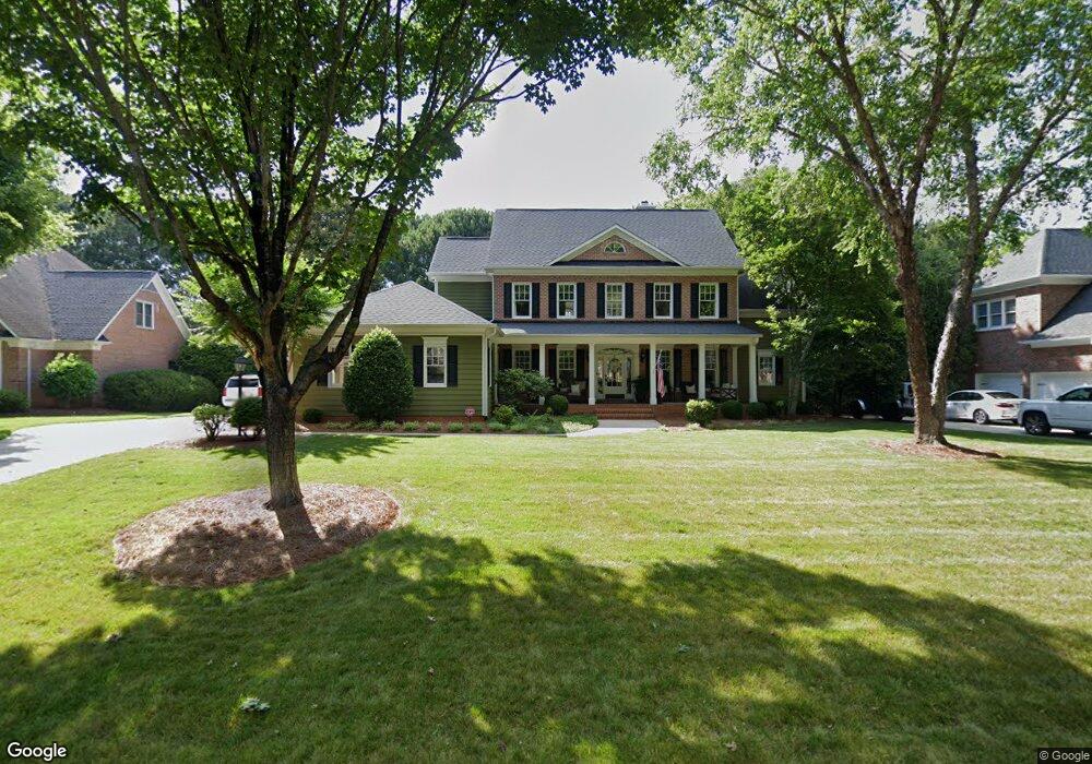
18815 River Wind Ln Davidson, NC 28036
Estimated Value: $947,000 - $1,192,000
4
Beds
4
Baths
3,420
Sq Ft
$313/Sq Ft
Est. Value
About This Home
This home is located at 18815 River Wind Ln, Davidson, NC 28036 and is currently estimated at $1,069,249, approximately $312 per square foot. 18815 River Wind Ln is a home located in Mecklenburg County with nearby schools including Davidson Elementary School, William Amos Hough High School, and Lakeside Charter Academy.
Ownership History
Date
Name
Owned For
Owner Type
Purchase Details
Closed on
Oct 26, 2018
Sold by
Driest William C and Driest Elizabeth A
Bought by
Taft Cayce Compton and Taft Marshall Daniel
Current Estimated Value
Home Financials for this Owner
Home Financials are based on the most recent Mortgage that was taken out on this home.
Original Mortgage
$390,000
Outstanding Balance
$341,517
Interest Rate
4.6%
Mortgage Type
New Conventional
Estimated Equity
$727,732
Purchase Details
Closed on
Aug 17, 2001
Sold by
Lewis Richard A and Lewis Peri B
Bought by
Driest William C and Driest Elizabeth A
Home Financials for this Owner
Home Financials are based on the most recent Mortgage that was taken out on this home.
Original Mortgage
$344,000
Interest Rate
6.25%
Mortgage Type
Purchase Money Mortgage
Create a Home Valuation Report for This Property
The Home Valuation Report is an in-depth analysis detailing your home's value as well as a comparison with similar homes in the area
Home Values in the Area
Average Home Value in this Area
Purchase History
| Date | Buyer | Sale Price | Title Company |
|---|---|---|---|
| Taft Cayce Compton | $487,500 | None Available | |
| Driest William C | $430,000 | -- |
Source: Public Records
Mortgage History
| Date | Status | Borrower | Loan Amount |
|---|---|---|---|
| Open | Taft Cayce Compton | $390,000 | |
| Previous Owner | Driest William C | $344,000 |
Source: Public Records
Tax History
| Year | Tax Paid | Tax Assessment Tax Assessment Total Assessment is a certain percentage of the fair market value that is determined by local assessors to be the total taxable value of land and additions on the property. | Land | Improvement |
|---|---|---|---|---|
| 2025 | $6,123 | $810,800 | $166,300 | $644,500 |
| 2024 | $6,123 | $810,800 | $166,300 | $644,500 |
| 2023 | $6,037 | $810,800 | $166,300 | $644,500 |
| 2022 | $4,695 | $494,300 | $142,500 | $351,800 |
| 2021 | $4,723 | $494,300 | $142,500 | $351,800 |
| 2020 | $4,723 | $494,300 | $142,500 | $351,800 |
| 2019 | $4,717 | $494,300 | $142,500 | $351,800 |
| 2018 | $5,808 | $475,600 | $120,000 | $355,600 |
| 2017 | $5,769 | $475,600 | $120,000 | $355,600 |
| 2016 | $5,766 | $475,600 | $120,000 | $355,600 |
| 2015 | $5,762 | $475,600 | $120,000 | $355,600 |
| 2014 | $5,760 | $0 | $0 | $0 |
Source: Public Records
Map
Nearby Homes
- 18800 Boundary Oaks Ct
- 18441 Davidson Concord Rd
- 19310 River Falls Dr
- 18801 River Falls Dr
- 13446 Scanlan Way
- 13436 Scanlan Way
- 18637 Davidson Concord Rd
- 19016 Wildcat Trail
- 17928 Pages Pond Ct
- 13124 Davidson Park Dr
- 15910 Heath Aster Way
- 11334 James Coy Rd
- 18530 Carnegie Overlook Blvd
- 14532 E Rocky River Rd
- 21016 Molly Harper Dr
- 21012 Molly Harper Dr
- 15037 June Washam Rd
- 14309 Cameryn Elise Dr
- 13003 Riley Grace Ln
- 14015 Cameryn Elise Dr
- 18815 Riverwind Ln Unit 6
- 18807 Riverwind Ln
- 18823 River Wind Ln
- 18807 River Wind Ln
- 18823 Riverwind Ln
- 18906 Elm Row Ct
- 18814 River Wind Ln
- 18822 Riverwind Ln
- 18831 River Wind Ln
- 18822 River Wind Ln
- 18801 Riverwind Ln
- 18801 River Wind Ln
- 18901 Elm Row Ct
- 18901 Elm Row Ct
- 18806 River Wind Ln
- 18914 Elm Row Ct
- 18830 River Wind Ln
- 18830 Riverwind Ln
- 18830 Riverwind Ln Unit 13
- 18800 River Wind Ln
Your Personal Tour Guide
Ask me questions while you tour the home.