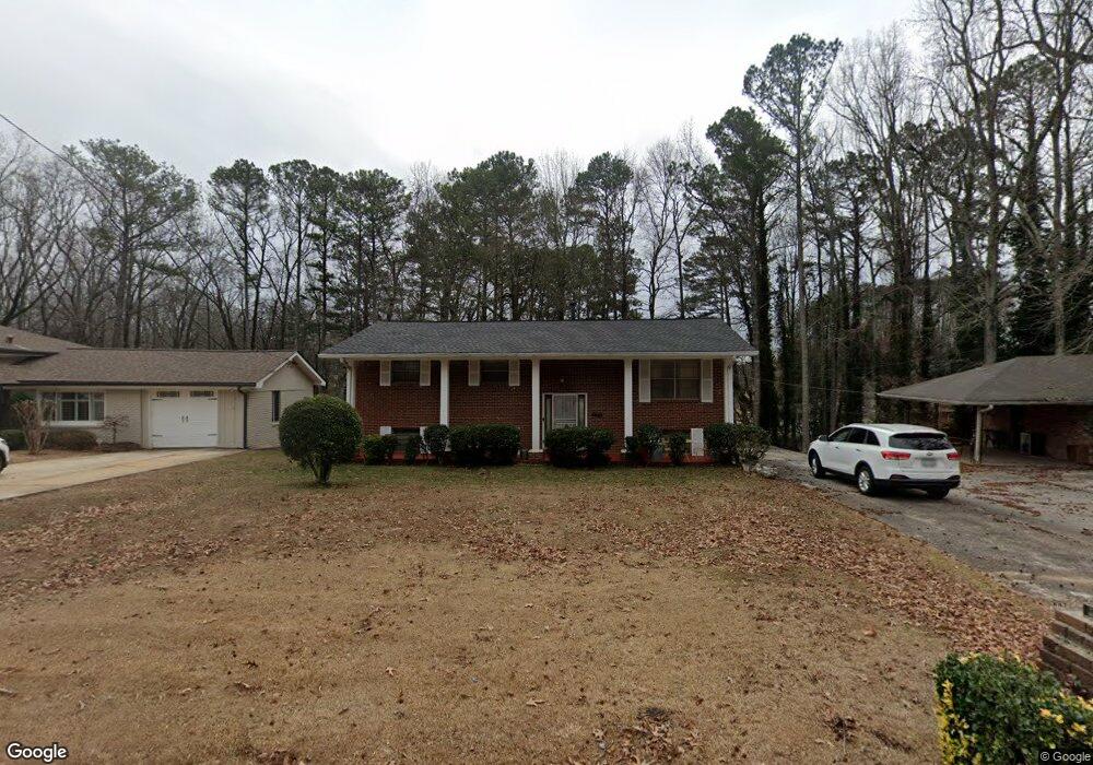
1882 Delphine Dr Decatur, GA 30032
East Lake NeighborhoodEstimated Value: $305,780 - $371,000
3
Beds
2
Baths
1,587
Sq Ft
$215/Sq Ft
Est. Value
About This Home
This home is located at 1882 Delphine Dr, Decatur, GA 30032 and is currently estimated at $340,445, approximately $214 per square foot. 1882 Delphine Dr is a home located in DeKalb County with nearby schools including McNair Middle School, McNair High School, and Charles Drew Charter School.
Ownership History
Date
Name
Owned For
Owner Type
Purchase Details
Closed on
Jul 14, 2023
Sold by
Housworth Beshun D
Bought by
Housworth Myrtis
Current Estimated Value
Purchase Details
Closed on
Sep 30, 2020
Sold by
Houseworth Emory
Bought by
Housworth Myrtis and Housworth Beshun D
Purchase Details
Closed on
Apr 24, 2003
Sold by
Housworth Emory
Bought by
Housworth Emory and Housworth Myrtis
Purchase Details
Closed on
Apr 2, 1999
Sold by
Housworth Emory
Bought by
Housworth Emory and Housworth Myrtis
Create a Home Valuation Report for This Property
The Home Valuation Report is an in-depth analysis detailing your home's value as well as a comparison with similar homes in the area
Home Values in the Area
Average Home Value in this Area
Purchase History
| Date | Buyer | Sale Price | Title Company |
|---|---|---|---|
| Housworth Myrtis | -- | -- | |
| Housworth Myrtis | -- | -- | |
| Housworth Emory | -- | -- | |
| Housworth Emory | -- | -- | |
| Housworth Emory | -- | -- | |
| Housworth Emory | -- | -- |
Source: Public Records
Tax History Compared to Growth
Tax History
| Year | Tax Paid | Tax Assessment Tax Assessment Total Assessment is a certain percentage of the fair market value that is determined by local assessors to be the total taxable value of land and additions on the property. | Land | Improvement |
|---|---|---|---|---|
| 2025 | $681 | $124,160 | $40,520 | $83,640 |
| 2024 | $707 | $115,120 | $40,520 | $74,600 |
| 2023 | $707 | $117,560 | $40,520 | $77,040 |
| 2022 | $610 | $108,560 | $32,960 | $75,600 |
| 2021 | $610 | $76,720 | $32,000 | $44,720 |
| 2020 | $610 | $80,400 | $32,000 | $48,400 |
| 2019 | $600 | $74,240 | $6,320 | $67,920 |
| 2018 | $577 | $60,600 | $6,320 | $54,280 |
| 2017 | $629 | $50,680 | $6,320 | $44,360 |
| 2016 | $543 | $32,120 | $6,320 | $25,800 |
| 2014 | $487 | $28,680 | $3,200 | $25,480 |
Source: Public Records
Map
Nearby Homes
- 1876 Delphine Dr
- 1870 Delphine Dr
- 1894 Delphine Dr
- 2048 Barberrie Ln
- 2042 Barberrie Ln
- 2054 Barberrie Ln
- 1864 Delphine Dr
- 2036 Barberrie Ln
- 1881 Delphine Dr
- 1887 Delphine Dr
- 2066 Barberrie Ln
- 1906 Delphine Dr
- 1873 Delphine Dr
- 2030 Barberrie Ln
- 1858 Delphine Dr
- 1867 Delphine Dr
- 0 Barberrie Ln Unit 7534203
- 0 Barberrie Ln Unit 3252648
- 0 Barberrie Ln Unit 3201186