Estimated Value: $209,000 - $235,000
1
Bed
1
Bath
--
Sq Ft
8,712
Sq Ft
About This Home
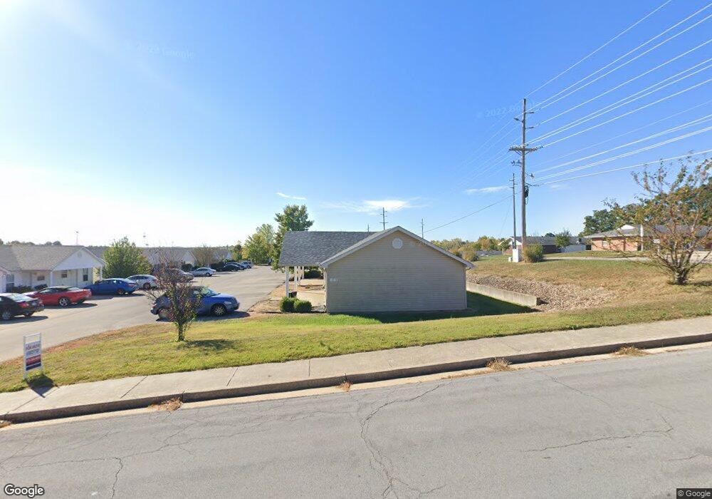
This home is located at 1883 Liam Ct, Rolla, MO 65401 and is currently estimated at $222,000. 1883 Liam Ct is a home located in Phelps County with nearby schools including Rolla Junior High School, Rolla Senior High School, and St. Patrick School.
Ownership History
Date
Name
Owned For
Owner Type
Purchase Details
Closed on
Sep 30, 2022
Sold by
Towne & Campus Apartments Inc
Bought by
Ysjr Investments Llc
Current Estimated Value
Home Financials for this Owner
Home Financials are based on the most recent Mortgage that was taken out on this home.
Original Mortgage
$324,000
Outstanding Balance
$308,181
Interest Rate
4.54%
Mortgage Type
Construction
Estimated Equity
-$86,181
Purchase Details
Closed on
Mar 26, 2010
Create a Home Valuation Report for This Property
The Home Valuation Report is an in-depth analysis detailing your home's value as well as a comparison with similar homes in the area
Home Values in the Area
Average Home Value in this Area
Purchase History
| Date | Buyer | Sale Price | Title Company |
|---|---|---|---|
| Ysjr Investments Llc | $405,000 | Other | |
| -- | $140,000 | -- |
Source: Public Records
Mortgage History
| Date | Status | Borrower | Loan Amount |
|---|---|---|---|
| Open | Ysjr Investments Llc | $324,000 |
Source: Public Records
Tax History
| Year | Tax Paid | Tax Assessment Tax Assessment Total Assessment is a certain percentage of the fair market value that is determined by local assessors to be the total taxable value of land and additions on the property. | Land | Improvement |
|---|---|---|---|---|
| 2025 | $1,606 | $30,780 | $4,100 | $26,680 |
| 2024 | $1,467 | $27,290 | $3,040 | $24,250 |
| 2023 | $1,476 | $27,290 | $3,040 | $24,250 |
| 2022 | $1,254 | $27,290 | $3,040 | $24,250 |
| 2021 | $1,262 | $27,290 | $3,040 | $24,250 |
| 2020 | $1,144 | $24,130 | $3,040 | $21,090 |
| 2019 | $1,138 | $24,130 | $3,040 | $21,090 |
| 2018 | $1,128 | $24,130 | $3,040 | $21,090 |
| 2017 | $1,125 | $24,130 | $3,040 | $21,090 |
| 2016 | $1,089 | $24,130 | $3,040 | $21,090 |
| 2015 | -- | $24,130 | $3,040 | $21,090 |
| 2014 | -- | $24,130 | $3,040 | $21,090 |
| 2013 | -- | $24,130 | $0 | $0 |
Source: Public Records
Map
Nearby Homes
- 1815 Maxwell St
- 1301 Eastwood Dr
- 1506 Heller St
- 0 California Dr
- 1306 Broadway St
- 1954 San Fernando Ct
- 1325 Eastwood Dr
- 0 Hillview Unit MIS25080072
- 1315 Harvey Ct
- 1408 Scenic Dr
- 507 E 13th St
- 0 Clayton Ct Unit MAR25028555
- 6.54 +/- ac Old Saint James Rd
- 10820 Clayton Ct
- 1603 Independence Rd
- 0 Faust Ct
- 711 E 10th St
- 10950 Hubbard Ct
- 700 Murry Ln
- 1500 Independence Rd
- 1883 Liam Ct Unit ABCD
- 1880 Liam Ct
- 1880 Liam Ct Unit Abcd
- 1892 Megan Ct Unit A-D
- 1892 Megan Ct
- 1910 Maxwell St
- 1913 Maxwell St
- 1906 Maxwell St
- 1898 Megan Ct Unit ABCD
- 1898 Megan Ct
- 2002 Maxwell St
- 1896 Megan Ct
- 1904 Maxwell St
- 1806 Farrar Dr
- 1900 Maxwell St
- 1909 Maxwell St
- 1081 E 18th St
- 2004 Maxwell St
- 1911 Maxwell St
- 1905 Maxwell St
Your Personal Tour Guide
Ask me questions while you tour the home.