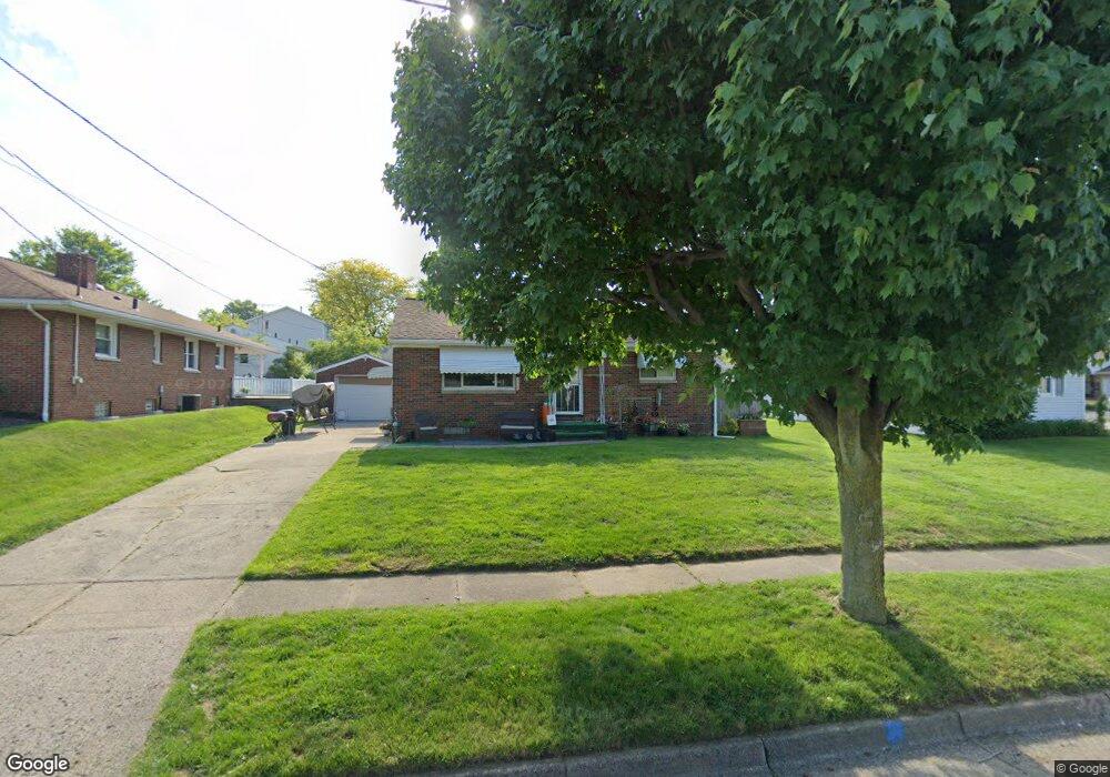
1883 Marigold Ave Akron, OH 44301
Firestone Park NeighborhoodEstimated Value: $132,000 - $140,000
2
Beds
1
Bath
884
Sq Ft
$153/Sq Ft
Est. Value
About This Home
This home is located at 1883 Marigold Ave, Akron, OH 44301 and is currently estimated at $135,139, approximately $152 per square foot. 1883 Marigold Ave is a home located in Summit County with nearby schools including Kenmore Garfield Community Learning Center, Main Preparatory Academy, and Eagle Elementary.
Ownership History
Date
Name
Owned For
Owner Type
Purchase Details
Closed on
Jan 8, 2024
Sold by
Reliford Carolyn Denise and Rice Dora A
Bought by
Rice Dora A and Rice Dora Thomas
Current Estimated Value
Purchase Details
Closed on
Jan 5, 2024
Sold by
Reliford Carolyn Denise and Rice Dora A
Bought by
Rice Dora A and Rice Dora Thomas
Purchase Details
Closed on
Oct 21, 2022
Sold by
Given Not
Bought by
Rumph Anthony J and Reliford Carolyn Denise
Purchase Details
Closed on
Dec 4, 2020
Sold by
Raliford Carolyn Denise
Bought by
Raliforrd Carolyn Denise and Rice Dora Ann
Purchase Details
Closed on
Nov 18, 2019
Sold by
Rumph Anthony J
Bought by
Rumph Anthony J and Raliford Carolyn Denise
Purchase Details
Closed on
Nov 6, 2019
Sold by
Laco Sean Micheal
Bought by
Rumph Anthony J
Create a Home Valuation Report for This Property
The Home Valuation Report is an in-depth analysis detailing your home's value as well as a comparison with similar homes in the area
Home Values in the Area
Average Home Value in this Area
Purchase History
| Date | Buyer | Sale Price | Title Company |
|---|---|---|---|
| Rice Dora A | $73,280 | None Listed On Document | |
| Rice Dora A | $73,280 | None Listed On Document | |
| Rumph Anthony J | -- | -- | |
| Raliforrd Carolyn Denise | -- | None Available | |
| Rumph Anthony J | -- | None Available | |
| Rumph Anthony J | $68,660 | None Available |
Source: Public Records
Tax History Compared to Growth
Tax History
| Year | Tax Paid | Tax Assessment Tax Assessment Total Assessment is a certain percentage of the fair market value that is determined by local assessors to be the total taxable value of land and additions on the property. | Land | Improvement |
|---|---|---|---|---|
| 2025 | $2,225 | $38,472 | $10,262 | $28,210 |
| 2024 | $2,225 | $38,472 | $10,262 | $28,210 |
| 2023 | $2,225 | $38,472 | $10,262 | $28,210 |
| 2022 | $1,980 | $28,169 | $7,438 | $20,731 |
| 2021 | $1,982 | $28,169 | $7,438 | $20,731 |
| 2020 | $1,903 | $28,170 | $7,440 | $20,730 |
| 2019 | $1,793 | $24,030 | $7,440 | $16,590 |
| 2018 | $1,769 | $24,030 | $7,440 | $16,590 |
| 2017 | $1,797 | $24,030 | $7,440 | $16,590 |
| 2016 | $3,085 | $24,030 | $7,440 | $16,590 |
| 2015 | $1,797 | $24,030 | $7,440 | $16,590 |
| 2014 | $1,831 | $24,030 | $7,440 | $16,590 |
| 2013 | $1,149 | $24,080 | $7,440 | $16,640 |
Source: Public Records
Map
Nearby Homes
- 146 E Woodsdale Ave
- 291 Selden Ave
- 79 Selden Ave
- 40 E Dresden Ave
- 315 Clinton Ave
- 37 Selden Ave
- 23 Selden Ave
- 74 E Catawba Ave
- 17 W Woodsdale Ave
- 739 S Firestone Blvd
- 41 W Woodsdale Ave
- 1637 Rockford St
- 55 W Ralston Ave
- 1861 S Main St
- 1614 Glenmount Ave
- 41 E Rosewood Ave
- 361 Mission Dr
- 1595 Evergreen Ave
- 249 Naomi St
- 29 E Dartmore Ave
- 196 E Linwood Ave
- 193 E Woodsdale Ave
- 204 E Linwood Ave
- 201 E Woodsdale Ave
- 210 E Linwood Ave
- 1882 Marigold Ave
- 207 E Woodsdale Ave
- 171 E Woodsdale Ave
- 1865 Marigold Ave
- 1874 Marigold Ave
- 214 E Linwood Ave
- 213 E Woodsdale Ave
- 194 E Woodsdale Ave
- 186 E Woodsdale Ave
- 201 E Linwood Ave
- 1868 Marigold Ave
- 202 E Woodsdale Ave
- 180 E Woodsdale Ave
- 220 E Linwood Ave
- 209 E Linwood Ave