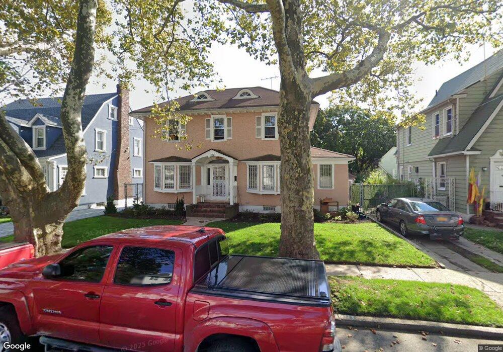
18834 Murdock Ave Saint Albans, NY 11412
Saint Albans NeighborhoodEstimated Value: $674,307 - $852,000
--
Bed
--
Bath
1,706
Sq Ft
$455/Sq Ft
Est. Value
About This Home
This home is located at 18834 Murdock Ave, Saint Albans, NY 11412 and is currently estimated at $776,577, approximately $455 per square foot. 18834 Murdock Ave is a home located in Queens County with nearby schools including Ps 36 St Albans School, Is 59 Springfield Gardens, and Riverton Street Charter School.
Ownership History
Date
Name
Owned For
Owner Type
Purchase Details
Closed on
Jun 5, 2002
Sold by
Cassiter Annie Lloyd
Bought by
Gibson Ernest M
Current Estimated Value
Home Financials for this Owner
Home Financials are based on the most recent Mortgage that was taken out on this home.
Original Mortgage
$216,000
Outstanding Balance
$91,200
Interest Rate
6.79%
Estimated Equity
$685,377
Purchase Details
Closed on
Jul 2, 2001
Sold by
Gibson Jewel
Bought by
Gibson Jewel (Trustee) and Jewel Gibson Living Trus
Create a Home Valuation Report for This Property
The Home Valuation Report is an in-depth analysis detailing your home's value as well as a comparison with similar homes in the area
Home Values in the Area
Average Home Value in this Area
Purchase History
| Date | Buyer | Sale Price | Title Company |
|---|---|---|---|
| Gibson Ernest M | -- | -- | |
| Gibson Jewel (Trustee) | -- | -- |
Source: Public Records
Mortgage History
| Date | Status | Borrower | Loan Amount |
|---|---|---|---|
| Open | Gibson Ernest M | $216,000 |
Source: Public Records
Tax History Compared to Growth
Tax History
| Year | Tax Paid | Tax Assessment Tax Assessment Total Assessment is a certain percentage of the fair market value that is determined by local assessors to be the total taxable value of land and additions on the property. | Land | Improvement |
|---|---|---|---|---|
| 2025 | $4,190 | $36,504 | $12,480 | $24,024 |
| 2024 | $4,190 | $35,260 | $12,725 | $22,535 |
| 2023 | $3,789 | $33,264 | $11,520 | $21,744 |
| 2022 | $3,490 | $39,360 | $14,400 | $24,960 |
| 2021 | $3,679 | $35,400 | $14,400 | $21,000 |
| 2020 | $3,391 | $30,420 | $14,400 | $16,020 |
| 2019 | $3,134 | $33,000 | $14,400 | $18,600 |
| 2018 | $2,715 | $27,720 | $13,070 | $14,650 |
| 2017 | $3,719 | $26,568 | $14,393 | $12,175 |
| 2016 | $1,813 | $26,568 | $14,393 | $12,175 |
| 2015 | $880 | $25,712 | $14,575 | $11,137 |
| 2014 | $880 | $24,486 | $14,496 | $9,990 |
Source: Public Records
Map
Nearby Homes
- 188-45 Quencer Rd
- 189-18 114th Dr
- 18914 114th Rd
- 114-13 203rd st 203rd St
- 187-15 Tioga Dr
- 18833 Keeseville Ave
- 18724 Tioga Dr
- 188-07 Mangin Ave
- 191-16 114th Rd
- 18823 Mangin Ave
- 188-25 Mangin Ave
- 18918 Tioga Dr
- 187-44 Jordan Ave
- 191-34 114th Rd
- 115-11 180th St
- 115-72 Farmers Blvd
- 116-39 Newburg St
- 191-47 114th Dr
- 191-40 112th Rd
- 179-07 Murdock Ave
- 18828 Murdock Ave
- 18840 Murdock Ave
- 18845 114th Dr
- 18824 Murdock Ave
- 18824 Murdock Ave
- 18846 Murdock Ave
- 189-03 114 Dr
- 18851 114th Dr
- 18818 Murdock Ave
- 18837 Murdock Ave
- 188-37 Murdock Ave
- 18840 114th Dr
- 11412 Newburgh St
- 11408 Newburgh St
- 18836 114th Dr
- 11418 Newburgh St
- 18840 114th Dr
- 18820 Lewiston Ave
- 18832 114th Dr
- 188-32 114th Dr