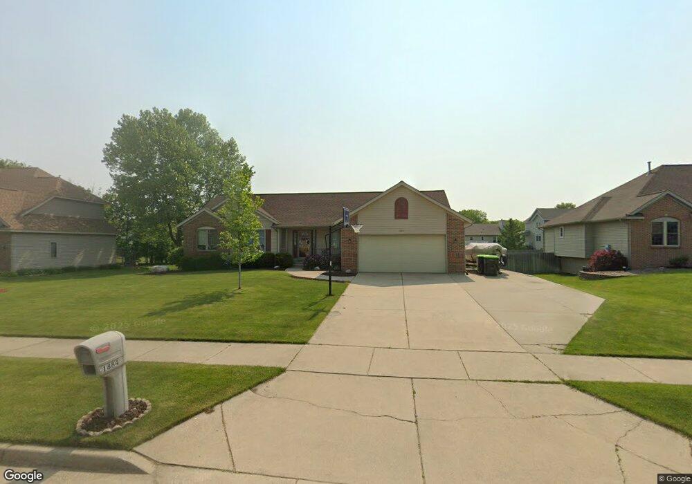
1884 Awixa St NW Grand Rapids, MI 49534
Estimated Value: $397,000 - $469,000
4
Beds
3
Baths
1,489
Sq Ft
$289/Sq Ft
Est. Value
About This Home
This home is located at 1884 Awixa St NW, Grand Rapids, MI 49534 and is currently estimated at $429,657, approximately $288 per square foot. 1884 Awixa St NW is a home located in Kent County with nearby schools including Kenowa Hills Central Elementary School, Kenowa Hills Middle School, and Kenowa Hills High School.
Ownership History
Date
Name
Owned For
Owner Type
Purchase Details
Closed on
Nov 22, 2002
Sold by
Blitchok Ronald J and Blitchok Maria P
Bought by
Klap Steven L and Klap Janet M
Current Estimated Value
Home Financials for this Owner
Home Financials are based on the most recent Mortgage that was taken out on this home.
Original Mortgage
$117,000
Outstanding Balance
$50,302
Interest Rate
6.38%
Mortgage Type
Purchase Money Mortgage
Estimated Equity
$379,355
Purchase Details
Closed on
Mar 3, 1997
Sold by
Sd Visser Builders
Bought by
Blitchok Ronald J and Klap Steven L
Create a Home Valuation Report for This Property
The Home Valuation Report is an in-depth analysis detailing your home's value as well as a comparison with similar homes in the area
Home Values in the Area
Average Home Value in this Area
Purchase History
| Date | Buyer | Sale Price | Title Company |
|---|---|---|---|
| Klap Steven L | $175,000 | -- | |
| Blitchok Ronald J | $155,500 | -- |
Source: Public Records
Mortgage History
| Date | Status | Borrower | Loan Amount |
|---|---|---|---|
| Open | Klap Steven L | $117,000 |
Source: Public Records
Tax History Compared to Growth
Tax History
| Year | Tax Paid | Tax Assessment Tax Assessment Total Assessment is a certain percentage of the fair market value that is determined by local assessors to be the total taxable value of land and additions on the property. | Land | Improvement |
|---|---|---|---|---|
| 2025 | $2,700 | $203,300 | $0 | $0 |
| 2024 | $2,700 | $171,500 | $0 | $0 |
| 2023 | $2,582 | $157,600 | $0 | $0 |
| 2022 | $2,777 | $146,000 | $0 | $0 |
| 2021 | $2,706 | $135,600 | $0 | $0 |
| 2020 | $2,375 | $129,900 | $0 | $0 |
| 2019 | $4,140 | $118,700 | $0 | $0 |
| 2018 | $2,568 | $109,900 | $0 | $0 |
| 2017 | $2,497 | $93,400 | $0 | $0 |
| 2016 | $2,224 | $87,700 | $0 | $0 |
| 2015 | $2,101 | $87,700 | $0 | $0 |
| 2013 | -- | $78,400 | $0 | $0 |
Source: Public Records
Map
Nearby Homes
- 3560 Richmond St NW
- 1781 Mullins Ave NW
- 1596 Geddes Ave NW
- 1733 Whitmore Ave NW
- 3120 Richmond St NW
- 3080 Richmond St NW
- 1524 Stark Ave NW
- 2140 Kinney Ave NW
- 1300 Lancaster Ave NW
- 1289 Lancaster Ave NW
- 2220 Elmridge Dr NW
- 2558 Meadow Ridge Dr
- 2549 Meadow Ridge Dr Unit 51
- 2551 Kinney Ave NW
- 1537 Browning Dr
- 1302 Hillburn Ave NW
- 2716 Elmridge Dr NW
- 3405 3 Mile Rd NW
- 1869 Wilson Ave NW
- 1270 Hillburn Ave NW Unit 35
- 1872 Awixa St NW
- 1896 Awixa St NW
- 1885 Ruthven Ave NW
- 1873 Ruthven Ave NW
- 1897 Ruthven Ave NW
- 1908 Awixa St NW
- 1875 Awixa St NW
- 1891 Awixa St NW
- 1861 Ruthven Ave NW
- 3472 Onandoga St NW
- 1909 Ruthven Ave NW
- 3494 Onandoga St NW
- 1867 Awixa St NW
- 1920 Awixa St NW
- 1849 Ruthven Ave NW
- 1921 Ruthven Ave NW
- 1851 Awixa St NW
- 1923 Awixa St NW
- 1890 Ruthven Ave NW
- 1878 Ruthven Ave NW