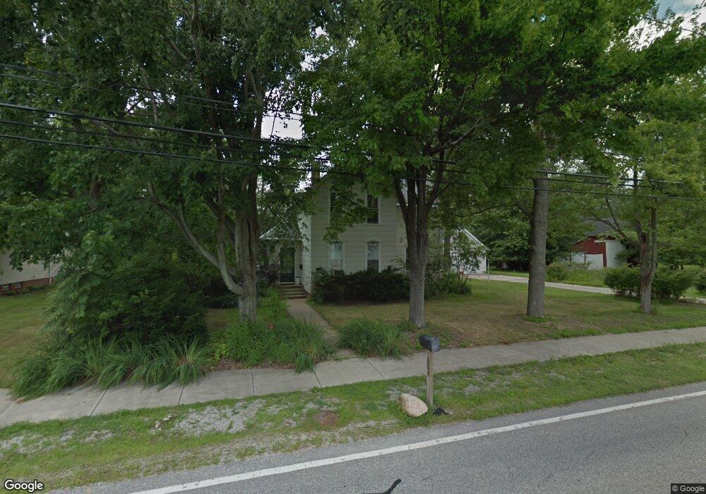
1884 Bassett Rd Westlake, OH 44145
Estimated Value: $427,635 - $601,000
4
Beds
2
Baths
2,584
Sq Ft
$196/Sq Ft
Est. Value
About This Home
This home is located at 1884 Bassett Rd, Westlake, OH 44145 and is currently estimated at $507,409, approximately $196 per square foot. 1884 Bassett Rd is a home located in Cuyahoga County with nearby schools including Dover Intermediate School, Lee Burneson Middle School, and Westlake High School.
Ownership History
Date
Name
Owned For
Owner Type
Purchase Details
Closed on
Oct 2, 2019
Sold by
Estate Of Melanie Hunter Olm
Bought by
Dean Don A
Current Estimated Value
Purchase Details
Closed on
Dec 6, 2013
Sold by
Hunter Olm Melanie and Dean Don A
Bought by
Hunter Olm Melanie and Dean Don A
Purchase Details
Closed on
Jun 18, 1976
Sold by
Olm Clifford M and Olm Melanie H
Bought by
Olm Melanie H
Purchase Details
Closed on
Jan 1, 1975
Bought by
Olm Clifford M and Olm Melanie H
Create a Home Valuation Report for This Property
The Home Valuation Report is an in-depth analysis detailing your home's value as well as a comparison with similar homes in the area
Home Values in the Area
Average Home Value in this Area
Purchase History
| Date | Buyer | Sale Price | Title Company |
|---|---|---|---|
| Dean Don A | -- | None Available | |
| Hunter Olm Melanie | -- | Resource Title Agency | |
| Pavicic Edward P | -- | Resource Title Agency | |
| Pavicic Edward P | $30,000 | Resource Title Agency | |
| Olm Melanie H | -- | -- | |
| Olm Clifford M | -- | -- |
Source: Public Records
Tax History Compared to Growth
Tax History
| Year | Tax Paid | Tax Assessment Tax Assessment Total Assessment is a certain percentage of the fair market value that is determined by local assessors to be the total taxable value of land and additions on the property. | Land | Improvement |
|---|---|---|---|---|
| 2024 | $5,506 | $126,035 | $25,305 | $100,730 |
| 2023 | $5,374 | $106,160 | $23,070 | $83,090 |
| 2022 | $5,311 | $106,160 | $23,070 | $83,090 |
| 2021 | $5,318 | $106,160 | $23,070 | $83,090 |
| 2020 | $4,879 | $90,720 | $19,710 | $71,020 |
| 2019 | $4,777 | $259,200 | $56,300 | $202,900 |
| 2018 | $4,367 | $90,720 | $19,710 | $71,020 |
| 2017 | $4,017 | $72,530 | $16,350 | $56,180 |
| 2016 | $3,910 | $72,530 | $16,350 | $56,180 |
| 2015 | $4,004 | $72,530 | $16,350 | $56,180 |
| 2014 | $4,004 | $72,700 | $16,520 | $56,180 |
Source: Public Records
Map
Nearby Homes
- 2075 Bassett Rd
- 29379 Detroit Rd
- 29363 Detroit Rd Unit 5
- 1476 Bobby Ln Unit 7
- 28167 Zinfandel Ct
- 28163 Zinfandel Ct
- Ashton Plan at Hope Pointe Place
- Bowman Plan at Hope Pointe Place
- 1625 Cedarwood Dr Unit 218
- 1721 Merlot Ln
- 28180 Detroit Rd Unit A2
- 1510 Alder Ln Unit 7C
- 1480 Cedarwood Dr Unit 21F
- 1670 Cedarwood Dr Unit 148
- 2647 Piedmont Ct Unit 56
- 27923 Hilliard Blvd
- 1316 Cedarwood Dr Unit D3
- 31000 Logan Ct
- 31035 Wilderness Trail
- 879 S Parkside Dr
- 1892 Bassett Rd
- SL 9 Graystone Dr
- 1916 Bassett Rd
- 29236 Graystone Dr
- 1842 Bassett Rd
- 1860 Bassett Rd
- 29218 Sunset Dr
- 29235 Graystone Dr
- 1867 Bassett Rd
- 1881 Bassett Rd
- 1936 Bassett Rd
- 1855 Bassett Rd
- 29234 Sunset Dr
- 1893 Bassett Rd
- 1843 Bassett Rd
- 29252 Graystone Dr
- 29250 Sunset Dr
- 29269 Graystone Dr
- 1917 Bassett Rd
- 1823 Bassett Rd