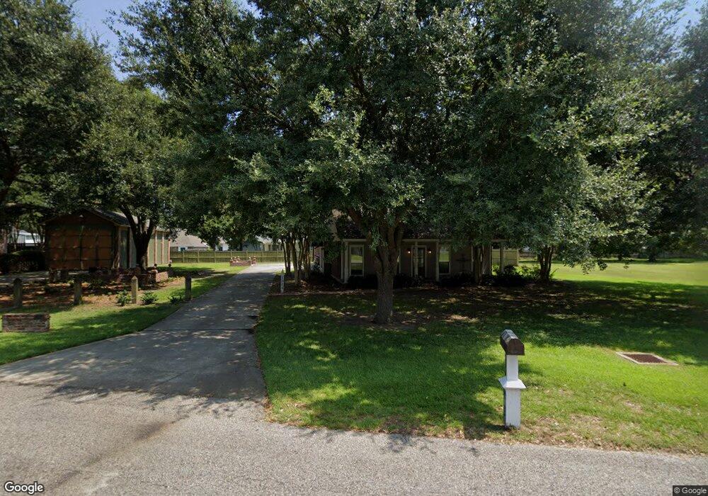
1884 Lansdown Ave Port Allen, LA 70767
West Baton Rouge Parish NeighborhoodEstimated Value: $240,469 - $403,000
--
Bed
--
Bath
1,824
Sq Ft
$162/Sq Ft
Est. Value
About This Home
This home is located at 1884 Lansdown Ave, Port Allen, LA 70767 and is currently estimated at $296,367, approximately $162 per square foot. 1884 Lansdown Ave is a home located in West Baton Rouge Parish with nearby schools including Brusly Elementary School, Lukeville Upper Elementary School, and Brusly Middle School.
Ownership History
Date
Name
Owned For
Owner Type
Purchase Details
Closed on
Jun 20, 2025
Sold by
Parent Morgan Adeline and Dupuy Nelson Andrew
Bought by
Newsom Lisa Marie
Current Estimated Value
Home Financials for this Owner
Home Financials are based on the most recent Mortgage that was taken out on this home.
Original Mortgage
$261,250
Outstanding Balance
$260,573
Interest Rate
6.76%
Mortgage Type
New Conventional
Estimated Equity
$35,794
Purchase Details
Closed on
Jun 20, 2006
Sold by
Barker Investement Company L L C
Bought by
Admiral Land Company L L C
Create a Home Valuation Report for This Property
The Home Valuation Report is an in-depth analysis detailing your home's value as well as a comparison with similar homes in the area
Home Values in the Area
Average Home Value in this Area
Purchase History
| Date | Buyer | Sale Price | Title Company |
|---|---|---|---|
| Newsom Lisa Marie | $275,000 | First American Title | |
| Newsom Lisa Marie | $275,000 | First American Title | |
| Admiral Land Company L L C | $78,750 | None Available |
Source: Public Records
Mortgage History
| Date | Status | Borrower | Loan Amount |
|---|---|---|---|
| Open | Newsom Lisa Marie | $261,250 | |
| Closed | Newsom Lisa Marie | $261,250 |
Source: Public Records
Tax History Compared to Growth
Tax History
| Year | Tax Paid | Tax Assessment Tax Assessment Total Assessment is a certain percentage of the fair market value that is determined by local assessors to be the total taxable value of land and additions on the property. | Land | Improvement |
|---|---|---|---|---|
| 2024 | $942 | $17,230 | $3,040 | $14,190 |
| 2023 | $1,010 | $17,230 | $3,040 | $14,190 |
| 2022 | $1,807 | $17,230 | $3,040 | $14,190 |
| 2021 | $1,848 | $17,230 | $3,040 | $14,190 |
| 2020 | $1,680 | $15,510 | $2,740 | $12,770 |
| 2019 | $1,944 | $17,230 | $3,040 | $14,190 |
| 2018 | $1,979 | $17,230 | $3,040 | $14,190 |
| 2017 | $1,828 | $17,230 | $3,040 | $14,190 |
| 2015 | $1,480 | $17,230 | $3,040 | $14,190 |
| 2014 | $1,456 | $17,230 | $3,040 | $14,190 |
| 2013 | $1,456 | $17,230 | $3,040 | $14,190 |
Source: Public Records
Map
Nearby Homes
- 1959 Fairview Ave
- 4747 Evergreen Dr
- 1394 Rue Riviere
- 2217 Silverstone Ave
- 1152 Freeman Ln
- 2428 Riverside Dr
- Whitmore II Plan at The Woodlands
- Woodland II Plan at The Woodlands
- Whitmore I - The Woodlands Plan at The Woodlands
- Waldorf I Plan at The Woodlands
- Chadford I Plan at The Woodlands
- 2488 Oak Alley Dr
- 2607 Riverside Dr
- 4000 Lake Beau Pre Blvd Unit 198
- 4000 Lake Beau Pre Blvd Unit 69
- 4000 Lake Beau Pre Blvd Unit 110
- 4000 Lake Beau Pre Blvd Unit 13
- 4000 Lake Beau Pre Blvd Unit 87
- 4000 Lake Beau Pre Blvd Unit 131
- 5654 Ducros Dr
- 1906 Lansdown Ave
- 1865 Fairview Ave
- 1851 Fairview Dr
- 1877 Fairview Ave
- 1833 Fairview Ave
- 1901 Lansdown Ave
- 1873 Lansdown Ave
- 1844 Lansdown Ave
- 4223 Stanton Ave
- 1909 Fairview Dr
- 1827 Fairview Ave
- 1853 Lansdown Ave
- 4233 Stanton Ave
- 1910 Lansdown Ave
- 4243 Stanton Ave
- 1819 Fairview Ave
- 1824 Lansdown Ave
- 1862 Fairview Dr
- 1920 Lansdown Ave
- 1920 Landsdown Drive3