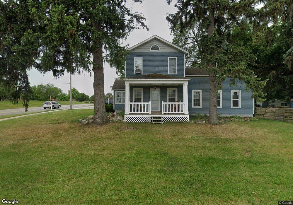
1884 Port Sheldon St Hudsonville, MI 49426
Estimated Value: $331,847 - $461,000
4
Beds
2
Baths
1,824
Sq Ft
$207/Sq Ft
Est. Value
About This Home
This home is located at 1884 Port Sheldon St, Hudsonville, MI 49426 and is currently estimated at $377,962, approximately $207 per square foot. 1884 Port Sheldon St is a home located in Ottawa County with nearby schools including Bursley School, Jenison Junior High School, and Jenison High School.
Ownership History
Date
Name
Owned For
Owner Type
Purchase Details
Closed on
Jan 18, 2018
Sold by
Nichols Brandon M and Nichols Kathryn M
Bought by
Board Of County Road Commissioners Of Th
Current Estimated Value
Purchase Details
Closed on
Dec 8, 2009
Sold by
Keen Lukas A
Bought by
Nichols Brandon
Home Financials for this Owner
Home Financials are based on the most recent Mortgage that was taken out on this home.
Original Mortgage
$72,000
Interest Rate
4.9%
Mortgage Type
New Conventional
Purchase Details
Closed on
Jun 26, 2008
Sold by
Sharpe Nathan A and Sharpe Alison L
Bought by
Wells Fargo Bank Na and Option One Mortgage Loan Trust 2005-3 As
Create a Home Valuation Report for This Property
The Home Valuation Report is an in-depth analysis detailing your home's value as well as a comparison with similar homes in the area
Home Values in the Area
Average Home Value in this Area
Purchase History
| Date | Buyer | Sale Price | Title Company |
|---|---|---|---|
| Board Of County Road Commissioners Of Th | -- | None Available | |
| Nichols Brandon | $90,000 | Chicago Title | |
| Wells Fargo Bank Na | $80,665 | None Available |
Source: Public Records
Mortgage History
| Date | Status | Borrower | Loan Amount |
|---|---|---|---|
| Previous Owner | Nichols Brandon | $72,000 |
Source: Public Records
Tax History Compared to Growth
Tax History
| Year | Tax Paid | Tax Assessment Tax Assessment Total Assessment is a certain percentage of the fair market value that is determined by local assessors to be the total taxable value of land and additions on the property. | Land | Improvement |
|---|---|---|---|---|
| 2025 | $1,755 | $125,700 | $0 | $0 |
| 2024 | $1,523 | $118,300 | $0 | $0 |
| 2023 | $1,454 | $105,900 | $0 | $0 |
| 2022 | $1,596 | $93,600 | $0 | $0 |
| 2021 | $1,550 | $83,300 | $0 | $0 |
| 2020 | $1,533 | $75,700 | $0 | $0 |
| 2019 | $1,534 | $70,000 | $0 | $0 |
| 2018 | $1,431 | $63,200 | $0 | $0 |
| 2017 | $1,406 | $61,500 | $0 | $0 |
| 2016 | $1,397 | $56,600 | $0 | $0 |
| 2015 | $1,232 | $49,800 | $0 | $0 |
| 2014 | $1,232 | $48,500 | $0 | $0 |
Source: Public Records
Map
Nearby Homes
- 6363 Eastridge Ct
- 6293 Eastridge Dr
- 1643 Laramy Ln
- 6129 W Bay Ct
- 1520 Winifred St
- 1433 Winifred St
- 1519 Eagle Shore Ct Unit Lot 33
- 1496 Eagle Shore Ct Unit 13
- 1481 Eagle Shore Ct Unit 39
- 1451 Eagle Shore Ct
- 1361 Carol Dr
- 1355 Bent Tree Dr Unit 12
- 5833 Nelson Dr
- 6905 Maple Ave
- 6451 12th Ave
- 6025 Gleneagle Dr
- 1187 Fairfield Dr
- 5954 Gleneagle Dr
- 2101 Rosewood St
- Parcel 8 16th Ave
- 6374 Springmont Ct
- 6374 Springmont Ct Unit 75
- 6374 Springmont Ct Unit 75
- 6376 Springmont Ct Unit 76
- 6361 Eastridge Ct
- 6361 Eastridge Ct Unit 2
- 6372 Springmont Ct
- 6372 Springmont Ct Unit 74
- 358 Port Sheldon St
- 394 Port Sheldon St
- 6349 Eastridge Ct
- 6349 Eastridge Ct Unit 3
- 6347 Eastridge Ct
- 6376 Getry Ct N
- 6376 Gentry Ct N Unit 120
- 6354 Springmont Ct Unit 70
- 6356 Gentry Ct N Unit 119
- 6356 Getry Ct N
- 6354 Gentry Ct N
- 6378 Gentry Ct N