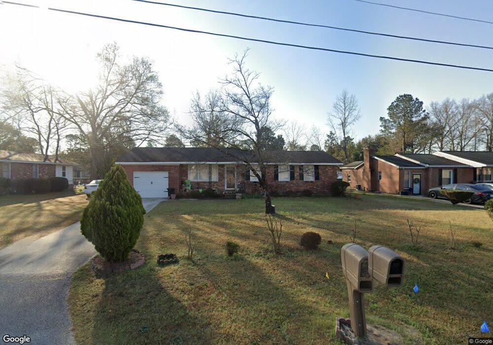
1884 S Briarcliff Rd Orangeburg, SC 29115
Estimated Value: $125,000 - $155,000
3
Beds
2
Baths
1,175
Sq Ft
$118/Sq Ft
Est. Value
About This Home
This home is located at 1884 S Briarcliff Rd, Orangeburg, SC 29115 and is currently estimated at $138,975, approximately $118 per square foot. 1884 S Briarcliff Rd is a home located in Orangeburg County with nearby schools including Whittaker Elementary, Whittaker Elementary School, and Robert E. Howard Middle School.
Ownership History
Date
Name
Owned For
Owner Type
Purchase Details
Closed on
Jun 12, 2023
Sold by
Mack John Henry
Bought by
Mack Josefina M
Current Estimated Value
Purchase Details
Closed on
Jun 22, 2010
Sold by
Mack John Henry
Bought by
Mack Josefina M
Home Financials for this Owner
Home Financials are based on the most recent Mortgage that was taken out on this home.
Original Mortgage
$31,000
Interest Rate
4.83%
Mortgage Type
Credit Line Revolving
Create a Home Valuation Report for This Property
The Home Valuation Report is an in-depth analysis detailing your home's value as well as a comparison with similar homes in the area
Home Values in the Area
Average Home Value in this Area
Purchase History
| Date | Buyer | Sale Price | Title Company |
|---|---|---|---|
| Mack Josefina M | -- | None Listed On Document | |
| Mack Josefina M | -- | -- |
Source: Public Records
Mortgage History
| Date | Status | Borrower | Loan Amount |
|---|---|---|---|
| Previous Owner | Mack Josefina M | $31,000 |
Source: Public Records
Tax History Compared to Growth
Tax History
| Year | Tax Paid | Tax Assessment Tax Assessment Total Assessment is a certain percentage of the fair market value that is determined by local assessors to be the total taxable value of land and additions on the property. | Land | Improvement |
|---|---|---|---|---|
| 2024 | $229 | $3,765 | $477 | $3,288 |
| 2023 | $135 | $2,721 | $437 | $2,284 |
| 2022 | $1,631 | $2,721 | $437 | $2,284 |
| 2021 | $127 | $2,721 | $437 | $2,284 |
| 2020 | $124 | $2,721 | $437 | $2,284 |
| 2019 | $125 | $2,721 | $437 | $2,284 |
| 2018 | $111 | $2,677 | $437 | $2,240 |
| 2017 | $106 | $2,677 | $0 | $0 |
| 2016 | $105 | $2,677 | $0 | $0 |
| 2015 | $99 | $2,677 | $0 | $0 |
| 2014 | $99 | $2,678 | $438 | $2,240 |
| 2013 | -- | $2,793 | $437 | $2,356 |
Source: Public Records
Map
Nearby Homes
- 397 Brookdale Dr
- 0000 Oc 1207
- 2466 Old Cameron Rd
- 1948 Belleville Rd
- 416 Palmetto Pkwy
- 0 Old Cameron Rd
- 1761 State Road S-38-1657
- 2266 Atlantic Ave
- 1542 Belleville Rd
- 575 Woodlawn Dr NE
- 0 Bryan Dr
- 0 Corona Dr Unit 25006444
- 2031 Atlantic Ave
- 2015 Atlantic Ave
- 1832par Co Par Ct
- 1832 Par Ct
- 1859 Atlantic Ave
- 344 Mingo St
- 120 Stamford Rd
- 128 Stamford Rd
- 1888 S Briarcliff Rd
- 1879 Dellwood Dr
- 1892 S Briarcliffe Dr
- 1889 Dellwood Dr
- 1871 Dellwood Dr
- 1893 Dellwood Dr
- 1862 S Briarcliff Rd
- 1865 Dellwood Dr
- 1896 S Briarcliff Rd
- 1896 S Briarcliff Rd
- 1897 Dellwood Dr
- 1857 Dellwood Dr
- 1880 Dellwood Dr
- 1886 Dellwood Dr
- 1872 Dellwood Dr
- 1872 Dellwood Dr
- 1866 Dellwood Dr
- 494 Shadow Lawn Dr
- 494 Shadow Lawn Dr
- 516 Shadow Lawn Dr