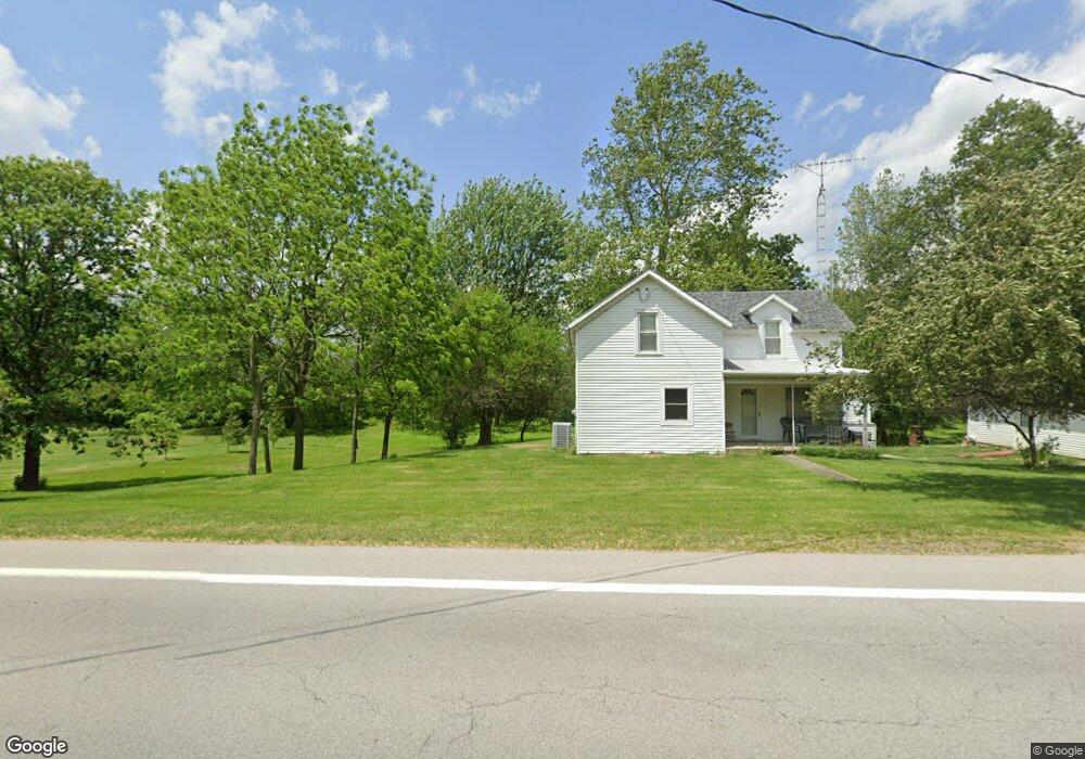
1884 State Route 412 Fremont, OH 43420
Estimated Value: $282,000 - $498,731
1
Bed
2
Baths
2,030
Sq Ft
$177/Sq Ft
Est. Value
About This Home
This home is located at 1884 State Route 412, Fremont, OH 43420 and is currently estimated at $359,433, approximately $177 per square foot. 1884 State Route 412 is a home located in Sandusky County with nearby schools including Fremont Ross High School, Temple Christian Academy, and Bishop Hoffman Catholic School - This is St Joe's School now.
Ownership History
Date
Name
Owned For
Owner Type
Purchase Details
Closed on
Oct 7, 2025
Sold by
Fisher Barbara J
Bought by
Darr Ronald S and Darr Julie A
Current Estimated Value
Purchase Details
Closed on
May 1, 1991
Bought by
Fisher Joseph A and Fisher Barbara J
Create a Home Valuation Report for This Property
The Home Valuation Report is an in-depth analysis detailing your home's value as well as a comparison with similar homes in the area
Home Values in the Area
Average Home Value in this Area
Purchase History
| Date | Buyer | Sale Price | Title Company |
|---|---|---|---|
| Darr Ronald S | $15,000 | None Listed On Document | |
| Fisher Joseph A | -- | -- |
Source: Public Records
Tax History Compared to Growth
Tax History
| Year | Tax Paid | Tax Assessment Tax Assessment Total Assessment is a certain percentage of the fair market value that is determined by local assessors to be the total taxable value of land and additions on the property. | Land | Improvement |
|---|---|---|---|---|
| 2024 | $4,198 | $144,550 | $63,560 | $80,990 |
| 2023 | $4,198 | $144,550 | $63,560 | $80,990 |
| 2022 | $3,862 | $144,550 | $63,560 | $80,990 |
| 2021 | $3,984 | $144,550 | $63,560 | $80,990 |
| 2020 | $4,132 | $138,640 | $65,100 | $73,540 |
| 2019 | $4,126 | $138,640 | $65,100 | $73,540 |
| 2018 | $4,134 | $138,640 | $65,100 | $73,540 |
| 2017 | $4,225 | $127,650 | $63,700 | $63,950 |
| 2016 | $3,722 | $127,650 | $63,700 | $63,950 |
| 2015 | $3,662 | $127,650 | $63,700 | $63,950 |
| 2014 | $3,322 | $119,180 | $50,370 | $68,810 |
| 2013 | $3,252 | $119,180 | $50,370 | $68,810 |
Source: Public Records
Map
Nearby Homes
- 263 Saint Paul Dr
- 251 Saint Paul Dr
- 199 Saint Thomas Dr
- 315 Ethan Dr
- 318 Ethan Dr
- 2248 E State St
- 0 Cr 214 Unit 20253055
- 1014 S County Road 198
- 711 Bloom Rd
- 230 N Pennsylvania Ave
- 2314 E Sr 20
- 1526 Sunrise Blvd
- 612 2nd St
- 533 Sandusky Ave Unit 535
- 800 Lawndale Dr
- 546 Oaklawn Ave
- 714 E State St
- 322 4th St
- 433 Sandusky Ave
- 314 S Collinwood Blvd
- 1958 State Route 412
- 1958 State Route 412
- 1968 State Route 412
- 1938 Ohio 412
- 1938 State Route 412
- 1910 State Route 412
- 1941 State Route 412
- 1941 Ohio 412
- 1904 State Route 412
- 412 Sr
- 2001 State Route 412
- 1876 State Route 412
- 2035 State Route 412
- 2077 State Route 412
- 1816 State Route 412
- 1806 State Route 412
- 824 N County Road 204
- 1788 State Route 412
- 840 N County Road 204
- 1789 State Route 412