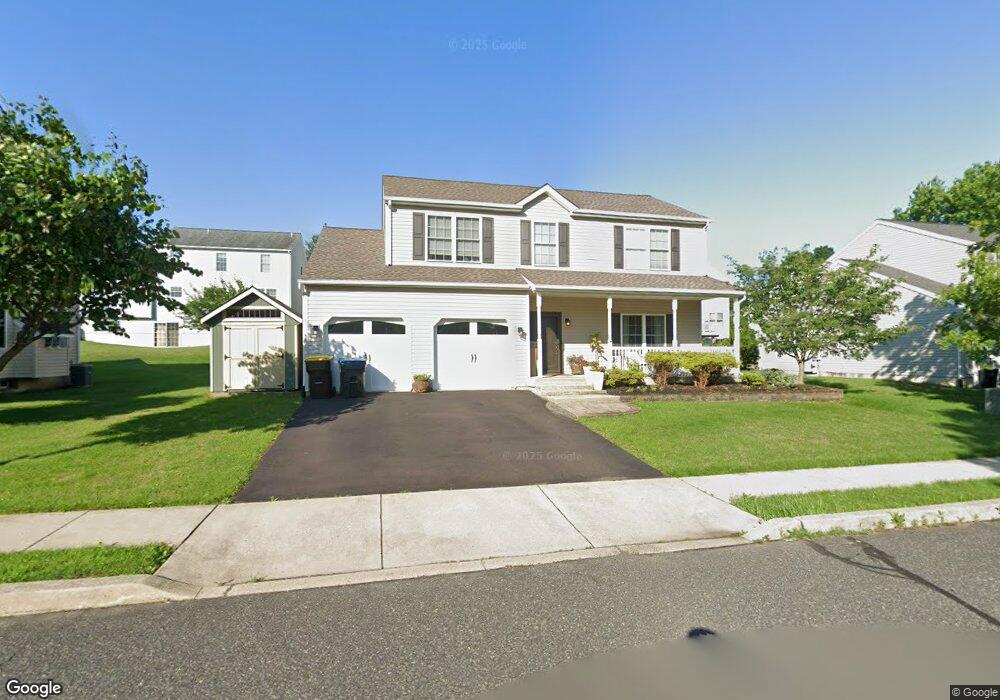
1884 Strong Rd Quakertown, PA 18951
Milford-Quakertown NeighborhoodEstimated Value: $443,000 - $497,624
3
Beds
3
Baths
1,852
Sq Ft
$258/Sq Ft
Est. Value
About This Home
This home is located at 1884 Strong Rd, Quakertown, PA 18951 and is currently estimated at $478,156, approximately $258 per square foot. 1884 Strong Rd is a home located in Bucks County with nearby schools including Pfaff Elementary School, Quakertown Community Senior High School, and United Friends School.
Ownership History
Date
Name
Owned For
Owner Type
Purchase Details
Closed on
Aug 24, 2004
Sold by
Mahler William F
Bought by
Bowersock Joshua D and Bowersock Audrey A
Current Estimated Value
Home Financials for this Owner
Home Financials are based on the most recent Mortgage that was taken out on this home.
Original Mortgage
$208,000
Outstanding Balance
$103,692
Interest Rate
6.08%
Mortgage Type
FHA
Estimated Equity
$374,464
Create a Home Valuation Report for This Property
The Home Valuation Report is an in-depth analysis detailing your home's value as well as a comparison with similar homes in the area
Home Values in the Area
Average Home Value in this Area
Purchase History
| Date | Buyer | Sale Price | Title Company |
|---|---|---|---|
| Bowersock Joshua D | $260,000 | -- |
Source: Public Records
Mortgage History
| Date | Status | Borrower | Loan Amount |
|---|---|---|---|
| Open | Bowersock Joshua D | $208,000 | |
| Closed | Bowersock Joshua D | $26,000 |
Source: Public Records
Tax History Compared to Growth
Tax History
| Year | Tax Paid | Tax Assessment Tax Assessment Total Assessment is a certain percentage of the fair market value that is determined by local assessors to be the total taxable value of land and additions on the property. | Land | Improvement |
|---|---|---|---|---|
| 2025 | $6,171 | $30,600 | $4,800 | $25,800 |
| 2024 | $6,171 | $30,600 | $4,800 | $25,800 |
| 2023 | $6,110 | $30,600 | $4,800 | $25,800 |
| 2022 | $6,006 | $30,600 | $4,800 | $25,800 |
| 2021 | $6,006 | $30,600 | $4,800 | $25,800 |
| 2020 | $6,006 | $30,600 | $4,800 | $25,800 |
| 2019 | $5,840 | $30,600 | $4,800 | $25,800 |
| 2018 | $5,637 | $30,600 | $4,800 | $25,800 |
| 2017 | $5,463 | $30,600 | $4,800 | $25,800 |
| 2016 | $5,463 | $30,600 | $4,800 | $25,800 |
| 2015 | -- | $30,600 | $4,800 | $25,800 |
| 2014 | -- | $30,600 | $4,800 | $25,800 |
Source: Public Records
Map
Nearby Homes
- 1805 Leedum Ln
- 1999 Crossing Way
- 1926 Alamingo Dr
- 1856 Alamingo Dr
- 1625 Canary Rd
- 1615 Canary Rd
- 444 Enclave Dr Unit SAVANNAH
- 444 Enclave Dr Unit COVINGTON
- 444 Enclave Dr Unit SEBASTIAN
- 444 Enclave Dr Unit DEVONSHIRE
- 444 Enclave Dr Unit PARKER
- 444 Enclave Dr Unit HAWTHORNE
- 1605 Canary Rd
- 8769 Spinnerstown Rd
- 1844 Enclave Dr
- 1765 Old Plains Rd
- 1270 Fennel Rd
- 1410 Fels Rd
- 1940 Geryville Pike
- 2365 E Swamp Rd
- 1888 Strong Rd
- 1880 Strong Rd
- 1818 Leedum Ln
- 1822 Leedum Ln
- 1814 Leedum Ln
- 1885 Strong Rd
- 1881 Strong Rd
- 1892 Strong Rd
- 1876 Strong Rd
- 1889 Strong Rd
- 1810 Leedum Ln
- 1826 Leedum Ln
- 1877 Strong Rd
- 1893 Strong Rd
- 1753 Red Bud Rd
- 1872 Strong Rd
- 1821 Leedum Ln
- 1806 Leedum Ln
- 1749 Red Bud Rd
- 1817 Leedum Ln