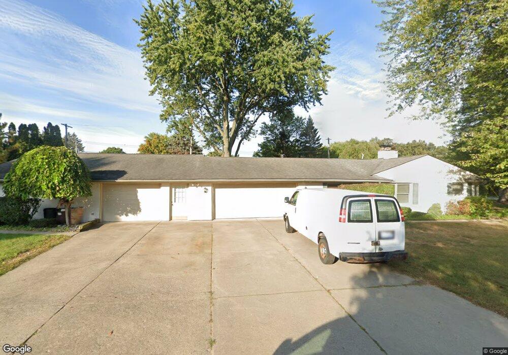
18848 Kappa Dr Clinton Township, MI 48036
Estimated Value: $422,000 - $569,000
4
Beds
5
Baths
3,300
Sq Ft
$157/Sq Ft
Est. Value
About This Home
This home is located at 18848 Kappa Dr, Clinton Township, MI 48036 and is currently estimated at $519,027, approximately $157 per square foot. 18848 Kappa Dr is a home located in Macomb County with nearby schools including Ottawa Elementary School, Algonquin Middle School, and Chippewa Valley High School.
Ownership History
Date
Name
Owned For
Owner Type
Purchase Details
Closed on
Aug 10, 2005
Sold by
Benac Lucille C
Bought by
Danner Terry F and Danner Louise A
Current Estimated Value
Purchase Details
Closed on
Dec 12, 2004
Sold by
Benac David Daniel
Bought by
Benac Lucille C
Home Financials for this Owner
Home Financials are based on the most recent Mortgage that was taken out on this home.
Original Mortgage
$265,000
Interest Rate
5.8%
Mortgage Type
Fannie Mae Freddie Mac
Create a Home Valuation Report for This Property
The Home Valuation Report is an in-depth analysis detailing your home's value as well as a comparison with similar homes in the area
Home Values in the Area
Average Home Value in this Area
Purchase History
| Date | Buyer | Sale Price | Title Company |
|---|---|---|---|
| Danner Terry F | $335,000 | Title One Inc | |
| Benac Lucille C | -- | Title One Inc |
Source: Public Records
Mortgage History
| Date | Status | Borrower | Loan Amount |
|---|---|---|---|
| Previous Owner | Benac Lucille C | $265,000 |
Source: Public Records
Tax History Compared to Growth
Tax History
| Year | Tax Paid | Tax Assessment Tax Assessment Total Assessment is a certain percentage of the fair market value that is determined by local assessors to be the total taxable value of land and additions on the property. | Land | Improvement |
|---|---|---|---|---|
| 2025 | $6,608 | $256,700 | $0 | $0 |
| 2024 | $3,937 | $248,300 | $0 | $0 |
| 2023 | $3,734 | $223,700 | $0 | $0 |
| 2022 | $5,987 | $201,100 | $0 | $0 |
| 2021 | $5,823 | $188,400 | $0 | $0 |
| 2020 | $3,426 | $183,200 | $0 | $0 |
| 2019 | $5,424 | $174,800 | $0 | $0 |
| 2018 | $5,328 | $163,100 | $0 | $0 |
| 2017 | $5,264 | $149,300 | $37,700 | $111,600 |
| 2016 | $5,078 | $149,300 | $0 | $0 |
| 2015 | -- | $143,300 | $0 | $0 |
| 2014 | -- | $132,300 | $0 | $0 |
| 2011 | -- | $108,100 | $32,300 | $75,800 |
Source: Public Records
Map
Nearby Homes
- VL Moravian Dr
- 18633 Omega St
- 38638 Santa Barbara St
- 37943 Santa Barbara St
- 38219 Santa Anna St
- 37829 Pocahontas Dr
- 38906 Santa Barbara St
- 18917 Monica Dr
- 20463 Harmony Dr
- 18908 Monica Dr
- 37053 Brynford Dr
- 20080 Rhapsody Dr
- 20543 Glenallen Dr
- 38383 Saddle Ln
- 20455 Palms Dr
- 37218 Charter Oaks Blvd
- 37439 Charter Oaks Blvd Unit 114
- 37619 Charter Oaks Blvd Unit 222
- 19128 Cheyenne St
- 19975 S Great Oaks Cir