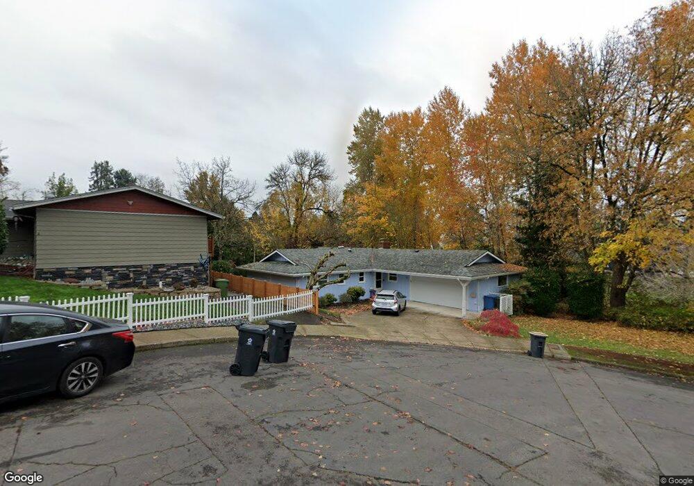
1885 Ewald Ave SE Salem, OR 97302
Morningside NeighborhoodEstimated Value: $467,399 - $517,000
3
Beds
2
Baths
1,863
Sq Ft
$269/Sq Ft
Est. Value
About This Home
This home is located at 1885 Ewald Ave SE, Salem, OR 97302 and is currently estimated at $500,350, approximately $268 per square foot. 1885 Ewald Ave SE is a home located in Marion County with nearby schools including Morningside Elementary School, Leslie Middle School, and South Salem High School.
Ownership History
Date
Name
Owned For
Owner Type
Purchase Details
Closed on
Mar 6, 2002
Sold by
Harlan James M
Bought by
Harlan Elaine M
Current Estimated Value
Home Financials for this Owner
Home Financials are based on the most recent Mortgage that was taken out on this home.
Original Mortgage
$113,700
Interest Rate
6.94%
Mortgage Type
Purchase Money Mortgage
Create a Home Valuation Report for This Property
The Home Valuation Report is an in-depth analysis detailing your home's value as well as a comparison with similar homes in the area
Home Values in the Area
Average Home Value in this Area
Purchase History
| Date | Buyer | Sale Price | Title Company |
|---|---|---|---|
| Harlan Elaine M | $74,118 | Amerititle Inc |
Source: Public Records
Mortgage History
| Date | Status | Borrower | Loan Amount |
|---|---|---|---|
| Closed | Harlan Elaine M | $113,700 |
Source: Public Records
Tax History Compared to Growth
Tax History
| Year | Tax Paid | Tax Assessment Tax Assessment Total Assessment is a certain percentage of the fair market value that is determined by local assessors to be the total taxable value of land and additions on the property. | Land | Improvement |
|---|---|---|---|---|
| 2025 | $4,868 | $255,370 | -- | -- |
| 2024 | $4,868 | $247,940 | -- | -- |
| 2023 | $4,725 | $240,720 | $0 | $0 |
| 2022 | $4,455 | $233,710 | $0 | $0 |
| 2021 | $4,327 | $226,910 | $0 | $0 |
| 2020 | $4,201 | $220,310 | $0 | $0 |
| 2019 | $4,054 | $213,900 | $0 | $0 |
| 2018 | $4,125 | $0 | $0 | $0 |
| 2017 | $3,724 | $0 | $0 | $0 |
| 2016 | $3,547 | $0 | $0 | $0 |
| 2015 | $3,573 | $0 | $0 | $0 |
| 2014 | $3,458 | $0 | $0 | $0 |
Source: Public Records
Map
Nearby Homes
- 2010 Audubon Ave SE
- 3732 Village Center Dr SE
- 2116 Audubon Ave SE
- 1655 Corina Dr SE
- 3950 Bartholomew Place SE
- 1620 Marshall Dr SE
- 1892 Cousteau Loop SE
- 4039 Village Center Dr SE
- 1633 Leslie Wind Ln SE
- 4072 Dornoch Ln SE
- 4059 Dornoch Ln SE
- 2094 Legacy Heights Dr SE
- 4030 Cheshire Ln SE
- 1720 Strong Rd SE
- 1714 Strong Rd SE
- 1702 Strong Rd SE
- 1710 Strong Rd SE
- 1792 Strong Rd SE
- 1299 Marshall Dr SE
- 1290 Madrona Ave SE
- 1855 Ewald Ave SE
- 1890 Corina Dr SE
- 1850 Corina Dr SE
- 3728 Edward Dr SE
- 1866 Ewald Ave SE
- 2049 Audubon Ave SE
- 3696 Edward Dr SE
- 1856 Ewald Ave SE
- 2047 Audubon Ave SE
- 2037 Audubon Ave SE
- 1826 Ewald Ave SE
- 2067 Audubon Ave SE
- 2027 Audubon Ave SE
- 2057 Audubon Ave SE
- 2017 Audubon Ave SE
- 2019 Audubon Ave SE
- 2077 Audubon Ave SE
- 2017 SE Audobon Ave
- 2087 Audubon Ave SE
- 2007 Audubon Ave SE