Estimated Value: $502,000 - $1,057,000
5
Beds
4
Baths
3,130
Sq Ft
$216/Sq Ft
Est. Value
About This Home
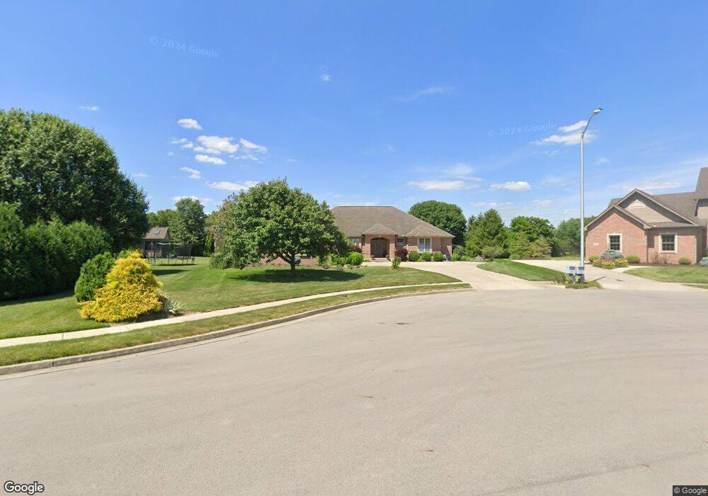
This home is located at 1885 Pheasant Point Ct, Troy, OH 45373 and is currently estimated at $674,600, approximately $215 per square foot. 1885 Pheasant Point Ct is a home located in Miami County with nearby schools including Concord Elementary School, Van Cleve Elementary School, and Troy Junior High School.
Ownership History
Date
Name
Owned For
Owner Type
Purchase Details
Closed on
Apr 9, 2021
Bought by
Hollenbacher Darrel W and Hollenbacher Rita J
Current Estimated Value
Purchase Details
Closed on
Mar 12, 2001
Sold by
Tom S Behm Builders Inc
Bought by
Hollenbacher Darrel W and Hollenbacher Rita J
Purchase Details
Closed on
Mar 2, 2001
Sold by
T E Development Inc
Bought by
Tom S Behm Builders Inc
Purchase Details
Closed on
Feb 21, 2001
Sold by
Gw Land Inc
Bought by
T E Development Inc
Create a Home Valuation Report for This Property
The Home Valuation Report is an in-depth analysis detailing your home's value as well as a comparison with similar homes in the area
Purchase History
| Date | Buyer | Sale Price | Title Company |
|---|---|---|---|
| Hollenbacher Darrel W | -- | -- | |
| Hollenbacher Darrel W | $45,900 | -- | |
| Tom S Behm Builders Inc | $45,500 | -- | |
| T E Development Inc | -- | -- |
Source: Public Records
Tax History
| Year | Tax Paid | Tax Assessment Tax Assessment Total Assessment is a certain percentage of the fair market value that is determined by local assessors to be the total taxable value of land and additions on the property. | Land | Improvement |
|---|---|---|---|---|
| 2025 | $8,444 | $253,020 | $18,480 | $234,540 |
| 2024 | $8,444 | $201,460 | $19,250 | $182,210 |
| 2023 | $7,596 | $201,460 | $19,250 | $182,210 |
| 2022 | $6,421 | $201,460 | $19,250 | $182,210 |
| 2021 | $5,424 | $161,180 | $15,400 | $145,780 |
| 2020 | $5,380 | $161,180 | $15,400 | $145,780 |
| 2019 | $5,412 | $161,180 | $15,400 | $145,780 |
| 2018 | $4,993 | $140,080 | $16,630 | $123,450 |
| 2017 | $5,028 | $140,080 | $16,630 | $123,450 |
| 2016 | $4,960 | $140,080 | $16,630 | $123,450 |
| 2015 | $4,796 | $129,710 | $15,400 | $114,310 |
| 2014 | $4,796 | $129,710 | $15,400 | $114,310 |
| 2013 | $4,826 | $129,710 | $15,400 | $114,310 |
Source: Public Records
Map
Nearby Homes
- 1811 Greenbriar Dr
- 1595 Fox Run
- 1985 Fox Run
- 2586 Renwick Way
- 1345 Kenton Way
- 1371 Edinburgh Dr
- 1550 Creekwood Dr
- 1181 Winchester Dr
- 1212 Spruce St
- 2924 Huntington Dr
- 2927 Huntington Dr
- 1173 Parkview Dr
- 2880 Manor Ct
- 1610 Creekwood Dr
- 2972 Huntington Dr
- 2375 Monroe-Concord Rd
- 2375 Monroe Concord Rd
- 1369 Goldenrod Dr
- 1201 Maple St
- 1464 Goldenrod Dr
- 1865 Pheasant Point Ct
- 1885 Quail Nest Ct
- 1865 Quail Nest Ct
- 1905 Quail Nest Ct
- 1860 Pheasant Point Ct
- 1910 Pheasant Point Ct
- 1845 Quail Nest Ct
- 1880 Pheasant Point Ct
- 1980 Pheasant Point Ct
- 1880 Quail Nest Ct
- 1880 Quail Nest Ct
- 1900 Quail Nest Ct
- 1860 Quail Nest Ct
- 1920 Quail Nest Ct
- 1755 Swailes Rd
- 1840 Quail Nest Ct
- 1940 Quail Nest Ct
- 1820 Quail Nest Ct
- 1791 Swailes Rd
- 1985 Quail Nest Ct
Your Personal Tour Guide
Ask me questions while you tour the home.