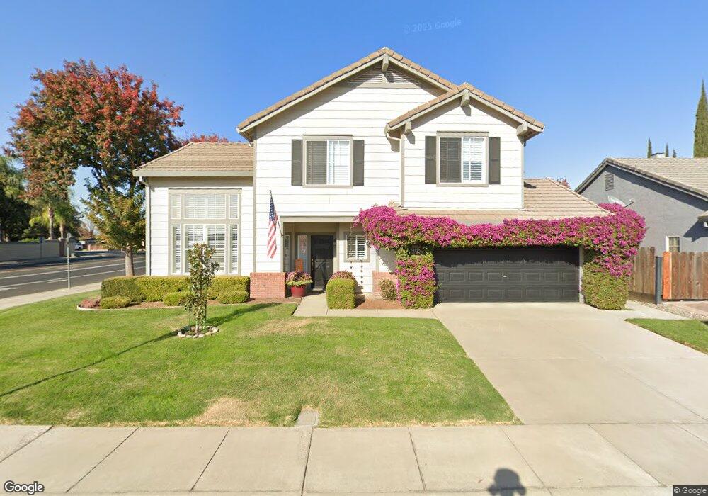
1885 Rail St Manteca, CA 95337
Estimated Value: $521,000 - $605,000
3
Beds
3
Baths
1,984
Sq Ft
$280/Sq Ft
Est. Value
About This Home
This home is located at 1885 Rail St, Manteca, CA 95337 and is currently estimated at $555,617, approximately $280 per square foot. 1885 Rail St is a home located in San Joaquin County with nearby schools including Brock Elliott Elementary School and Sierra High School.
Ownership History
Date
Name
Owned For
Owner Type
Purchase Details
Closed on
Sep 26, 1996
Sold by
Morrison Homes
Bought by
Behmer Lawrence P and Behmer Angelina M
Current Estimated Value
Home Financials for this Owner
Home Financials are based on the most recent Mortgage that was taken out on this home.
Original Mortgage
$162,050
Outstanding Balance
$14,589
Interest Rate
7.87%
Mortgage Type
VA
Estimated Equity
$541,028
Create a Home Valuation Report for This Property
The Home Valuation Report is an in-depth analysis detailing your home's value as well as a comparison with similar homes in the area
Purchase History
| Date | Buyer | Sale Price | Title Company |
|---|---|---|---|
| Behmer Lawrence P | $159,000 | Old Republic Title Company |
Source: Public Records
Mortgage History
| Date | Status | Borrower | Loan Amount |
|---|---|---|---|
| Open | Behmer Lawrence P | $162,050 |
Source: Public Records
Tax History
| Year | Tax Paid | Tax Assessment Tax Assessment Total Assessment is a certain percentage of the fair market value that is determined by local assessors to be the total taxable value of land and additions on the property. | Land | Improvement |
|---|---|---|---|---|
| 2025 | $2,820 | $258,776 | $65,140 | $193,636 |
| 2024 | $3,303 | $253,703 | $63,863 | $189,840 |
| 2023 | $3,261 | $248,729 | $62,611 | $186,118 |
| 2022 | $3,219 | $243,853 | $61,384 | $182,469 |
| 2021 | $3,189 | $239,073 | $60,181 | $178,892 |
| 2020 | $3,082 | $236,622 | $59,564 | $177,058 |
| 2019 | $3,047 | $231,984 | $58,397 | $173,587 |
| 2018 | $3,013 | $227,436 | $57,252 | $170,184 |
| 2017 | $2,976 | $222,978 | $56,130 | $166,848 |
| 2016 | $2,917 | $218,607 | $55,030 | $163,577 |
| 2014 | $2,749 | $211,107 | $53,142 | $157,965 |
Source: Public Records
Map
Nearby Homes
- 1821 Avo Way
- 1752 Sierra Brook Ct
- 1785 Flaxen Ct
- 1176 Junction Dr
- 1565 Daniels St
- 1432 Driftwood Way
- 1049 Compass Ln
- 1781 Goldpoppy St
- 154 N Airport Way
- 2256 W Yosemite Ave
- 140 Swanson Rd
- 2039 Peregrine St
- 380 N Airport Way
- 1653 Dairy Ln
- 2214 Milano St
- 232 Swanson Rd
- 2231 Hewins St
- 1037 Tenaya Ct
- 2261 Hewins St
- 1444 Meridian St
- 1871 Rail St
- 1880 Wawona St
- 0 Rail Ln Unit 8-294839
- 1872 Wawona St
- 1886 Rail St
- 1857 Rail St
- 1874 Rail St
- 1858 Wawona St
- 1014 Iron Horse Way
- 1010 Iron Horse Way
- 1862 Rail St
- 1018 Iron Horse Way
- 1026 Fishback Rd
- 1846 Wawona St
- 1850 Rail St
- 1923 Reading Way
- 1024 Iron Horse Way
- 1833 Rail St
- 1834 Wawona St
Your Personal Tour Guide
Ask me questions while you tour the home.