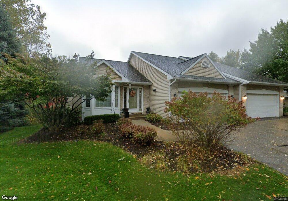
1885 Turnstone Ln NE Unit 94 Grand Rapids, MI 49505
North East Citizens Action NeighborhoodEstimated Value: $376,272 - $473,000
2
Beds
3
Baths
2,627
Sq Ft
$158/Sq Ft
Est. Value
About This Home
This home is located at 1885 Turnstone Ln NE Unit 94, Grand Rapids, MI 49505 and is currently estimated at $414,818, approximately $157 per square foot. 1885 Turnstone Ln NE Unit 94 is a home located in Kent County with nearby schools including Riverside Middle School, Union High School, and Knapp Charter Academy.
Ownership History
Date
Name
Owned For
Owner Type
Purchase Details
Closed on
Mar 15, 2010
Sold by
The Henry A & Melva J Vroegindewey Trust
Bought by
Vroegindewey Henry A and Vroegindewey Melva J
Current Estimated Value
Purchase Details
Closed on
Feb 12, 2010
Sold by
Lowe Debra Lynne
Bought by
The Henry A & Melva J Vroegindewey Trust
Purchase Details
Closed on
Aug 11, 2009
Sold by
Lowe Debra Lynne and Estate Of Richard Beckett
Bought by
Lowe Debra Lynne
Purchase Details
Closed on
Jun 11, 2004
Sold by
Hoeksema Douglas C and Hoeksema Sharon S
Bought by
Beckett Richard
Purchase Details
Closed on
Nov 17, 2000
Bought by
Hksema Hksema D and Hksema S
Create a Home Valuation Report for This Property
The Home Valuation Report is an in-depth analysis detailing your home's value as well as a comparison with similar homes in the area
Home Values in the Area
Average Home Value in this Area
Purchase History
| Date | Buyer | Sale Price | Title Company |
|---|---|---|---|
| Vroegindewey Henry A | -- | None Available | |
| The Henry A & Melva J Vroegindewey Trust | $170,000 | None Available | |
| Lowe Debra Lynne | -- | None Available | |
| Beckett Richard | $195,000 | Fatic | |
| Hksema Hksema D | $181,800 | -- |
Source: Public Records
Tax History Compared to Growth
Tax History
| Year | Tax Paid | Tax Assessment Tax Assessment Total Assessment is a certain percentage of the fair market value that is determined by local assessors to be the total taxable value of land and additions on the property. | Land | Improvement |
|---|---|---|---|---|
| 2025 | $3,499 | $170,300 | $0 | $0 |
| 2024 | $3,499 | $152,400 | $0 | $0 |
| 2023 | $3,550 | $141,800 | $0 | $0 |
| 2022 | $3,370 | $132,200 | $0 | $0 |
| 2021 | $3,295 | $131,400 | $0 | $0 |
| 2020 | $3,150 | $128,500 | $0 | $0 |
| 2019 | $3,300 | $124,800 | $0 | $0 |
| 2018 | $3,186 | $119,200 | $0 | $0 |
| 2017 | $3,103 | $105,700 | $0 | $0 |
| 2016 | $3,139 | $92,400 | $0 | $0 |
| 2015 | $2,920 | $92,400 | $0 | $0 |
| 2013 | -- | $85,000 | $0 | $0 |
Source: Public Records
Map
Nearby Homes
- 2324 Whimbrel Ct NE
- 2041 Krislin St
- 2016 Tall Meadow St NE
- 2058 Ken Ade St NE Unit 147
- 2037 Tall Meadow St NE Unit 13
- 1600 Cherry Hill Dr NE
- 2112 Jo Dean Ct NE
- 2151 Chelsea Rd NE
- 1410 Rothbury Dr NE
- 2420 Hylane Ct NE
- 2353 Midvale St NE
- 2078 Celadon Dr NE Unit 92
- 1336 Banbury Ave NE
- 2753 Dean Lake Ave NE
- 1759 Briarcliff Dr NE
- 2157 New Town Dr NE Unit 10
- 2032 Celadon Dr NE
- 1261 Banbury Ave NE
- 1250 Walwood Dr NE
- 2194 New Town Dr NE
- 1883 Turnstone Ln NE
- 1881 Turnstone Ln NE Unit 92
- 1881 Turnstone Ln NE
- 1882 Turnstone Ln NE Unit 26
- 1880 Turnstone Ln NE Unit 27
- 1871 Turnstone Ln NE Unit 91
- 1950 Dunlin Ct NE
- 1950 Dunlin Ct NE Unit 7
- 1869 Turnstone Ln NE Unit 90
- 1868 Turnstone Ln NE
- 1868 Turnstone Ln NE Unit 28
- 1948 Dunlin Ct NE
- 1948 Dunlin Ct NE Unit 8
- 1867 Turnstone Ln NE
- 1867 Turnstone Ln NE Unit 89
- 1943 Dunlin Ct NE
- 1946 Dunlin Ct NE Unit 9
- 1974 Dunlin Ct NE
- 1866 Turnstone Ln NE Unit 29
- 1866 Turnstone Ln NE