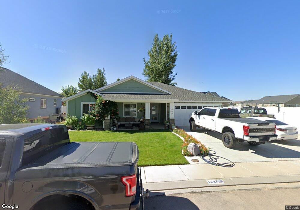
1885 W 4700 N Unit lot 28 Cedar City, UT 84721
Estimated Value: $399,000 - $477,000
--
Bed
--
Bath
--
Sq Ft
8,756
Sq Ft Lot
About This Home
This home is located at 1885 W 4700 N Unit lot 28, Cedar City, UT 84721 and is currently estimated at $439,325. 1885 W 4700 N Unit lot 28 is a home located in Iron County with nearby schools including Three Peaks School, Cedar Middle School, and Cedar City High School.
Ownership History
Date
Name
Owned For
Owner Type
Purchase Details
Closed on
Apr 25, 2019
Sold by
Archway Construction Company
Bought by
Sorensen Carrie Mae and Messerly Douglas G
Current Estimated Value
Home Financials for this Owner
Home Financials are based on the most recent Mortgage that was taken out on this home.
Original Mortgage
$228,937
Outstanding Balance
$201,072
Interest Rate
4.25%
Mortgage Type
FHA
Estimated Equity
$238,253
Purchase Details
Closed on
May 29, 2018
Sold by
Keystone Developers Inc
Bought by
Archway Construction Company
Create a Home Valuation Report for This Property
The Home Valuation Report is an in-depth analysis detailing your home's value as well as a comparison with similar homes in the area
Home Values in the Area
Average Home Value in this Area
Purchase History
| Date | Buyer | Sale Price | Title Company |
|---|---|---|---|
| Sorensen Carrie Mae | -- | Cedar Land Title Inc | |
| Archway Construction Company | -- | Security Escrow & Title Insu |
Source: Public Records
Mortgage History
| Date | Status | Borrower | Loan Amount |
|---|---|---|---|
| Open | Sorensen Carrie Mae | $228,937 |
Source: Public Records
Tax History Compared to Growth
Tax History
| Year | Tax Paid | Tax Assessment Tax Assessment Total Assessment is a certain percentage of the fair market value that is determined by local assessors to be the total taxable value of land and additions on the property. | Land | Improvement |
|---|---|---|---|---|
| 2025 | $1,531 | $196,430 | $43,084 | $153,346 |
| 2023 | $1,613 | $231,110 | $37,465 | $193,645 |
| 2022 | $1,586 | $177,285 | $28,330 | $148,955 |
| 2021 | $1,347 | $140,655 | $16,525 | $124,130 |
| 2020 | $1,341 | $118,825 | $14,990 | $103,835 |
| 2019 | $1,138 | $98,585 | $13,815 | $84,770 |
| 2018 | $271 | $25,115 | $25,115 | $0 |
| 2017 | $270 | $25,115 | $25,115 | $0 |
| 2016 | $255 | $21,360 | $21,360 | $0 |
| 2015 | $267 | $21,360 | $0 | $0 |
| 2014 | $218 | $16,465 | $0 | $0 |
Source: Public Records
Map
Nearby Homes
- 6001 W 4675 N
- 1941 W 4750 N
- 1968 W 4700 N
- 1966 W 4750 N Unit LOT 7
- 1966 W 4750 N
- 1993 W 4700 N
- 4701 N 2000 W
- 4836 N 2350 W Unit 3
- 4836 N 2350 W
- 4836 N 2350 W Unit Lot 3
- 2424 W 4390 N
- 4346 N 2400 W
- 4784 N 2525 W
- 4552 N 2525 W
- 4262 N 2325 W
- 5268 N 2300 W
- 5241 N 2300 W
- 2390 W 5190 N Unit 4
- 2390 W 5190 N Unit Lot 4
- 2390 W 5190 Unit Lot 4
- 1885 W 4700 N Unit 1
- 1885 W 4700 N
- 1867 W 4700 N Unit lot 29
- 1867 W 4700 N
- 1878 W 4675 N
- 1916 W 4675 N
- 1970 W 4675 N
- 1945 W 4675 N
- 1969 W 4675 N
- 1994 W 4675 N
- 1845 W 4700 N
- 1845 W 4700 N Unit Phase 1
- 1868 W 4700 N
- 1914 W 4700 N
- 1848 W 4675 N
- Lot 37 the Parks at Deer Hollow
- 1846 W 4700 N
- 1946 W 4675 N
- 1946 W 4675 N Unit 2A
- 6086 W 4675 N