Estimated Value: $190,000 - $201,107
2
Beds
2
Baths
1,412
Sq Ft
$138/Sq Ft
Est. Value
About This Home
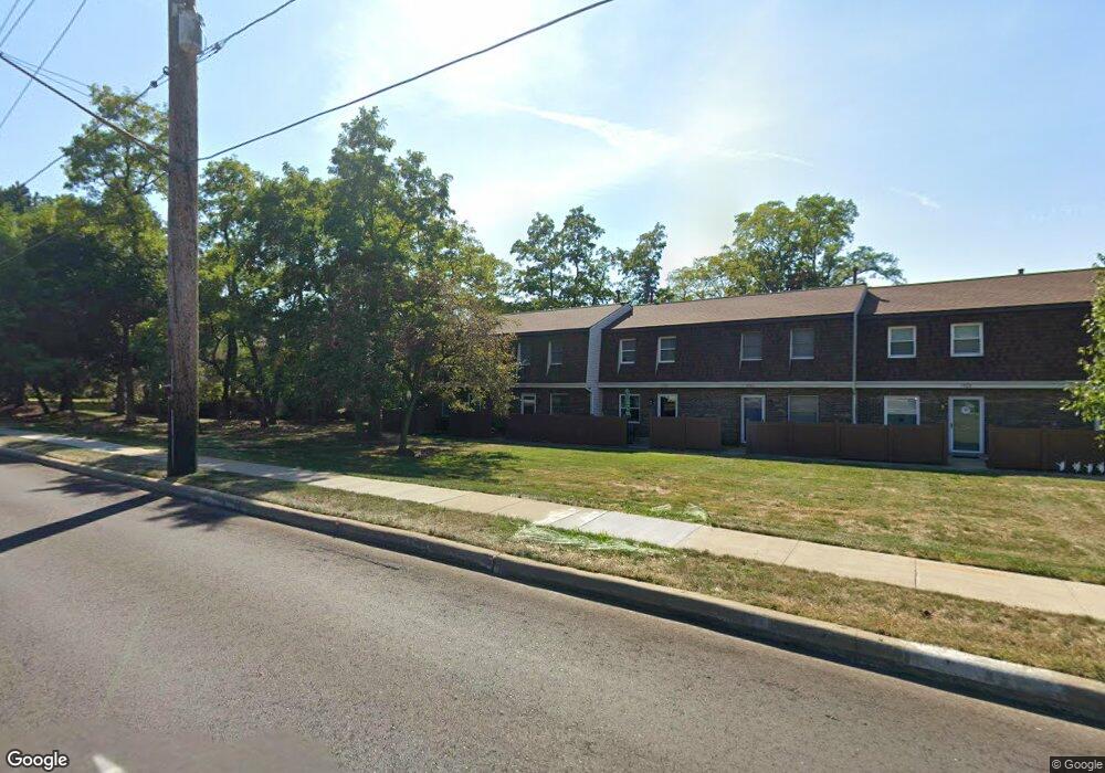
This home is located at 1886 Lillian Rd Unit 9, Stow, OH 44224 and is currently estimated at $195,527, approximately $138 per square foot. 1886 Lillian Rd Unit 9 is a home located in Summit County with nearby schools including Stow-Munroe Falls High School, Holy Family Elementary School, and Walsh Jesuit High School.
Ownership History
Date
Name
Owned For
Owner Type
Purchase Details
Closed on
Jun 29, 2006
Sold by
F I A Ltd
Bought by
Dolence Loretta A
Current Estimated Value
Purchase Details
Closed on
Dec 9, 1998
Sold by
Sherman Joseph P and Sherman Linda L
Bought by
F I A Ltd
Purchase Details
Closed on
Sep 28, 1994
Sold by
Roberts Sharlene K
Bought by
Sherman Joseph P and Sherman Linda L
Home Financials for this Owner
Home Financials are based on the most recent Mortgage that was taken out on this home.
Original Mortgage
$21,000
Interest Rate
5.25%
Mortgage Type
New Conventional
Create a Home Valuation Report for This Property
The Home Valuation Report is an in-depth analysis detailing your home's value as well as a comparison with similar homes in the area
Home Values in the Area
Average Home Value in this Area
Purchase History
| Date | Buyer | Sale Price | Title Company |
|---|---|---|---|
| Dolence Loretta A | $132,000 | Land America-Lawyers Title | |
| F I A Ltd | $125,000 | Buckeye Reserve Title Agency | |
| Sherman Joseph P | $91,500 | -- |
Source: Public Records
Mortgage History
| Date | Status | Borrower | Loan Amount |
|---|---|---|---|
| Previous Owner | Sherman Joseph P | $21,000 |
Source: Public Records
Tax History Compared to Growth
Tax History
| Year | Tax Paid | Tax Assessment Tax Assessment Total Assessment is a certain percentage of the fair market value that is determined by local assessors to be the total taxable value of land and additions on the property. | Land | Improvement |
|---|---|---|---|---|
| 2025 | $2,290 | $49,203 | $5,299 | $43,904 |
| 2024 | $2,290 | $49,203 | $5,299 | $43,904 |
| 2023 | $2,290 | $49,203 | $5,299 | $43,904 |
| 2022 | $1,895 | $37,850 | $4,078 | $33,772 |
| 2021 | $1,700 | $37,850 | $4,078 | $33,772 |
| 2020 | $1,671 | $37,850 | $4,080 | $33,770 |
| 2019 | $1,440 | $32,040 | $3,960 | $28,080 |
| 2018 | $1,417 | $32,040 | $4,180 | $27,860 |
| 2017 | $1,455 | $32,040 | $4,180 | $27,860 |
| 2016 | $1,497 | $32,040 | $4,180 | $27,860 |
| 2015 | $1,455 | $32,040 | $4,180 | $27,860 |
| 2014 | $1,457 | $32,040 | $4,180 | $27,860 |
| 2013 | $1,658 | $35,580 | $4,180 | $31,400 |
Source: Public Records
Map
Nearby Homes
- 3908 Stow Rd
- 2055-2059 Bryn Mawr Dr
- 1736 Lafayette Cir
- 2140 Uniondale Dr
- 3901 Moreland Ave
- 3961 Klein Ave
- 1231 Graham Rd
- 2260 E Gilwood Dr
- 1514 & 1516 Robin Ln
- 1530 Pilgrim Dr
- 4424 Timberdale Dr Unit 4428
- 4322 Lorwood Dr
- 3679 Sanford Ave
- 4462 Timberdale Dr
- 3114 W Edgerton Rd
- 4155 Burton Dr
- 4131 Burton Dr
- 3058 N Oak Hill Rd
- 4078 Pardee Rd
- 1857 Gorge Park Blvd
- 1878 Lillian Rd
- 1878 Lillian Rd Unit 5
- 1888 Lillian Rd
- 1884 Lillian Rd
- 1882 Lillian Rd
- 1880 Lillian Rd
- 1888 Lillian Rd Unit 10
- 3996 Darrow Rd
- 1938 Lillian Rd
- 1942 Lillian Rd Unit 2
- 1940 Lillian Rd Unit 3
- 1944 Lillian Rd Unit 1
- 1934 Lillian Rd
- 1934 Lillian Rd Unit 41
- 1932 Lillian Rd
- 1932 Lillian Rd Unit 40
- 1902 Lillian Rd Unit 15
- 1900 Lillian Rd
- 1898 Lillian Rd Unit 13
- 1896 Lillian Rd