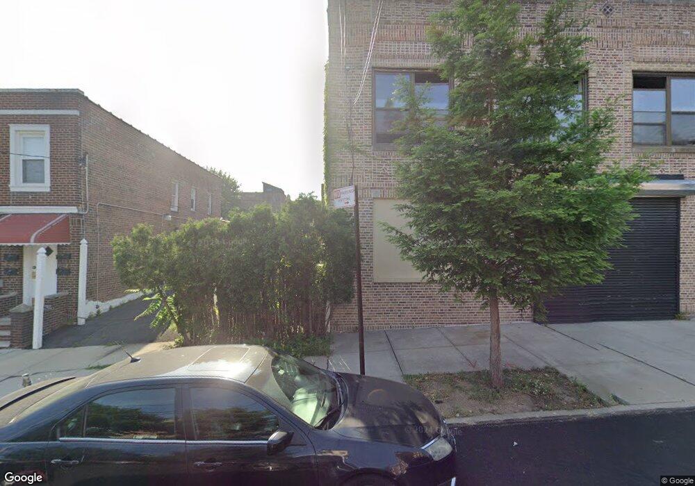
1886 Mulford Ave Bronx, NY 10461
Middletown-Pelham Bay NeighborhoodEstimated Value: $507,000
--
Bed
--
Bath
550
Sq Ft
$922/Sq Ft
Est. Value
About This Home
This home is located at 1886 Mulford Ave, Bronx, NY 10461 and is currently estimated at $507,000, approximately $921 per square foot. 1886 Mulford Ave is a home located in Bronx County with nearby schools including P.S. 71 Rose E Scala, Herbert H Lehman High School, and Bold Charter School.
Ownership History
Date
Name
Owned For
Owner Type
Purchase Details
Closed on
Jun 18, 2025
Sold by
Grasso John
Bought by
Peckerhood Llc
Current Estimated Value
Purchase Details
Closed on
Apr 21, 2004
Sold by
Pedi Family Sprinking Trust
Bought by
John Grasso
Home Financials for this Owner
Home Financials are based on the most recent Mortgage that was taken out on this home.
Original Mortgage
$356,000
Interest Rate
5.75%
Mortgage Type
Commercial
Purchase Details
Closed on
Oct 19, 2002
Sold by
Dicarrado Connie and Pedi John
Bought by
Dicarrado Connie and Pedi John
Create a Home Valuation Report for This Property
The Home Valuation Report is an in-depth analysis detailing your home's value as well as a comparison with similar homes in the area
Home Values in the Area
Average Home Value in this Area
Purchase History
| Date | Buyer | Sale Price | Title Company |
|---|---|---|---|
| Peckerhood Llc | $850,000 | -- | |
| John Grasso | $400,000 | -- | |
| John Grasso | $400,000 | -- | |
| Dicarrado Connie | -- | -- | |
| Dicarrado Connie | -- | -- |
Source: Public Records
Mortgage History
| Date | Status | Borrower | Loan Amount |
|---|---|---|---|
| Previous Owner | John Grasso | $356,000 |
Source: Public Records
Tax History Compared to Growth
Tax History
| Year | Tax Paid | Tax Assessment Tax Assessment Total Assessment is a certain percentage of the fair market value that is determined by local assessors to be the total taxable value of land and additions on the property. | Land | Improvement |
|---|---|---|---|---|
| 2025 | $1,784 | $9,384 | $5,169 | $4,215 |
| 2024 | $1,784 | $8,881 | $5,247 | $3,634 |
| 2023 | $1,702 | $8,381 | $5,362 | $3,019 |
| 2022 | $1,580 | $26,940 | $18,540 | $8,400 |
| 2021 | $1,666 | $25,440 | $18,540 | $6,900 |
| 2020 | $1,655 | $25,440 | $18,540 | $6,900 |
| 2019 | $1,548 | $23,040 | $18,540 | $4,500 |
| 2018 | $1,424 | $6,984 | $5,961 | $1,023 |
| 2017 | $1,345 | $6,596 | $5,908 | $688 |
| 2016 | $1,319 | $6,596 | $6,553 | $43 |
| 2015 | $751 | $6,517 | $6,474 | $43 |
| 2014 | $751 | $6,168 | $6,127 | $41 |
Source: Public Records
Map
Nearby Homes
- 1865 Mulford Ave
- 1836 Mulford Ave
- 1826 Mulford Ave
- 1926 Hutchinson River Pkwy E Unit E
- 2884 Saint Theresa Ave
- 1725 Edison Ave Unit 4C
- 1725 Edison Ave Unit 2D
- 1950 Pilgrim Ave
- 3036 Buhre Ave
- 1619 Mulford Ave
- 2871 E 194th St
- 2010 Hobart Ave
- 2887 E 194th St
- 1711 Mahan Ave
- 2866 Middletown Rd
- 2935 Middletown Rd Unit B
- 2032 Hobart Ave
- 2941 Middletown Rd
- 2873 Roebling Ave
- 2024 Continental Ave
- 1888 Mulford Ave
- 1865 Mayflower Ave
- 1876 Mulford Ave
- 2838 Mayflower Ave
- 1874 Mulford Ave Unit 2
- 1874 Mulford Ave
- 1874 Mulford Ave Unit 1876
- 1869 Mayflower Ave Unit 2
- 1861 Mayflower Ave
- 1900 Mulford Ave
- 1872 Mulford Ave
- 1859 Mayflower Ave
- 1859 Mayflower Ave Unit 3
- 1906 Mulford Ave
- 1870 Mulford Ave
- 1885 Mulford Ave
- 1883 Mulford Ave
- 2820 Saint Theresa Ave
- 1857 Mayflower Ave
- 1901 Mayflower Ave