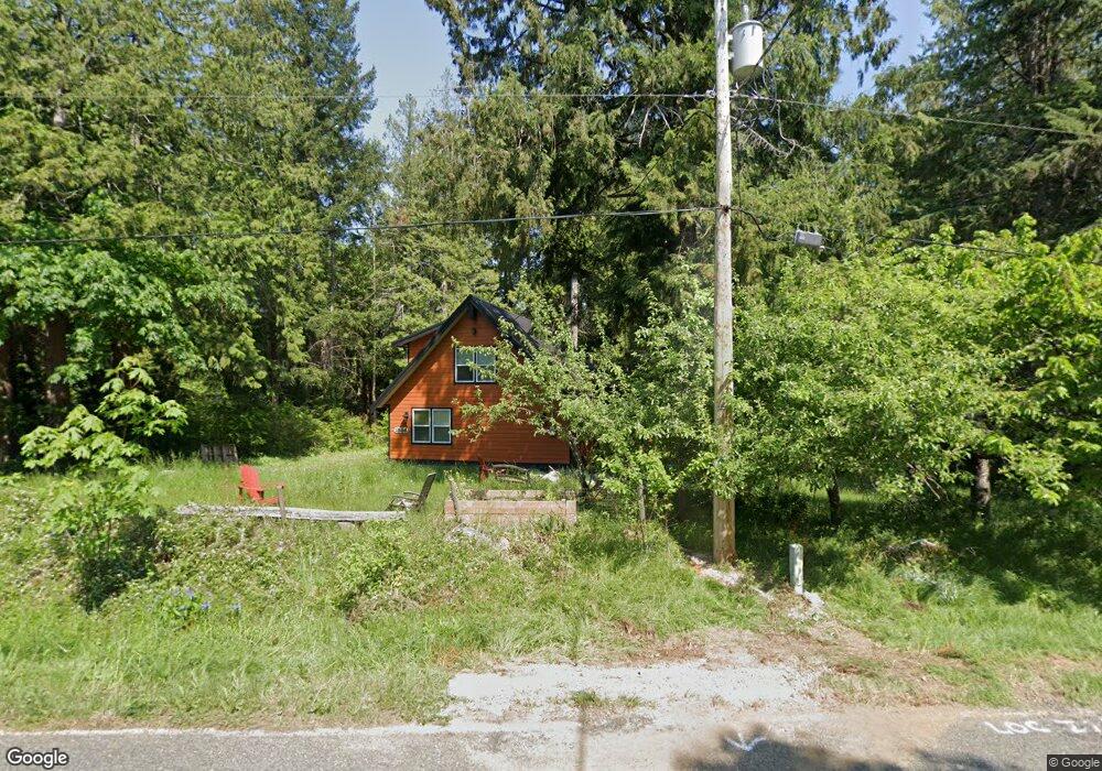
1886 Province Rd Point Roberts, WA 98281
Estimated Value: $594,000 - $687,000
--
Bed
1
Bath
1,992
Sq Ft
$320/Sq Ft
Est. Value
About This Home
This home is located at 1886 Province Rd, Point Roberts, WA 98281 and is currently estimated at $637,804, approximately $320 per square foot. 1886 Province Rd is a home with nearby schools including Point Roberts Primary School, Blaine Middle School, and Blaine High School.
Ownership History
Date
Name
Owned For
Owner Type
Purchase Details
Closed on
Aug 17, 2006
Sold by
Colinview Llc
Bought by
Mudie Craig and Ellis Karrie
Current Estimated Value
Purchase Details
Closed on
Jul 24, 2006
Sold by
Burt William R and Burt Pamela
Bought by
Colinview Llc
Purchase Details
Closed on
Jul 30, 2002
Sold by
Sterling Svgs Bank
Bought by
Burt William R and Burt Pamela
Purchase Details
Closed on
Jun 28, 2002
Sold by
Liptrot Darren W and Moffatt Holly A
Bought by
Sterling Svgs Bank
Create a Home Valuation Report for This Property
The Home Valuation Report is an in-depth analysis detailing your home's value as well as a comparison with similar homes in the area
Home Values in the Area
Average Home Value in this Area
Purchase History
| Date | Buyer | Sale Price | Title Company |
|---|---|---|---|
| Mudie Craig | $60,280 | Chicago Title Insurance | |
| Colinview Llc | $125,280 | First American Title Insuran | |
| Burt William R | -- | First American Title Insuran | |
| Sterling Svgs Bank | $36,060 | First American Title Insuran |
Source: Public Records
Tax History Compared to Growth
Tax History
| Year | Tax Paid | Tax Assessment Tax Assessment Total Assessment is a certain percentage of the fair market value that is determined by local assessors to be the total taxable value of land and additions on the property. | Land | Improvement |
|---|---|---|---|---|
| 2024 | $4,539 | $577,900 | $162,608 | $415,292 |
| 2023 | $4,539 | $563,117 | $147,825 | $415,292 |
| 2022 | $3,666 | $514,262 | $135,000 | $379,262 |
| 2021 | $3,651 | $375,789 | $56,179 | $319,610 |
| 2020 | $3,631 | $347,948 | $52,017 | $295,931 |
| 2019 | $3,361 | $333,760 | $49,896 | $283,864 |
| 2018 | $3,293 | $300,047 | $44,856 | $255,191 |
| 2017 | $2,854 | $286,562 | $42,840 | $243,722 |
| 2016 | $2,684 | $280,943 | $42,000 | $238,943 |
| 2015 | $418 | $256,715 | $40,576 | $216,139 |
| 2014 | -- | $37,758 | $37,758 | $0 |
| 2013 | -- | $42,000 | $42,000 | $0 |
Source: Public Records
Map
Nearby Homes
- 1931 Sanders Ct Unit 11
- 1871 Johnson Rd
- 25 Roosevelt Way
- 0 3 73 Acres Derby Ave
- 1 Mill Rd
- 2 Mill Rd
- 245 Shady Glen Ave
- 125 Park Dr
- 103 Goodman Rd
- 2145 Fir St
- 8 Heather Way
- 2 Benson Rd
- 17 Lot Massey Way
- 2138 Benson Rd
- 251 Elizabeth Dr
- 1521 Roosevelt Way
- Lot 2 Greenwood Dr
- 0 6 39 Acres South Beach Rd
- 168 Tyee Dr
- 158 Tyee Dr
- 76 Calgary Way
- 1894 Province Rd
- 97 Calgary Way
- 83 Calgary Way
- 1893 Cliff Rd
- 1897 Cliff Rd
- 1881 Cliff Rd
- 75 Calgary Way
- 0 Kennedy Rd
- 1904 Province Rd
- 161 Ronald Dr
- 161 Ronald Dr
- 1889 Province Rd Unit Lot 2
- 1905 Province Rd
- 92 Victoria Way
- 65 Calgary Way
- 1893 Province Rd Unit Lot 3
- 1860 Province Rd
- 1910 Province Rd
- 1881 Province Rd Unit Lot 1