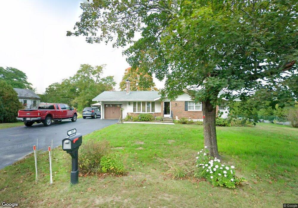
1887 Main St Unit 1 Lancaster, MA 01523
Estimated Value: $472,000 - $530,906
3
Beds
2
Baths
1,520
Sq Ft
$332/Sq Ft
Est. Value
About This Home
This home is located at 1887 Main St Unit 1, Lancaster, MA 01523 and is currently estimated at $503,977, approximately $331 per square foot. 1887 Main St Unit 1 is a home located in Worcester County with nearby schools including Mary Rowlandson Elementary School, Luther Burbank Middle School, and Nashoba Regional High School.
Ownership History
Date
Name
Owned For
Owner Type
Purchase Details
Closed on
Dec 27, 2012
Sold by
Cutler Lawrence H and Cutler Margaret E
Bought by
Cutler Ft
Current Estimated Value
Purchase Details
Closed on
Sep 15, 1972
Bought by
Cutler Ft
Create a Home Valuation Report for This Property
The Home Valuation Report is an in-depth analysis detailing your home's value as well as a comparison with similar homes in the area
Home Values in the Area
Average Home Value in this Area
Purchase History
| Date | Buyer | Sale Price | Title Company |
|---|---|---|---|
| Cutler Ft | -- | -- | |
| Cutler Ft | -- | -- |
Source: Public Records
Mortgage History
| Date | Status | Borrower | Loan Amount |
|---|---|---|---|
| Previous Owner | Cutler Ft | $30,000 | |
| Previous Owner | Cutler Ft | $12,000 | |
| Previous Owner | Cutler Ft | $78,000 |
Source: Public Records
Tax History Compared to Growth
Tax History
| Year | Tax Paid | Tax Assessment Tax Assessment Total Assessment is a certain percentage of the fair market value that is determined by local assessors to be the total taxable value of land and additions on the property. | Land | Improvement |
|---|---|---|---|---|
| 2025 | $7,022 | $434,500 | $97,400 | $337,100 |
| 2024 | $7,022 | $402,200 | $88,600 | $313,600 |
| 2023 | $6,455 | $375,500 | $80,500 | $295,000 |
| 2022 | $5,831 | $299,800 | $75,300 | $224,500 |
| 2021 | $5,656 | $283,100 | $75,300 | $207,800 |
| 2020 | $5,933 | $298,900 | $75,400 | $223,500 |
| 2019 | $5,453 | $276,100 | $75,400 | $200,700 |
| 2018 | $4,885 | $244,500 | $75,400 | $169,100 |
| 2016 | $4,409 | $225,500 | $74,500 | $151,000 |
| 2015 | $4,191 | $223,400 | $74,500 | $148,900 |
| 2014 | $4,156 | $219,800 | $74,500 | $145,300 |
Source: Public Records
Map
Nearby Homes
- 303 Ponakin Rd
- 2237 Main St
- 2038-1 Laurel Hill Ln
- 2038 Laurel Hill Ln Unit LOT 18
- 765 Brockelman Road Lot C
- 0 Main St
- 144 Seven Bridge Rd
- 1497 Lunenburg Rd
- 0 Brockelman Rd Unit 73424117
- 35 Mcgovern Blvd
- 121 &125 Flanagan Hill Rd
- 91 Berrington Rd Unit 91
- 97 Berrington Rd Unit 97
- 17 Turtle Ln Unit 17
- 12 Drummer Ln
- 213 Bayberry Hill Ln
- 64 Sycamore Dr
- 7 Lawson Ave
- 50 Indian Ridge Dr
- 85 Prescott St
- 1887 Main St
- 1903 Main St
- 1882 Main St
- 1882 Main St Unit 1
- 5 Devonshire Way Unit 184-LOT
- 12 Devonshire Way
- 9 Devonshire Way Unit 284-LOT
- 1921 Main St
- 1920 Main St
- 1845 Main St
- 1845 Main St Unit 1
- 2 Devonshire Way
- 0 Devonshire Way
- 6 Devonshire Way Unit 206-LOT
- 1906 Main St
- 10 Devonshire Way
- 1835 Main St
- 1943 Main St
- 1958 Main St
- 1815 Main St